TopoQuest Logo
Do you find TopoQuest useful?
Help keep TopoQuest running and adding new maps/features by donating!
Bitcoin:  19c7KJd3qBynnjoSw5npx9KScwjBe4ifkT
Litecoin:  LXs6TkuXGGXo1vDsWCkWVdjQX94eUKd6ui
Home View Maps Find Maps Find Places Resources & Links


Flat Top, Utah Topographic Map

USGS Map Title: Flat Top, UT
USGS Map MRC: 38111D4
DRG (GeoTIFF) Download: o38111d4.tif


Neighboring USGS Topographic Map Quads:


  Forsyth Reservoir, UT  
38111E5
 

  Geyser Peak, UT  
38111E4
 

  Solomons Temple, UT  
38111E3
 

  Lyman, UT  
38111D5
 

  Flat Top, UT  
38111D4
 

  Cathedral Mountain, UT  
38111D3
 

  Bicknell, UT  
38111C5
 

  Torrey, UT  
38111C4
 

  Twin Rocks, UT  
38111C3


Map MRC Location:

N39°
W112°
N39°
W111°
H8 H7 H6 H5 H4 H3 H2 H1
G8 G7 G6 G5 G4 G3 G2 G1
F8 F7 F6 F5 F4 F3 F2 F1
E8 E7 E6 E5 E4 E3 E2 E1
D8 D7 D6 D5 D4 D3 D2 D1
C8 C7 C6 C5 C4 C3 C2 C1
B8 B7 B6 B5 B4 B3 B2 B1
A8 A7 A6 A5 A4 A3 A2 A1
N38°
W112°
N38°
W111°

Flat Top, UT USGS 1:24K Topographic Map Preview:
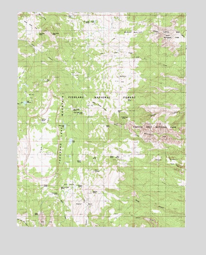
Flat Top, UT USGS Topographic Map
Click on map above to begin viewing in our Map Viewer.

This topographic map contains these locations and features:
Feature Name Type Latitude Longitude GNIS ID View Map
Alex SpringSpringN38.4155°W111.4416°1448059View Map
Billings PassGapN38.4422°W111.4235°1448137View Map
Blue LakeLakeN38.4603°W111.4788°1438935View Map
Bull Run FlatFlatN38.4522°W111.4918°1439279View Map
Bullberry FlatFlatN38.4672°W111.4127°1439295View Map
Bullings PassGapN38.4450°W111.4280°1439304View Map
Chaffin SpringSpringN38.3991°W111.4802°1448258View Map
Clay Dugway SpringSpringN38.4430°W111.4593°1448282View Map
Deep Creek LakeLakeN38.4336°W111.4647°1440355View Map
Deep Creek RidgeRidgeN38.4462°W111.4454°1448334View Map
Deep Creek SpringSpringN38.4389°W111.4227°1448335View Map
East Sand Creek SpringSpringN38.3980°W111.4680°1448368View Map
Elkhorn CampgroundLocaleN38.4639°W111.4563°1451237View Map
Elkhorn Guard StationLocaleN38.4639°W111.4605°1451238View Map
Elkhorn Ranger Station and Forest CampLocaleN38.4639°W111.4571°1440916View Map
Flat TopSummitN38.4172°W111.4793°1441135View Map
Flat Top SpringSpringN38.4368°W111.4820°1448409View Map
Heart LakeLakeN38.4975°W111.4602°1444712View Map
Heart LakeLakeN38.4976°W111.4600°1448460View Map
Hens Hole FlatFlatN38.4919°W111.4910°1448463View Map
Hens Hole PeakSummitN38.4869°W111.4750°1441717View Map
Hens Peak SpringSpringN38.4878°W111.4841°1448464View Map
Hickman SpringSpringN38.3961°W111.4438°1448467View Map
Indian SpringSpringN38.3825°W111.4870°1448509View Map
Indian SpringSpringN38.4346°W111.4341°1448510View Map
Jahu FlatFlatN38.4619°W111.4974°1442101View Map
McDonld BasinBasinN38.4869°W111.4135°1443248View Map
Mud SpringSpringN38.4160°W111.4247°1448712View Map
Neff ReservoirReservoirN38.4473°W111.4944°1443783View Map
Neffs DamDamN38.4466°W111.4974°1447710View Map
Pine SpringSpringN38.4496°W111.4186°1448837View Map
Point LookoutSummitN38.4076°W111.4432°1448045View Map
Polk Creek RidgeRidgeN38.4733°W111.4420°1448863View Map
Round LakeLakeN38.4947°W111.4431°1445166View Map
Round Lake SpringsSpringN38.4940°W111.4515°1448943View Map
Sand Creek SpringSpringN38.3944°W111.4702°1448969View Map
Sand FlatFlatN38.3811°W111.4260°1445307View Map
Sawmill SpringSpringN38.4131°W111.4529°1448978View Map
Sidehill SpringSpringN38.4166°W111.4312°1449004View Map
Snow LakeLakeN38.4249°W111.4606°1438698View Map
Sulphur BasinBasinN38.3883°W111.4493°1436444View Map
Sulphur SpringSpringN38.3994°W111.4549°1449080View Map
Thousand Lake MountainSummitN38.4169°W111.4793°1446554View Map
Tub FlatFlatN38.4455°W111.4463°1449115View Map
Upper Deep Creek SpringSpringN38.4414°W111.4516°1449132View Map
Wiffs PastureFlatN38.3997°W111.4621°1449192View Map

Note: Coordinates in the location and feature list above are referenced to NAD83 datum.


Copyright (C) 2008-2024 Ryan Niemi / Sunset Dynamics ... All Rights Reserved