TopoQuest Logo
Do you find TopoQuest useful?
Help keep TopoQuest running and adding new maps/features by donating!
Bitcoin:  19c7KJd3qBynnjoSw5npx9KScwjBe4ifkT
Litecoin:  LXs6TkuXGGXo1vDsWCkWVdjQX94eUKd6ui
Home View Maps Find Maps Find Places Resources & Links


Fletcher, Michigan Topographic Map

USGS Map Title: Fletcher, MI
USGS Map MRC: 44084E8
DRG (GeoTIFF) Download: o44084e8.tif


Neighboring USGS Topographic Map Quads:


  Sigma, MI  
44085F1
 

  Black Creek, MI  
44084F8
 

  Lake Margrethe, MI  
44084F7
 

  Sharon, MI  
44085E1
 

  Fletcher, MI  
44084E8
 

  Cote Dame Marie, MI  
44084E7


Map MRC Location:

N45°
W85°
N45°
W84°
H8 H7 H6 H5 H4 H3 H2 H1
G8 G7 G6 G5 G4 G3 G2 G1
F8 F7 F6 F5 F4 F3 F2 F1
E8 E7 E6 E5 E4 E3 E2 E1
D8 D7 D6 D5 D4 D3 D2 D1
C8 C7 C6 C5 C4 C3 C2 C1
B8 B7 B6 B5 B4 B3 B2 B1
A8 A7 A6 A5 A4 A3 A2 A1
N44°
W85°
N44°
W84°

Fletcher, MI USGS 1:24K Topographic Map Preview:
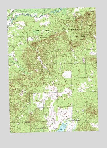
Fletcher, MI USGS Topographic Map
Click on map above to begin viewing in our Map Viewer.

This topographic map contains these locations and features:
Feature Name Type Latitude Longitude GNIS ID View Map
Beecher HillSummitN44.6078°W84.8878°621003View Map
Black CreekStreamN44.6183°W84.9509°621496View Map
Camp GraylingMilitaryN44.5976°W84.8994°2512058View Map
CCC Bridge State Forest CampgroundLocaleN44.6147°W84.9908°2494733View Map
Clear CreekStreamN44.6203°W84.9353°623399View Map
Cleary HillSummitN44.5989°W84.8834°623441View Map
Ester HillSummitN44.6181°W84.8864°625649View Map
FletcherPopulated PlaceN44.5395°W84.9523°1617561View Map
Fletcher Post Office (historical)Post OfficeN44.5394°W84.9522°2494713View Map
Fletcher SchoolSchoolN44.5392°W84.9420°626169View Map
Grass LakeLakeN44.5025°W84.9276°627209View Map
Grube HillSummitN44.6206°W84.8764°627485View Map
Kalkaska State ForestForestN44.5447°W84.9406°629451View Map
King Trout AirportAirportN44.6164°W84.9500°1623936View Map
Lindquist HillSummitN44.6067°W84.8795°630504View Map
Richards HillSummitN44.5958°W84.8898°635864View Map
Smith HillSummitN44.6133°W84.8975°638152View Map
Waldo HillSummitN44.5925°W84.8928°1615684View Map

Note: Coordinates in the location and feature list above are referenced to NAD83 datum.


Copyright (C) 2008-2025 Ryan Niemi / Sunset Dynamics ... All Rights Reserved