TopoQuest Logo
Do you find TopoQuest useful?
Help keep TopoQuest running and adding new maps/features by donating!
Bitcoin:  19c7KJd3qBynnjoSw5npx9KScwjBe4ifkT
Litecoin:  LXs6TkuXGGXo1vDsWCkWVdjQX94eUKd6ui
Home View Maps Find Maps Find Places Resources & Links


Fletcher Peak, Wyoming Topographic Map

USGS Map Title: Fletcher Peak, WY
USGS Map MRC: 41107A1
DRG (GeoTIFF) Download: o41107a1.tif


Neighboring USGS Topographic Map Quads:


  Singer Peak, WY  
41107B2
 

  Bridger Peak, WY  
41107B1
 

  Red Mountain, WY  
41106B8
 

  Cottonwood Rim, WY  
41107A2
 

  Fletcher Peak, WY  
41107A1
 

  Solomon Creek, WY  
41106A8
 

  Tumble Mountain, CO  
40107H2
 

  Shield Mountain, CO  
40107H1
 

  Elkhorn Mountain, CO  
40106H8


Map MRC Location:

N42°
W108°
N42°
W107°
H8 H7 H6 H5 H4 H3 H2 H1
G8 G7 G6 G5 G4 G3 G2 G1
F8 F7 F6 F5 F4 F3 F2 F1
E8 E7 E6 E5 E4 E3 E2 E1
D8 D7 D6 D5 D4 D3 D2 D1
C8 C7 C6 C5 C4 C3 C2 C1
B8 B7 B6 B5 B4 B3 B2 B1
A8 A7 A6 A5 A4 A3 A2 A1
N41°
W108°
N41°
W107°

Fletcher Peak, WY USGS 1:24K Topographic Map Preview:
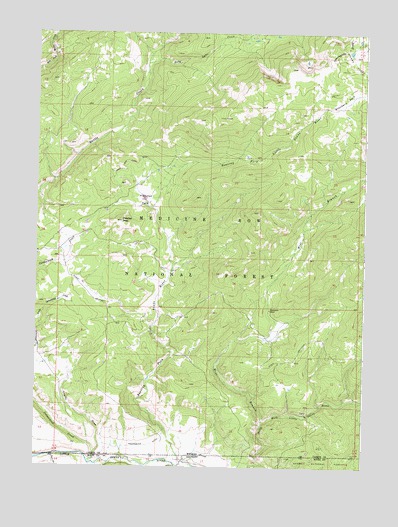
Fletcher Peak, WY USGS Topographic Map
Click on map above to begin viewing in our Map Viewer.

This topographic map contains these locations and features:
Feature Name Type Latitude Longitude GNIS ID View Map
Aspen CreekStreamN41.1166°W107.0723°1764004View Map
Baby Lake CreekStreamN41.1155°W107.0839°1597854View Map
Cherry DrawValleyN41.0020°W107.1023°169884View Map
Cottonwood CreekStreamN41.0016°W107.1048°169882View Map
Deer CreekStreamN41.0033°W107.1178°1599197View Map
Deer CreekStreamN41.0033°W107.1181°169881View Map
Fletcher ParkFlatN41.0781°W107.0838°1599764View Map
Fletcher PeakSummitN41.0711°W107.0928°1599765View Map
Hackmaster DitchCanalN41.0064°W107.0817°1600157View Map
Haggarty CreekStreamN41.1250°W107.1148°1589227View Map
Karen CreekStreamN41.0494°W107.0784°1764015View Map
Little Snake RiverStreamN41.0033°W107.1192°1601041View Map
Mallard CreekStreamN41.0533°W107.0748°1764016View Map
Meadow CreekStreamN41.1216°W107.0570°1764018View Map
North Fork Group MineMineN41.0105°W107.0114°1725972View Map
Pease Placers MineMineN41.0175°W107.0209°1725973View Map
Rabbit CreekStreamN41.0564°W107.0312°1764019View Map
Rasmusson RanchLocaleN41.0452°W107.0364°1602398View Map
Roaring ForkStreamN41.0014°W107.0689°169885View Map
Roaring Fork Little Snake RiverStreamN41.0014°W107.0687°1602555View Map
Sherard CreekStreamN41.0880°W107.0537°1764021View Map
Standard CreekStreamN41.0758°W107.0173°1764024View Map
Standard MineMineN41.1075°W107.0142°1603326View Map
Standard ParkFlatN41.1061°W107.0081°1603327View Map
Standard Park Area MineMineN41.1061°W107.0001°1726165View Map
Three Forks Group MineMineN41.0175°W107.0209°1725974View Map
Victoria Post Office (historical)Post OfficeN41.0239°W107.0309°1764027View Map
West Branch North Fork Little Snake RiverStreamN41.0133°W107.0387°1604033View Map

Note: Coordinates in the location and feature list above are referenced to NAD83 datum.


Copyright (C) 2008-2025 Ryan Niemi / Sunset Dynamics ... All Rights Reserved