TopoQuest Logo
Do you find TopoQuest useful?
Help keep TopoQuest running and adding new maps/features by donating!
Bitcoin:  19c7KJd3qBynnjoSw5npx9KScwjBe4ifkT
Litecoin:  LXs6TkuXGGXo1vDsWCkWVdjQX94eUKd6ui
Home View Maps Find Maps Find Places Resources & Links


Shield Mountain, Colorado Topographic Map

USGS Map Title: Shield Mountain, CO
USGS Map MRC: 40107H1
DRG (GeoTIFF) Download: o40107h1.tif


Neighboring USGS Topographic Map Quads:


  Cottonwood Rim, WY  
41107A2
 

  Fletcher Peak, WY  
41107A1
 

  Solomon Creek, WY  
41106A8
 

  Tumble Mountain, CO  
40107H2
 

  Shield Mountain, CO  
40107H1
 

  Elkhorn Mountain, CO  
40106H8
 

  Bears Ears Peaks, CO  
40107G2
 

  Meaden Peak, CO  
40107G1
 

  Hahns Peak, CO  
40106G8


Map MRC Location:

N41°
W108°
N41°
W107°
H8 H7 H6 H5 H4 H3 H2 H1
G8 G7 G6 G5 G4 G3 G2 G1
F8 F7 F6 F5 F4 F3 F2 F1
E8 E7 E6 E5 E4 E3 E2 E1
D8 D7 D6 D5 D4 D3 D2 D1
C8 C7 C6 C5 C4 C3 C2 C1
B8 B7 B6 B5 B4 B3 B2 B1
A8 A7 A6 A5 A4 A3 A2 A1
N40°
W108°
N40°
W107°

Shield Mountain, CO USGS 1:24K Topographic Map Preview:
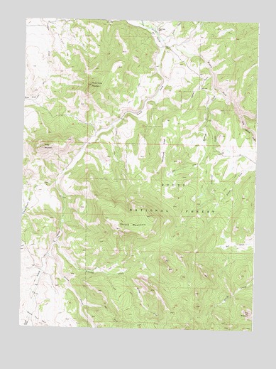
Shield Mountain, CO USGS Topographic Map
Click on map above to begin viewing in our Map Viewer.

This topographic map contains these locations and features:
Feature Name Type Latitude Longitude GNIS ID View Map
Bedrock CreekStreamN40.9736°W107.0239°169898View Map
Beeler GulchValleyN40.9788°W107.0247°169894View Map
Burton CreekStreamN40.8966°W107.0737°169902View Map
Burton Creek TrailTrailN40.8864°W107.0642°197384View Map
City MountainSummitN40.8816°W107.0023°201865View Map
Deadhorse RidgeRidgeN40.9380°W107.0539°169897View Map
Dudley CreekStreamN40.9533°W107.0020°169888View Map
East Fork Oliver CreekStreamN40.8844°W107.0920°169903View Map
Johnson CreekStreamN40.9091°W107.1078°169901View Map
King Solomon CreekStreamN40.9625°W107.0084°169883View Map
Middle Fork Little Snake RiverStreamN40.9933°W107.0476°169887View Map
Nipple Peak TrailTrailN40.8761°W107.0642°169402View Map
North Fork Little Snake RiverStreamN40.9933°W107.0476°169886View Map
Oliver CreekStreamN40.9044°W107.1106°169892View Map
Oliver Creek TrailTrailN40.8911°W107.0756°169380View Map
Piney MountainSummitN40.9480°W107.1148°169896View Map
Shield MountainSummitN40.9155°W107.0726°169900View Map
South Fork Little Snake RiverStreamN40.9916°W107.0520°169891View Map
Tennessee CreekStreamN40.9677°W107.0267°169899View Map
Three ForksAreaN40.9916°W107.0506°196429View Map
Three Forks CemeteryCemeteryN40.9872°W107.0478°2400571View Map
Three Forks MountainSummitN40.9736°W107.0895°169895View Map
Three Forks RanchLocaleN40.9964°W107.0548°169893View Map
Tunnel CreekStreamN40.8783°W107.1214°169849View Map

Note: Coordinates in the location and feature list above are referenced to NAD83 datum.


Copyright (C) 2008-2025 Ryan Niemi / Sunset Dynamics ... All Rights Reserved