TopoQuest Logo
Do you find TopoQuest useful?
Help keep TopoQuest running and adding new maps/features by donating!
Bitcoin:  19c7KJd3qBynnjoSw5npx9KScwjBe4ifkT
Litecoin:  LXs6TkuXGGXo1vDsWCkWVdjQX94eUKd6ui
Home View Maps Find Maps Find Places Resources & Links


Florida, New Mexico Topographic Map

USGS Map Title: Florida, NM
USGS Map MRC: 32107D5
DRG (GeoTIFF) Download: o32107d5.tif


Neighboring USGS Topographic Map Quads:


  OK Canyon, NM  
32107E6
 

  Greg Hills, NM  
32107E5
 

  Nutt, NM  
32107E4
 

  Massacre Peak, NM  
32107D6
 

  Florida, NM  
32107D5
 

  Good Sight Peak, NM  
32107D4
 

  Deming East, NM  
32107C6
 

  Carne, NM  
32107C5
 

  Myndus, NM  
32107C4


Map MRC Location:

N33°
W108°
N33°
W107°
H8 H7 H6 H5 H4 H3 H2 H1
G8 G7 G6 G5 G4 G3 G2 G1
F8 F7 F6 F5 F4 F3 F2 F1
E8 E7 E6 E5 E4 E3 E2 E1
D8 D7 D6 D5 D4 D3 D2 D1
C8 C7 C6 C5 C4 C3 C2 C1
B8 B7 B6 B5 B4 B3 B2 B1
A8 A7 A6 A5 A4 A3 A2 A1
N32°
W108°
N32°
W107°

Florida, NM USGS 1:24K Topographic Map Preview:
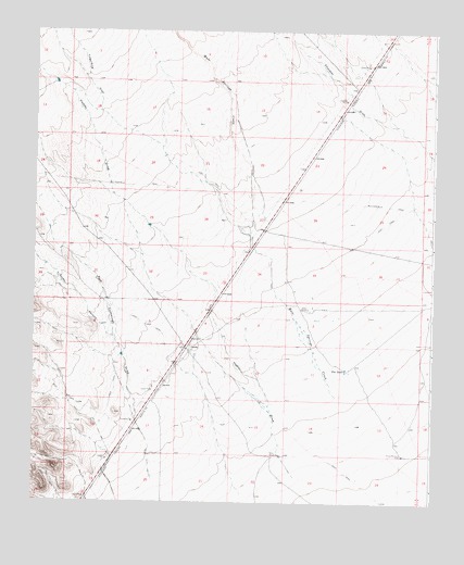
Florida, NM USGS Topographic Map
Click on map above to begin viewing in our Map Viewer.

This topographic map contains these locations and features:
Feature Name Type Latitude Longitude GNIS ID View Map
01207 Water WellWellN32.4123°W107.5022°923281View Map
01213 Water WellWellN32.4259°W107.5339°930153View Map
01214 Water WellWellN32.4162°W107.5789°922480View Map
01215 Water WellWellN32.3884°W107.6111°923278View Map
01217 Water WellWellN32.3862°W107.5347°930161View Map
01218 Water WellWellN32.3859°W107.5411°930160View Map
01276 Water WellWellN32.4487°W107.5575°922482View Map
01583 Water WellWellN32.4262°W107.5414°922481View Map
10468 Water WellWellN32.3868°W107.5422°930162View Map
Britan WindmillLocaleN32.3879°W107.5092°886737View Map
Cookes CanyonValleyN32.4190°W107.6003°898291View Map
Cooks Spring Historic SiteSpringN32.4159°W107.5767°933619View Map
Dobies WindmillLocaleN32.4265°W107.5409°888416View Map
Finger-Ring DrawValleyN32.4806°W107.6039°889035View Map
Flat TankReservoirN32.4106°W107.5273°889080View Map
FloridaPopulated PlaceN32.4159°W107.5767°920595View Map
Florida Post Office (historical)Post OfficeN32.4159°W107.5767°937341View Map
Florida Weather StationLocaleN32.4159°W107.5767°931881View Map
Fort Cummings DrawValleyN32.3806°W107.5872°889151View Map
Hadley DrawValleyN32.3826°W107.5434°889713View Map
Miller WindmillLocaleN32.3873°W107.5495°892066View Map
Mule Springs CreekStreamN32.4034°W107.5297°908978View Map
Nunn RanchLocaleN32.4287°W107.5000°892769View Map

Note: Coordinates in the location and feature list above are referenced to NAD83 datum.


Copyright (C) 2008-2024 Ryan Niemi / Sunset Dynamics ... All Rights Reserved