TopoQuest Logo
Do you find TopoQuest useful?
Help keep TopoQuest running and adding new maps/features by donating!
Bitcoin:  19c7KJd3qBynnjoSw5npx9KScwjBe4ifkT
Litecoin:  LXs6TkuXGGXo1vDsWCkWVdjQX94eUKd6ui
Home View Maps Find Maps Find Places Resources & Links


Massacre Peak, New Mexico Topographic Map

USGS Map Title: Massacre Peak, NM
USGS Map MRC: 32107D6
DRG (GeoTIFF) Download: o32107d6.tif


Neighboring USGS Topographic Map Quads:


  Dwyer SE, NM  
32107E7
 

  OK Canyon, NM  
32107E6
 

  Greg Hills, NM  
32107E5
 

  Goat Ridge, NM  
32107D7
 

  Massacre Peak, NM  
32107D6
 

  Florida, NM  
32107D5
 

  Deming West, NM  
32107C7
 

  Deming East, NM  
32107C6
 

  Carne, NM  
32107C5


Map MRC Location:

N33°
W108°
N33°
W107°
H8 H7 H6 H5 H4 H3 H2 H1
G8 G7 G6 G5 G4 G3 G2 G1
F8 F7 F6 F5 F4 F3 F2 F1
E8 E7 E6 E5 E4 E3 E2 E1
D8 D7 D6 D5 D4 D3 D2 D1
C8 C7 C6 C5 C4 C3 C2 C1
B8 B7 B6 B5 B4 B3 B2 B1
A8 A7 A6 A5 A4 A3 A2 A1
N32°
W108°
N32°
W107°

Massacre Peak, NM USGS 1:24K Topographic Map Preview:
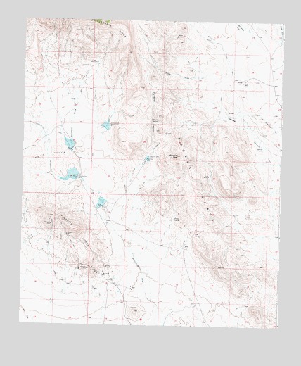
Massacre Peak, NM USGS Topographic Map
Click on map above to begin viewing in our Map Viewer.

This topographic map contains these locations and features:
Feature Name Type Latitude Longitude GNIS ID View Map
01216 Water WellWellN32.4009°W107.6253°923279View Map
01226 Water WellWellN32.4179°W107.7073°922424View Map
01277 Water WellWellN32.4829°W107.7161°922385View Map
01278 Water WellWellN32.4379°W107.6586°930156View Map
01282 Water WellWellN32.4687°W107.7259°922425View Map
01579 Water WellWellN32.4776°W107.6447°925474View Map
01580 Water WellWellN32.4751°W107.6456°922426View Map
Clark DrawValleyN32.4773°W107.6609°887641View Map
Cookes SpringSpringN32.4628°W107.6487°897529View Map
Cookes Spring Station (historical)LocaleN32.4606°W107.6484°898292View Map
Deming North DivisionCivilN32.4161°W107.7447°1937519View Map
Detention Dam Number 1DamN32.4351°W107.7239°897919View Map
Detention Dam Number 2DamN32.4471°W107.7265°897920View Map
Detention Dam Number 5DamN32.4237°W107.7111°897921View Map
Doubtful GroupMineN32.3773°W107.6684°914788View Map
Fluorite RidgeRidgeN32.4140°W107.7253°889116View Map
Fort Cummings (historical)MilitaryN32.4656°W107.6458°918184View Map
Fort Cummings 1836-1886 Historical MarkerParkN32.4656°W107.6464°932260View Map
Fort Cummings CemeteryCemeteryN32.4620°W107.6397°889150View Map
Fort Cummings Post Office (historical)Post OfficeN32.4656°W107.6464°937695View Map
Fryingpan CanyonValleyN32.4223°W107.7023°889255View Map
Fryingpan SpringSpringN32.4593°W107.6875°889256View Map
Grattan MineMineN32.4120°W107.7281°916243View Map
Gratten MineMineN32.4120°W107.7278°889531View Map
Green Spar MineMineN32.4162°W107.7361°889590View Map
Greenleaf MineMineN32.3937°W107.7070°889609View Map
Hill Top MineMineN32.3981°W107.7178°890007View Map
Hilltop ProspectMineN32.3981°W107.7181°916245View Map
Hyatt RanchLocaleN32.4745°W107.6442°890282View Map
Lucky MineMineN32.3993°W107.7086°891478View Map
Massacre PeakSummitN32.4448°W107.6750°891673View Map
Millard WindmillLocaleN32.4940°W107.6761°892047View Map
Number 1228 Water WellWellN32.4090°W107.6255°923280View Map
Oil Well WindmillLocaleN32.4829°W107.7159°892817View Map
Pony HillsRangeN32.4423°W107.7453°920666View Map
Puma SpringSpringN32.4190°W107.6759°893548View Map
Rattlesnake CanyonValleyN32.4976°W107.6467°893680View Map
Rattlesnake RidgeRidgeN32.4981°W107.7081°897452View Map
Sadler MineMineN32.3965°W107.7125°894256View Map
San Juan MineMineN32.3956°W107.7100°894446View Map
Sidey WindmillLocaleN32.4365°W107.6600°894828View Map
Starvation Draw Detention Dam Number 1DamN32.4384°W107.7256°923866View Map
Starvation Draw Detention Dam Number 2DamN32.4501°W107.7306°923867View Map
Starvation Draw Detention Dam Number 3DamN32.4550°W107.7096°898133View Map
Starvation Draw Detention Dam Number 4DamN32.4429°W107.6903°898134View Map
Starvation Draw Detention Dam Number 5DamN32.4247°W107.7098°923868View Map
Tip Top ProspectMineN32.4143°W107.7289°915259View Map
Valley MineMineN32.3895°W107.6959°896089View Map
White BluffMineN32.4104°W107.7142°915426View Map
Whitehill ProspectMineN32.4101°W107.7245°915256View Map
Wilson RanchLocaleN32.4070°W107.6709°896684View Map

Note: Coordinates in the location and feature list above are referenced to NAD83 datum.


Copyright (C) 2008-2024 Ryan Niemi / Sunset Dynamics ... All Rights Reserved