TopoQuest Logo
Do you find TopoQuest useful?
Help keep TopoQuest running and adding new maps/features by donating!
Bitcoin:  19c7KJd3qBynnjoSw5npx9KScwjBe4ifkT
Litecoin:  LXs6TkuXGGXo1vDsWCkWVdjQX94eUKd6ui
Home View Maps Find Maps Find Places Resources & Links


OK Canyon, New Mexico Topographic Map

USGS Map Title: OK Canyon, NM
USGS Map MRC: 32107E6
DRG (GeoTIFF) Download: o32107e6.tif


Neighboring USGS Topographic Map Quads:


  Dwyer, NM  
32107F7
 

  Whiterock Mountain, NM  
32107F6
 

  Lake Valley, NM  
32107F5
 

  Dwyer SE, NM  
32107E7
 

  OK Canyon, NM  
32107E6
 

  Greg Hills, NM  
32107E5
 

  Goat Ridge, NM  
32107D7
 

  Massacre Peak, NM  
32107D6
 

  Florida, NM  
32107D5


Map MRC Location:

N33°
W108°
N33°
W107°
H8 H7 H6 H5 H4 H3 H2 H1
G8 G7 G6 G5 G4 G3 G2 G1
F8 F7 F6 F5 F4 F3 F2 F1
E8 E7 E6 E5 E4 E3 E2 E1
D8 D7 D6 D5 D4 D3 D2 D1
C8 C7 C6 C5 C4 C3 C2 C1
B8 B7 B6 B5 B4 B3 B2 B1
A8 A7 A6 A5 A4 A3 A2 A1
N32°
W108°
N32°
W107°

OK Canyon, NM USGS 1:24K Topographic Map Preview:
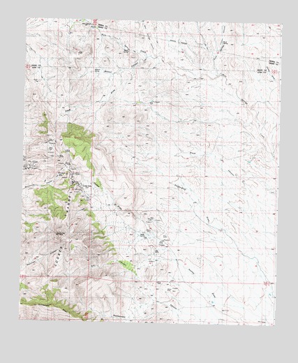
OK Canyon, NM USGS Topographic Map
Click on map above to begin viewing in our Map Viewer.

This topographic map contains these locations and features:
Feature Name Type Latitude Longitude GNIS ID View Map
01507 Water WellWellN32.6006°W107.6956°928670View Map
01508 Water WellWellN32.5715°W107.6878°928669View Map
01509 Water WellWellN32.5681°W107.6535°927543View Map
01510 Water WellWellN32.5715°W107.6878°928668View Map
01511 Water WellWellN32.5687°W107.6942°927544View Map
01512 Water WellWellN32.5554°W107.7078°927541View Map
01514 Water WellWellN32.5270°W107.6759°927540View Map
01522 Water WellWellN32.5556°W107.7411°927542View Map
Bear Springs CanyonValleyN32.6098°W107.6853°903675View Map
Burro SpringSpringN32.6117°W107.6992°886963View Map
Cathy RanchLocaleN32.5751°W107.6325°887292View Map
Clark DrawValleyN32.6031°W107.7031°887642View Map
Cookes PeakSummitN32.5370°W107.7311°920579View Map
Cookes RangeRangeN32.5393°W107.7292°920580View Map
Cookes Range Wilderness Study AreaParkN32.5370°W107.7311°935807View Map
Cooks PeakLocaleN32.5565°W107.7186°923782View Map
Cooks Peak CemeteryCemeteryN32.5565°W107.7186°931271View Map
Dove SpringSpringN32.6167°W107.6531°888497View Map
Dove Springs CanyonValleyN32.6031°W107.6536°905846View Map
Flying Y RanchLocaleN32.5892°W107.6378°898313View Map
Gladys MineMineN32.5679°W107.7323°932957View Map
Graphic MineMineN32.5284°W107.6839°932958View Map
Greenleaf 3 MineMineN32.5598°W107.7270°924733View Map
Greenleaf 4 MineMineN32.5598°W107.7270°924734View Map
Greenleaf 5 MineMineN32.5598°W107.7270°924735View Map
Hope MineMineN32.5598°W107.7270°932959View Map
Inez MineMineN32.5598°W107.7270°932960View Map
L McKinney RanchLocaleN32.5915°W107.6939°890762View Map
Little Mary MineMineN32.5598°W107.7270°939545View Map
Lookout DepositMineN32.5762°W107.7353°915274View Map
Mickey MineMineN32.5598°W107.7270°939544View Map
Mule SpringsSpringN32.6215°W107.7161°902310View Map
Ok CanyonValleyN32.5090°W107.6823°892840View Map
Old Commodore MineMineN32.5598°W107.7270°939548View Map
Poe Group MineMineN32.5598°W107.7270°939550View Map
Raithel MineMineN32.5598°W107.7270°939543View Map
Riley SpringSpringN32.5515°W107.7186°893901View Map
Shale SpringSpringN32.5359°W107.6920°894748View Map
Silver Cave Number 2MineN32.5584°W107.7256°915264View Map
Summit Group MineMineN32.5598°W107.7270°939552View Map
Surprise and Mahonney Number 1 ShaftMineN32.5573°W107.7256°915283View Map
Walnut CanyonValleyN32.6092°W107.6909°898469View Map
Walnut SpringSpringN32.6031°W107.7161°896230View Map
Webster MineMineN32.5573°W107.7256°939555View Map
West Side MineMineN32.5598°W107.7270°939556View Map
White Oaks MineMineN32.5598°W107.7270°939541View Map

Note: Coordinates in the location and feature list above are referenced to NAD83 datum.


Copyright (C) 2008-2025 Ryan Niemi / Sunset Dynamics ... All Rights Reserved