TopoQuest Logo
Do you find TopoQuest useful?
Help keep TopoQuest running and adding new maps/features by donating!
Bitcoin:  19c7KJd3qBynnjoSw5npx9KScwjBe4ifkT
Litecoin:  LXs6TkuXGGXo1vDsWCkWVdjQX94eUKd6ui
Home View Maps Find Maps Find Places Resources & Links


Floris, Iowa Topographic Map

USGS Map Title: Floris, IA
USGS Map MRC: 40092G3
DRG (GeoTIFF) Download: o40092g3.tif


Neighboring USGS Topographic Map Quads:


  Ottumwa South, IA  
40092H4
 

  Agency, IA  
40092H3
 

  Eldon, IA  
40092H2
 

  Bloomfield North, IA  
40092G4
 

  Floris, IA  
40092G3
 

  Selma, IA  
40092G2
 

  Bloomfield South, IA  
40092F4
 

  Pulaski, IA  
40092F3
 

  Milton, IA  
40092F2


Map MRC Location:

N41°
W93°
N41°
W92°
H8 H7 H6 H5 H4 H3 H2 H1
G8 G7 G6 G5 G4 G3 G2 G1
F8 F7 F6 F5 F4 F3 F2 F1
E8 E7 E6 E5 E4 E3 E2 E1
D8 D7 D6 D5 D4 D3 D2 D1
C8 C7 C6 C5 C4 C3 C2 C1
B8 B7 B6 B5 B4 B3 B2 B1
A8 A7 A6 A5 A4 A3 A2 A1
N40°
W93°
N40°
W92°

Floris, IA USGS 1:24K Topographic Map Preview:
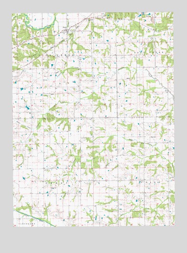
Floris, IA USGS Topographic Map
Click on map above to begin viewing in our Map Viewer.

This topographic map contains these locations and features:
Feature Name Type Latitude Longitude GNIS ID View Map
Butter CreekStreamN40.8075°W92.3594°455021View Map
City of FlorisCivilN40.8639°W92.3323°2394776View Map
Cupp GraveCemeteryN40.7667°W92.2668°1976114View Map
Fiedler CemeteryCemeteryN40.8611°W92.3585°1976149View Map
FlorisPopulated PlaceN40.8650°W92.3330°456644View Map
Floris (historical)LocaleN40.8645°W92.3266°1976100View Map
Floris Baptist ChurchChurchN40.8650°W92.3330°1976099View Map
Floris City HallBuildingN40.8650°W92.3330°1976098View Map
Floris Fire DepartmentBuildingN40.8653°W92.3330°1976097View Map
Floris ParkParkN40.8653°W92.3307°1976004View Map
Floris Post OfficePost OfficeN40.8650°W92.3330°1976096View Map
Hooper Field (historical)AirportN40.8084°W92.2502°466716View Map
Jay CemeteryCemeteryN40.8285°W92.3223°457913View Map
Lick CreekStreamN40.8653°W92.3532°458335View Map
Locust Grove ChurchChurchN40.7839°W92.3510°458556View Map
North Chequest CreekStreamN40.8364°W92.3018°459573View Map
Odd Fellows CemeteryCemeteryN40.8705°W92.3173°1823298View Map
Pagett CemeteryCemeteryN40.8334°W92.2641°1976117View Map
Pewter CemeteryCemeteryN40.8088°W92.3259°1976142View Map
Pierce CemeteryCemeteryN40.8708°W92.2934°460124View Map
Rouch CemeteryCemeteryN40.8022°W92.2688°460820View Map
Salt Creek Post Office (historical)Post OfficeN40.8639°W92.2641°1976018View Map
ShunemPopulated PlaceN40.7767°W92.2974°464745View Map
Shunem CemeteryCemeteryN40.7734°W92.3425°461593View Map
Stark CemeteryCemeteryN40.8089°W92.3240°1976141View Map
Township of Lick CreekCivilN40.8563°W92.3520°468233View Map
Township of PerryCivilN40.7764°W92.3441°468507View Map
Twin Ridge FarmsLocaleN40.7994°W92.3394°2709249View Map
White CemeteryCemeteryN40.8084°W92.3030°1976143View Map
Wilson CemeteryCemeteryN40.8334°W92.3002°1976148View Map

Note: Coordinates in the location and feature list above are referenced to NAD83 datum.


Copyright (C) 2008-2025 Ryan Niemi / Sunset Dynamics ... All Rights Reserved