TopoQuest Logo
Do you find TopoQuest useful?
Help keep TopoQuest running and adding new maps/features by donating!
Bitcoin:  19c7KJd3qBynnjoSw5npx9KScwjBe4ifkT
Litecoin:  LXs6TkuXGGXo1vDsWCkWVdjQX94eUKd6ui
Home View Maps Find Maps Find Places Resources & Links


Bloomfield South, Iowa Topographic Map

USGS Map Title: Bloomfield South, IA
USGS Map MRC: 40092F4
DRG (GeoTIFF) Download: o40092f4.tif


Neighboring USGS Topographic Map Quads:


  Paris, IA  
40092G5
 

  Bloomfield North, IA  
40092G4
 

  Floris, IA  
40092G3
 

  West Grove, IA  
40092F5
 

  Bloomfield South, IA  
40092F4
 

  Pulaski, IA  
40092F3
 

  Lancaster, MO  
40092E5
 

  Bunker Hill, MO  
40092E4
 

  Kilwinning, MO  
40092E3


Map MRC Location:

N41°
W93°
N41°
W92°
H8 H7 H6 H5 H4 H3 H2 H1
G8 G7 G6 G5 G4 G3 G2 G1
F8 F7 F6 F5 F4 F3 F2 F1
E8 E7 E6 E5 E4 E3 E2 E1
D8 D7 D6 D5 D4 D3 D2 D1
C8 C7 C6 C5 C4 C3 C2 C1
B8 B7 B6 B5 B4 B3 B2 B1
A8 A7 A6 A5 A4 A3 A2 A1
N40°
W93°
N40°
W92°

Bloomfield South, IA USGS 1:24K Topographic Map Preview:
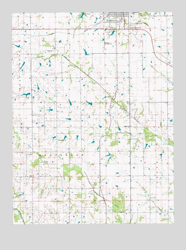
Bloomfield South, IA USGS Topographic Map
Click on map above to begin viewing in our Map Viewer.

This topographic map contains these locations and features:
Feature Name Type Latitude Longitude GNIS ID View Map
Bloomfield (historical)LocaleN40.7495°W92.4252°1976058View Map
Bloomfield Agri-Center ElevatorLocaleN40.7472°W92.4257°1976036View Map
Bloomfield Municipal AirportAirportN40.7294°W92.4290°466715View Map
Bloomfield South CemeteryCemeteryN40.7405°W92.4080°454705View Map
Bloomfield Volunteer Fire DepartmentBuildingN40.7473°W92.4186°1976054View Map
Bragg CemeteryCemeteryN40.6306°W92.4169°1976126View Map
Church of the Open BibleChurchN40.7489°W92.4113°1976075View Map
City of BloomfieldCivilN40.7488°W92.4174°467463View Map
Davies CemeteryCemeteryN40.6750°W92.4169°1976108View Map
Davis CountyCivilN40.7477°W92.4097°465214View Map
Davis County Flex - Ed High SchoolSchoolN40.7442°W92.4138°2719807View Map
Dooley CemeteryCemeteryN40.6528°W92.4869°455956View Map
French CemeteryCemeteryN40.6320°W92.3794°1976107View Map
Inskeep CemeteryCemeteryN40.6319°W92.4132°457818View Map
McGowen Recreation and Wildlife AreaParkN40.7445°W92.3946°1976006View Map
Patterson CemeteryCemeteryN40.6826°W92.4087°460040View Map
Pollard CemeteryCemeteryN40.7274°W92.4684°460353View Map
SteubenPopulated PlaceN40.7236°W92.3885°464761View Map
Steuben (historical)LocaleN40.7236°W92.3885°1976008View Map
Sullivan CemeteryCemeteryN40.7167°W92.4169°1976125View Map
Township of ClevelandCivilN40.7430°W92.4087°467623View Map
Township of WyacondahCivilN40.6548°W92.4617°469020View Map
Wesley Chapel CemeteryCemeteryN40.6749°W92.4651°462800View Map

Note: Coordinates in the location and feature list above are referenced to NAD83 datum.


Copyright (C) 2008-2025 Ryan Niemi / Sunset Dynamics ... All Rights Reserved