TopoQuest Logo
Do you find TopoQuest useful?
Help keep TopoQuest running and adding new maps/features by donating!
Bitcoin:  19c7KJd3qBynnjoSw5npx9KScwjBe4ifkT
Litecoin:  LXs6TkuXGGXo1vDsWCkWVdjQX94eUKd6ui
Home View Maps Find Maps Find Places Resources & Links


Flowers Gulch, Oregon Topographic Map

USGS Map Title: Flowers Gulch, OR
USGS Map MRC: 44119G1
DRG (GeoTIFF) Download: o44119g1.tif


Neighboring USGS Topographic Map Quads:


  Ritter, OR  
44119H2
 

  Meadow Brook Summit, OR  
44119H1
 

  Dale, OR  
44118H8
 

  Bullock Gulch, OR  
44119G2
 

  Flowers Gulch, OR  
44119G1
 

  Wildcat Point, OR  
44118G8
 

  Fox, OR  
44119F2
 

  Long Creek, OR  
44119F1
 

  Keeney Point, OR  
44118F8


Map MRC Location:

N45°
W120°
N45°
W119°
H8 H7 H6 H5 H4 H3 H2 H1
G8 G7 G6 G5 G4 G3 G2 G1
F8 F7 F6 F5 F4 F3 F2 F1
E8 E7 E6 E5 E4 E3 E2 E1
D8 D7 D6 D5 D4 D3 D2 D1
C8 C7 C6 C5 C4 C3 C2 C1
B8 B7 B6 B5 B4 B3 B2 B1
A8 A7 A6 A5 A4 A3 A2 A1
N44°
W120°
N44°
W119°

Flowers Gulch, OR USGS 1:24K Topographic Map Preview:
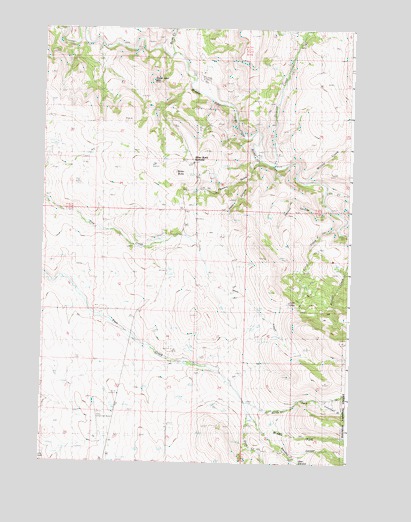
Flowers Gulch, OR USGS Topographic Map
Click on map above to begin viewing in our Map Viewer.

This topographic map contains these locations and features:
Feature Name Type Latitude Longitude GNIS ID View Map
Caverhill (historical)Populated PlaceN44.8179°W119.0983°1153788View Map
Caverhill Post Office (historical)Post OfficeN44.8179°W119.0983°1165023View Map
Dale CanyonValleyN44.7515°W119.0216°1140601View Map
Elliot CreekStreamN44.8185°W119.0050°1141828View Map
Flowers GulchValleyN44.8374°W119.0378°1142265View Map
Granite CreekStreamN44.8363°W119.0319°1142922View Map
Hanson CanyonValleyN44.8240°W119.0097°1143272View Map
Lick CreekStreamN44.8290°W119.0105°1144983View Map
Low GapGapN44.7957°W119.0252°1145588View Map
Middle Fork John Day River Rest AreaLocaleN44.8371°W119.0303°1638081View Map
Middle Fork Pass CreekStreamN44.7652°W119.0414°1146156View Map
Miranda's Skyranch AirportAirportN44.7585°W119.1006°1154052View Map
North Fork Pass CreekStreamN44.7677°W119.0425°1146989View Map
Plant CanyonValleyN44.8315°W119.0436°1147792View Map
Range School (historical)SchoolN44.8713°W119.0241°1148206View Map
Ritter ButteSummitN44.8338°W119.0730°1148486View Map
Ritter Butte SummitGapN44.8365°W119.0650°1158237View Map
Rush CreekStreamN44.8682°W119.0736°1148850View Map
Sugar Loaf MountainSummitN44.8596°W119.0814°1150535View Map
Swickey CanyonValleyN44.7593°W119.0341°1150782View Map
Troutman GulchValleyN44.7679°W119.0094°1151460View Map
Willow CreekStreamN44.8315°W119.0191°1152416View Map

Note: Coordinates in the location and feature list above are referenced to NAD83 datum.


Copyright (C) 2008-2025 Ryan Niemi / Sunset Dynamics ... All Rights Reserved