TopoQuest Logo
Do you find TopoQuest useful?
Help keep TopoQuest running and adding new maps/features by donating!
Bitcoin:  19c7KJd3qBynnjoSw5npx9KScwjBe4ifkT
Litecoin:  LXs6TkuXGGXo1vDsWCkWVdjQX94eUKd6ui
Home View Maps Find Maps Find Places Resources & Links


Flowing Well, Montana Topographic Map

USGS Map Title: Flowing Well, MT
USGS Map MRC: 47106C2
DRG (GeoTIFF) Download: o47106c2.tif


Neighboring USGS Topographic Map Quads:


  Frank Coulee, MT  
47106D3
 

  Fortyfour Coulee, MT  
47106D2
 

  Johnson Coulee West, MT  
47106D1
 

  Coal Creek, MT  
47106C3
 

  Flowing Well, MT  
47106C2
 

  Cemetery Coulee, MT  
47106C1
 

  Whiteside Ranch, MT  
47106B3
 

  Hedstrom Lake NW, MT  
47106B2
 

  Hedstrom Lake, MT  
47106B1


Map MRC Location:

N48°
W107°
N48°
W106°
H8 H7 H6 H5 H4 H3 H2 H1
G8 G7 G6 G5 G4 G3 G2 G1
F8 F7 F6 F5 F4 F3 F2 F1
E8 E7 E6 E5 E4 E3 E2 E1
D8 D7 D6 D5 D4 D3 D2 D1
C8 C7 C6 C5 C4 C3 C2 C1
B8 B7 B6 B5 B4 B3 B2 B1
A8 A7 A6 A5 A4 A3 A2 A1
N47°
W107°
N47°
W106°

Flowing Well, MT USGS 1:24K Topographic Map Preview:
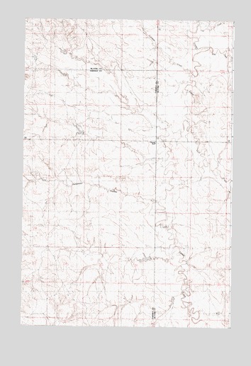
Flowing Well, MT USGS Topographic Map
Click on map above to begin viewing in our Map Viewer.

This topographic map contains these locations and features:
Feature Name Type Latitude Longitude GNIS ID View Map
17N44E08AAAD01 WellWellN47.2519°W106.1286°821699View Map
18N43E02CC__01 WellWellN47.3414°W106.2106°822317View Map
18N43E04DB__01 WellWellN47.3450°W106.2425°822354View Map
18N43E10ACD_01 WellWellN47.3306°W106.2317°822257View Map
18N43E10DABD01 WellWellN47.3311°W106.2164°822260View Map
18N43E12AAAB01 WellWellN47.3392°W106.1720°822301View Map
18N43E13AAAA01 WellWellN47.3247°W106.1711°822214View Map
18N43E13BAAA01 WellWellN47.3247°W106.1820°822215View Map
18N43E13DD__01 WellWellN47.3125°W106.1734°822134View Map
18N43E14AA__01 WellWellN47.3233°W106.1945°822204View Map
18N43E15CD__01 WellWellN47.3125°W106.2264°822135View Map
18N43E24AAAB01 WellWellN47.3103°W106.1720°822117View Map
18N43E28AABA01 WellWellN47.2961°W106.2378°822031View Map
18N43E28CD__01 WellWellN47.2839°W106.2478°821934View Map
18N44E08BAAB01 WellWellN47.3389°W106.1395°822298View Map
18N44E16CCCB01 WellWellN47.3117°W106.1267°822125View Map
18N44E19BDAD01 WellWellN47.3058°W106.1606°822098View Map
18N44E20BABC01 WellWellN47.3094°W106.1425°822106View Map
18N44E30BDCA01 WellWellN47.2900°W106.1634°821985View Map
18N44E30CDDC01 WellWellN47.2817°W106.1973°821925View Map
19N43E25DAAC01 WellWellN47.3744°W106.1711°822529View Map
19N44E29CBBD01 WellWellN47.3744°W106.1492°822528View Map
19N44E31CADB01 WellWellN47.3542°W106.1672°822405View Map
19N44E35DDDD01 WellWellN47.3550°W106.2311°822409View Map
Coal CreekStreamN47.3731°W106.1464°799785View Map
Crooked CreekStreamN47.3528°W106.1495°799796View Map
Dinosaurs Historical MarkerParkN47.3256°W106.1711°1715949View Map
Flowing WellLocaleN47.3247°W106.1711°799797View Map
Flowing Wells Rest AreaLocaleN47.3256°W106.1711°1715950View Map
Frady Number 1 DamDamN47.2600°W106.1473°797588View Map
Frady Number 3 DamDamN47.3617°W106.2256°797725View Map
Fradys Reservoir DamDamN47.3317°W106.2089°796141View Map
Gerold Gibbs DamDamN47.2767°W106.1723°796646View Map
Paris (historical)Populated PlaceN47.2911°W106.1589°1716180View Map
Paris Post Office (historical)Post OfficeN47.2911°W106.1589°1716181View Map
Patterson CouleeValleyN47.3031°W106.1681°799798View Map
Skull CreekStreamN47.3325°W106.1486°776617View Map
Soda CreekStreamN47.3642°W106.1395°799787View Map

Note: Coordinates in the location and feature list above are referenced to NAD83 datum.


Copyright (C) 2008-2024 Ryan Niemi / Sunset Dynamics ... All Rights Reserved