TopoQuest Logo
Do you find TopoQuest useful?
Help keep TopoQuest running and adding new maps/features by donating!
Bitcoin:  19c7KJd3qBynnjoSw5npx9KScwjBe4ifkT
Litecoin:  LXs6TkuXGGXo1vDsWCkWVdjQX94eUKd6ui
Home View Maps Find Maps Find Places Resources & Links


Coal Creek, Montana Topographic Map

USGS Map Title: Coal Creek, MT
USGS Map MRC: 47106C3
DRG (GeoTIFF) Download: o47106c3.tif


Neighboring USGS Topographic Map Quads:


  Hagen Gap, MT  
47106D4
 

  Frank Coulee, MT  
47106D3
 

  Fortyfour Coulee, MT  
47106D2
 

  Maxwell Coulee, MT  
47106C4
 

  Coal Creek, MT  
47106C3
 

  Flowing Well, MT  
47106C2
 

  Hafla School, MT  
47106B4
 

  Whiteside Ranch, MT  
47106B3
 

  Hedstrom Lake NW, MT  
47106B2


Map MRC Location:

N48°
W107°
N48°
W106°
H8 H7 H6 H5 H4 H3 H2 H1
G8 G7 G6 G5 G4 G3 G2 G1
F8 F7 F6 F5 F4 F3 F2 F1
E8 E7 E6 E5 E4 E3 E2 E1
D8 D7 D6 D5 D4 D3 D2 D1
C8 C7 C6 C5 C4 C3 C2 C1
B8 B7 B6 B5 B4 B3 B2 B1
A8 A7 A6 A5 A4 A3 A2 A1
N47°
W107°
N47°
W106°

Coal Creek, MT USGS 1:24K Topographic Map Preview:
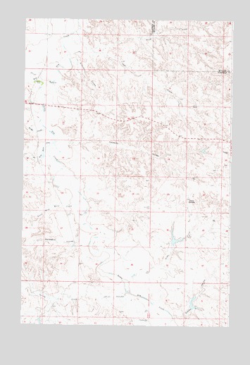
Coal Creek, MT USGS Topographic Map
Click on map above to begin viewing in our Map Viewer.

This topographic map contains these locations and features:
Feature Name Type Latitude Longitude GNIS ID View Map
17N42E01D___01 WellWellN47.2567°W106.3059°821733View Map
17N42E04DCCC01 WellWellN47.2533°W106.3723°821706View Map
18N43E06BB__01 WellWellN47.3522°W106.2956°822388View Map
18N43E17B___01 WellWellN47.3208°W106.2739°822192View Map
18N43E28CBDB01 WellWellN47.2872°W106.2523°821966View Map
18N43E29AA__01 WellWellN47.2947°W106.2584°822008View Map
19N42E25DA__01 WellWellN47.3750°W106.3006°822531View Map
Big Wild Horse CreekStreamN47.3219°W106.3550°768836View Map
Bridge CouleeValleyN47.3294°W106.3628°769218View Map
Calamity CouleeValleyN47.3250°W106.3361°769498View Map
Coal CreekStreamN47.3681°W106.3481°769970View Map
Frady Number 1 DamDamN47.3417°W106.2823°797746View Map
Gibbs CreekStreamN47.2675°W106.3109°771757View Map
Hook RockSummitN47.3400°W106.2734°806955View Map
Jeffrey Number 1 DamDamN47.3233°W106.3606°797449View Map
Jeffrey Number 2 DamDamN47.2850°W106.2839°797450View Map
Little Dry CreekStreamN47.3486°W106.3620°773442View Map
Little Wild Horse CreekStreamN47.3017°W106.3386°773501View Map
North Prong Coal CreekStreamN47.3617°W106.3286°774847View Map
Norwegian CouleeValleyN47.2894°W106.3406°774877View Map
Spring CreekStreamN47.2636°W106.3120°777049View Map
Stevens Coulee Number 1 DamDamN47.2583°W106.2723°797470View Map
Steves CouleeValleyN47.2539°W106.2842°777207View Map
White ButtesSummitN47.3008°W106.2753°806987View Map
Wilkinson CouleeValleyN47.3592°W106.3478°778505View Map

Note: Coordinates in the location and feature list above are referenced to NAD83 datum.


Copyright (C) 2008-2025 Ryan Niemi / Sunset Dynamics ... All Rights Reserved