TopoQuest Logo
Do you find TopoQuest useful?
Help keep TopoQuest running and adding new maps/features by donating!
Bitcoin:  19c7KJd3qBynnjoSw5npx9KScwjBe4ifkT
Litecoin:  LXs6TkuXGGXo1vDsWCkWVdjQX94eUKd6ui
Home View Maps Find Maps Find Places Resources & Links


Cemetery Coulee, Montana Topographic Map

USGS Map Title: Cemetery Coulee, MT
USGS Map MRC: 47106C1
DRG (GeoTIFF) Download: o47106c1.tif


Neighboring USGS Topographic Map Quads:


  Fortyfour Coulee, MT  
47106D2
 

  Johnson Coulee West, MT  
47106D1
 

  Johnson Coulee East, MT  
47105D8
 

  Flowing Well, MT  
47106C2
 

  Cemetery Coulee, MT  
47106C1
 

  Beauty Creek, MT  
47105C8
 

  Hedstrom Lake NW, MT  
47106B2
 

  Hedstrom Lake, MT  
47106B1
 

  Berry School, MT  
47105B8


Map MRC Location:

N48°
W107°
N48°
W106°
H8 H7 H6 H5 H4 H3 H2 H1
G8 G7 G6 G5 G4 G3 G2 G1
F8 F7 F6 F5 F4 F3 F2 F1
E8 E7 E6 E5 E4 E3 E2 E1
D8 D7 D6 D5 D4 D3 D2 D1
C8 C7 C6 C5 C4 C3 C2 C1
B8 B7 B6 B5 B4 B3 B2 B1
A8 A7 A6 A5 A4 A3 A2 A1
N47°
W107°
N47°
W106°

Cemetery Coulee, MT USGS 1:24K Topographic Map Preview:
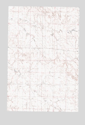
Cemetery Coulee, MT USGS Topographic Map
Click on map above to begin viewing in our Map Viewer.

This topographic map contains these locations and features:
Feature Name Type Latitude Longitude GNIS ID View Map
17N44E01ACAA01 WellWellN47.2636°W106.0486°821790View Map
17N44E02BAAB01 WellWellN47.2672°W106.0759°821822View Map
17N44E02BABA01 WellWellN47.2672°W106.0781°821823View Map
17N44E03ADCD01 WellWellN47.2614°W106.0886°821778View Map
17N44E10ABAA01 WellWellN47.2528°W106.0914°821704View Map
17N44E12ABBC01 WellWellN47.2519°W106.0520°821697View Map
17N44E12ABBC02 WellWellN47.2519°W106.0520°821698View Map
17N45E05CAAA01 WellWellN47.2594°W106.0109°821751View Map
17N45E06AAAA01 WellWellN47.2667°W106.0217°821808View Map
17N45E06ABBD01 WellWellN47.2658°W106.0295°821804View Map
18N44E13AAAC01 WellWellN47.3236°W106.0436°822205View Map
18N44E14ABAC01 WellWellN47.3239°W106.0709°822207View Map
18N44E14BABD01 WellWellN47.3239°W106.0781°822208View Map
18N45E30DDCB01 WellWellN47.2825°W106.0259°821930View Map
19N44E21DCDD01 WellWellN47.2967°W106.1131°822033View Map
19N44E33ACCD01 WellWellN47.3619°W106.1159°822448View Map
Cemetery CouleeValleyN47.3575°W106.0922°799786View Map
Haglunds Ritchie CemeteryCemeteryN47.3247°W106.0645°1716215View Map
Hannaland Number 3 DamDamN47.3467°W106.0956°796652View Map
Hannaland Number 4 DamDamN47.3600°W106.0972°796653View Map
Hannaland Number 5 DamDamN47.3450°W106.0722°796654View Map
Hannaland Number 6 DamDamN47.3400°W106.0456°796655View Map
Hannaland Reservoir DamDamN47.3450°W106.0156°796111View Map
Walkerville DamDamN47.2967°W106.1089°798177View Map
White (historical)Populated PlaceN47.2917°W106.0339°1716164View Map
White Post Office (historical)Post OfficeN47.2917°W106.0339°1716163View Map

Note: Coordinates in the location and feature list above are referenced to NAD83 datum.


Copyright (C) 2008-2025 Ryan Niemi / Sunset Dynamics ... All Rights Reserved