TopoQuest Logo
Do you find TopoQuest useful?
Help keep TopoQuest running and adding new maps/features by donating!
Bitcoin:  19c7KJd3qBynnjoSw5npx9KScwjBe4ifkT
Litecoin:  LXs6TkuXGGXo1vDsWCkWVdjQX94eUKd6ui
Home View Maps Find Maps Find Places Resources & Links


Foolhen Mountain, Montana Topographic Map

USGS Map Title: Foolhen Mountain, MT
USGS Map MRC: 45113G2
DRG (GeoTIFF) Download: o45113g2.tif


Neighboring USGS Topographic Map Quads:


  Long Peak, MT  
45113H3
 

  Lower Seymour Lake, MT  
45113H2
 

  Lincoln Gulch, MT  
45113H1
 

  Pine Hill, MT  
45113G3
 

  Foolhen Mountain, MT  
45113G2
 

  Dickie Hills, MT  
45113G1
 

  Proposal Rock, MT  
45113F3
 

  Shaw Mountain, MT  
45113F2
 

  Stine Mountain, MT  
45113F1


Map MRC Location:

N46°
W114°
N46°
W113°
H8 H7 H6 H5 H4 H3 H2 H1
G8 G7 G6 G5 G4 G3 G2 G1
F8 F7 F6 F5 F4 F3 F2 F1
E8 E7 E6 E5 E4 E3 E2 E1
D8 D7 D6 D5 D4 D3 D2 D1
C8 C7 C6 C5 C4 C3 C2 C1
B8 B7 B6 B5 B4 B3 B2 B1
A8 A7 A6 A5 A4 A3 A2 A1
N45°
W114°
N45°
W113°

Foolhen Mountain, MT USGS 1:24K Topographic Map Preview:
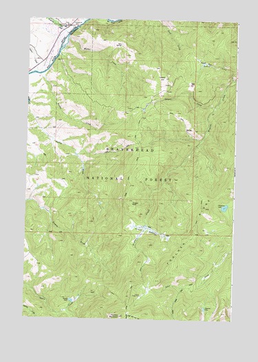
Foolhen Mountain, MT USGS Topographic Map
Click on map above to begin viewing in our Map Viewer.

This topographic map contains these locations and features:
Feature Name Type Latitude Longitude GNIS ID View Map
01N13W04BCBC01 WellWellN45.8674°W113.2362°812899View Map
Calvert CreekStreamN45.8394°W113.1373°780795View Map
Calvert CreekStreamN45.8524°W113.2445°780796View Map
Calvert HillSummitN45.8505°W113.1687°780797View Map
Calvert MineMineN45.8574°W113.1528°802492View Map
Ferguson LakeLakeN45.7972°W113.1310°783355View Map
FishtrapPopulated PlaceN45.8721°W113.2295°783466View Map
Fishtrap CampgroundLocaleN45.8716°W113.2226°801938View Map
Fishtrap CreekStreamN45.8683°W113.2259°783468View Map
Fishtrap Creek Sportmans AccessLocaleN45.8705°W113.2264°801937View Map
Fishtrap Post Office (historical)Post OfficeN45.8721°W113.2295°1786373View Map
Fishtrap School (historical)SchoolN45.8733°W113.2234°783471View Map
Foolhen Forest Service StatinLocaleN45.7588°W113.1812°801960View Map
Foolhen MountainSummitN45.7510°W113.1928°783582View Map
Foolhen Ranger CabinLocaleN45.7596°W113.1803°783584View Map
Foolhen RidgeRidgeN45.7927°W113.1467°783585View Map
Johanna LakeLakeN45.7548°W113.1422°785505View Map
La Marche CreekStreamN45.8746°W113.1973°785872View Map
Lovell LakeLakeN45.7575°W113.2219°791383View Map
Minnie CreekStreamN45.8738°W113.2170°787484View Map
Moose ParkFlatN45.8571°W113.1439°787665View Map
Trident MeadowsSwampN45.7874°W113.1764°792376View Map
Trident PeakSummitN45.7983°W113.1867°792377View Map
Tucker CreekStreamN45.8516°W113.2431°792436View Map
Walker CreekStreamN45.8671°W113.2267°792760View Map
Zero SpringSpringN45.8644°W113.1950°793635View Map

Note: Coordinates in the location and feature list above are referenced to NAD83 datum.


Copyright (C) 2008-2025 Ryan Niemi / Sunset Dynamics ... All Rights Reserved