TopoQuest Logo
Do you find TopoQuest useful?
Help keep TopoQuest running and adding new maps/features by donating!
Bitcoin:  19c7KJd3qBynnjoSw5npx9KScwjBe4ifkT
Litecoin:  LXs6TkuXGGXo1vDsWCkWVdjQX94eUKd6ui
Home View Maps Find Maps Find Places Resources & Links


Lower Seymour Lake, Montana Topographic Map

USGS Map Title: Lower Seymour Lake, MT
USGS Map MRC: 45113H2
DRG (GeoTIFF) Download: o45113h2.tif


Neighboring USGS Topographic Map Quads:


  Storm Lake, MT  
46113A3
 

  Mount Evans, MT  
46113A2
 

  Mount Haggin, MT  
46113A1
 

  Long Peak, MT  
45113H3
 

  Lower Seymour Lake, MT  
45113H2
 

  Lincoln Gulch, MT  
45113H1
 

  Pine Hill, MT  
45113G3
 

  Foolhen Mountain, MT  
45113G2
 

  Dickie Hills, MT  
45113G1


Map MRC Location:

N46°
W114°
N46°
W113°
H8 H7 H6 H5 H4 H3 H2 H1
G8 G7 G6 G5 G4 G3 G2 G1
F8 F7 F6 F5 F4 F3 F2 F1
E8 E7 E6 E5 E4 E3 E2 E1
D8 D7 D6 D5 D4 D3 D2 D1
C8 C7 C6 C5 C4 C3 C2 C1
B8 B7 B6 B5 B4 B3 B2 B1
A8 A7 A6 A5 A4 A3 A2 A1
N45°
W114°
N45°
W113°

Lower Seymour Lake, MT USGS 1:24K Topographic Map Preview:
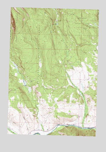
Lower Seymour Lake, MT USGS Topographic Map
Click on map above to begin viewing in our Map Viewer.

This topographic map contains these locations and features:
Feature Name Type Latitude Longitude GNIS ID View Map
02N13W16DDC_01 WellWellN45.9166°W113.2151°813350View Map
Anderson DitchCanalN45.8849°W113.2381°779033View Map
Arcola Scout CampLocaleN45.9441°W113.1698°801961View Map
Bacon DitchCanalN45.9183°W113.1928°779229View Map
Bear Trap GulchValleyN45.9835°W113.1375°779566View Map
Chub CreekStreamN45.9883°W113.1859°781264View Map
East Fork La Marche CreekStreamN45.9169°W113.2220°782866View Map
La Marche Creek RanchLocaleN45.9230°W113.2253°785873View Map
Lake Gulch (historical)LocaleN45.9430°W113.2064°1786401View Map
Lower Seymour LakeLakeN45.9847°W113.1846°786679View Map
Lower Seymour Laske CampgroundLocaleN45.9880°W113.1748°801962View Map
Pony CreekStreamN45.8808°W113.1834°789076View Map
Seymour CampgroundLocaleN45.9866°W113.1842°1797302View Map
Seymour CreekStreamN45.8827°W113.1434°790257View Map
Sportmans CampgroundLocaleN45.8855°W113.1670°801944View Map
Sundance LodgeLocaleN45.9219°W113.2428°801943View Map

Note: Coordinates in the location and feature list above are referenced to NAD83 datum.


Copyright (C) 2008-2025 Ryan Niemi / Sunset Dynamics ... All Rights Reserved