TopoQuest Logo
Do you find TopoQuest useful?
Help keep TopoQuest running and adding new maps/features by donating!
Bitcoin:  19c7KJd3qBynnjoSw5npx9KScwjBe4ifkT
Litecoin:  LXs6TkuXGGXo1vDsWCkWVdjQX94eUKd6ui
Home View Maps Find Maps Find Places Resources & Links


Fordham, Missouri Topographic Map

USGS Map Title: Fordham, MO
USGS Map MRC: 39094G3
DRG (GeoTIFF) Download: o39094g3.tif


Neighboring USGS Topographic Map Quads:


  Wood, MO  
39094H4
 

  Maysville, MO  
39094H3
 

  Weatherby, MO  
39094H2
 

  Amity, MO  
39094G4
 

  Fordham, MO  
39094G3
 

  Winston, MO  
39094G2
 

  Perrin, MO  
39094F4
 

  Cameron West, MO  
39094F3
 

  Cameron East, MO  
39094F2


Map MRC Location:

N40°
W95°
N40°
W94°
H8 H7 H6 H5 H4 H3 H2 H1
G8 G7 G6 G5 G4 G3 G2 G1
F8 F7 F6 F5 F4 F3 F2 F1
E8 E7 E6 E5 E4 E3 E2 E1
D8 D7 D6 D5 D4 D3 D2 D1
C8 C7 C6 C5 C4 C3 C2 C1
B8 B7 B6 B5 B4 B3 B2 B1
A8 A7 A6 A5 A4 A3 A2 A1
N39°
W95°
N39°
W94°

Fordham, MO USGS 1:24K Topographic Map Preview:
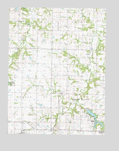
Fordham, MO USGS Topographic Map
Click on map above to begin viewing in our Map Viewer.

This topographic map contains these locations and features:
Feature Name Type Latitude Longitude GNIS ID View Map
A-27 LakeReservoirN39.7501°W94.3269°760811View Map
A-39 LakeReservoirN39.7967°W94.2619°760682View Map
B-36 LakeReservoirN39.8251°W94.3470°760708View Map
Baker SchoolSchoolN39.7772°W94.3388°729423View Map
Bee CreekStreamN39.8508°W94.2627°738094View Map
Cameron Number 1 ReservoirReservoirN39.7609°W94.2623°760258View Map
Cameron Reservoir DamDamN39.7750°W94.2736°760462View Map
Cameron Reservoir Number 2ReservoirN39.7702°W94.2664°760461View Map
Cameron Reservoir Number 2 DamDamN39.7650°W94.2619°760460View Map
Cameron Reservoir Number 3ReservoirN39.7750°W94.2736°760463View Map
Cameron ReservoirsReservoirN39.7628°W94.2597°738096View Map
City of Cameron Reservoir Number 1 DamDamN39.7633°W94.2636°760257View Map
FordhamPopulated PlaceN39.8300°W94.2705°729490View Map
Garden Prairie SchoolSchoolN39.8081°W94.2999°729495View Map
Gridley (historical)Populated PlaceN39.8061°W94.2752°740186View Map
Grindstone-Lost-Muddy Creek Watershed Dam A-39DamN39.7967°W94.2619°760681View Map
Grindstone-Lost-Muddy Creek Watershed Dam B-25DamN39.8433°W94.3302°762611View Map
Grindstone-Lost-Muddy Creek Watershed Dam B-35DamN39.8267°W94.3486°760707View Map
Hedge School (historical)SchoolN39.8519°W94.3194°729511View Map
Highland School (historical)SchoolN39.8106°W94.3397°729514View Map
Liberty SchoolSchoolN39.8042°W94.2527°729533View Map
Marvin ChapelChurchN39.8283°W94.3613°729550View Map
Mount Pleasant CemeteryCemeteryN39.8567°W94.3002°741949View Map
Mount Pleasant Church (historical)ChurchN39.8572°W94.3002°729567View Map
Osborn Elementary SchoolSchoolN39.7520°W94.3569°2545361View Map
Osborn High SchoolSchoolN39.7520°W94.3573°2545354View Map
Owens CreekStreamN39.8164°W94.2730°729598View Map
Peach CreekStreamN39.8569°W94.2563°738097View Map
Pleasant Valley School (historical)SchoolN39.8667°W94.2733°729615View Map
Redman CemeteryCemeteryN39.8730°W94.2811°741948View Map
Redman Lake DamDamN39.8750°W94.3652°762805View Map
Summit SchoolSchoolN39.7622°W94.2808°729663View Map
Surprise SchoolSchoolN39.8347°W94.3716°729666View Map
Township of Grand RiverCivilN39.7901°W94.2626°766595View Map
Walnut Grove SchoolSchoolN39.8383°W94.2772°729682View Map
Wamsley CreekStreamN39.8269°W94.2677°729684View Map
Wheeler CreekStreamN39.7811°W94.2880°729690View Map

Note: Coordinates in the location and feature list above are referenced to NAD83 datum.


Copyright (C) 2008-2025 Ryan Niemi / Sunset Dynamics ... All Rights Reserved