TopoQuest Logo
Do you find TopoQuest useful?
Help keep TopoQuest running and adding new maps/features by donating!
Bitcoin:  19c7KJd3qBynnjoSw5npx9KScwjBe4ifkT
Litecoin:  LXs6TkuXGGXo1vDsWCkWVdjQX94eUKd6ui
Home View Maps Find Maps Find Places Resources & Links


Perrin, Missouri Topographic Map

USGS Map Title: Perrin, MO
USGS Map MRC: 39094F4
DRG (GeoTIFF) Download: o39094f4.tif


Neighboring USGS Topographic Map Quads:


  Clarksdale, MO  
39094G5
 

  Amity, MO  
39094G4
 

  Fordham, MO  
39094G3
 

  Hemple, MO  
39094F5
 

  Perrin, MO  
39094F4
 

  Cameron West, MO  
39094F3
 

  Gower, MO  
39094E5
 

  Plattsburg, MO  
39094E4
 

  Lathrop, MO  
39094E3


Map MRC Location:

N40°
W95°
N40°
W94°
H8 H7 H6 H5 H4 H3 H2 H1
G8 G7 G6 G5 G4 G3 G2 G1
F8 F7 F6 F5 F4 F3 F2 F1
E8 E7 E6 E5 E4 E3 E2 E1
D8 D7 D6 D5 D4 D3 D2 D1
C8 C7 C6 C5 C4 C3 C2 C1
B8 B7 B6 B5 B4 B3 B2 B1
A8 A7 A6 A5 A4 A3 A2 A1
N39°
W95°
N39°
W94°

Perrin, MO USGS 1:24K Topographic Map Preview:
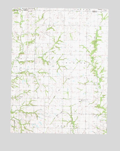
Perrin, MO USGS Topographic Map
Click on map above to begin viewing in our Map Viewer.

This topographic map contains these locations and features:
Feature Name Type Latitude Longitude GNIS ID View Map
Bethany ChurchChurchN39.6611°W94.4891°742008View Map
BraleyPopulated PlaceN39.6808°W94.4266°714629View Map
DelaneyPopulated PlaceN39.6417°W94.4516°740806View Map
Eskin Post OfficePost OfficeN39.7017°W94.4077°765610View Map
Fairview SchoolSchoolN39.6311°W94.4022°717813View Map
Freeman Farm Number Three DamDamN39.6433°W94.4636°761777View Map
Freeman Farm Number Two DamDamN39.6383°W94.4636°761778View Map
Freeman Farms Dam Number OneDamN39.6350°W94.4719°761779View Map
Freemans Farm Dam Number FourDamN39.6317°W94.4669°760647View Map
Grand Prairie SchoolSchoolN39.7336°W94.4111°718672View Map
Jones Lake Section 10 DamDamN39.6783°W94.4852°761775View Map
Lake Joseph DamDamN39.6867°W94.4400°758239View Map
Lebanon Church (historical)ChurchN39.6817°W94.4938°720873View Map
Long Branch School (historical)SchoolN39.7261°W94.4561°721534View Map
Maple HillPopulated PlaceN39.7017°W94.4077°758438View Map
Martin School (historical)SchoolN39.6814°W94.4658°741442View Map
Marun SchoolSchoolN39.6814°W94.4655°721941View Map
MoorsPopulated PlaceN39.7194°W94.3922°741082View Map
Number 17 ReservoirReservoirN39.6321°W94.4652°760648View Map
Old Presbyterian CemeteryCemeteryN39.7472°W94.4794°742009View Map
PerrinPopulated PlaceN39.6603°W94.4024°724231View Map
Perrin School (historical)SchoolN39.6561°W94.4036°747029View Map
Platte Center SchoolSchoolN39.6814°W94.4155°724463View Map
Spring Hill School (historical)SchoolN39.6589°W94.4919°726927View Map
Township of PlatteCivilN39.6961°W94.4037°766518View Map
Victory School (historical)SchoolN39.6353°W94.4566°728197View Map

Note: Coordinates in the location and feature list above are referenced to NAD83 datum.


Copyright (C) 2008-2024 Ryan Niemi / Sunset Dynamics ... All Rights Reserved