TopoQuest Logo
Do you find TopoQuest useful?
Help keep TopoQuest running and adding new maps/features by donating!
Bitcoin:  19c7KJd3qBynnjoSw5npx9KScwjBe4ifkT
Litecoin:  LXs6TkuXGGXo1vDsWCkWVdjQX94eUKd6ui
Home View Maps Find Maps Find Places Resources & Links


Winston, Missouri Topographic Map

USGS Map Title: Winston, MO
USGS Map MRC: 39094G2
DRG (GeoTIFF) Download: o39094g2.tif


Neighboring USGS Topographic Map Quads:


  Maysville, MO  
39094H3
 

  Weatherby, MO  
39094H2
 

  Altamont, MO  
39094H1
 

  Fordham, MO  
39094G3
 

  Winston, MO  
39094G2
 

  Kidder, MO  
39094G1
 

  Cameron West, MO  
39094F3
 

  Cameron East, MO  
39094F2
 

  Hamilton West, MO  
39094F1


Map MRC Location:

N40°
W95°
N40°
W94°
H8 H7 H6 H5 H4 H3 H2 H1
G8 G7 G6 G5 G4 G3 G2 G1
F8 F7 F6 F5 F4 F3 F2 F1
E8 E7 E6 E5 E4 E3 E2 E1
D8 D7 D6 D5 D4 D3 D2 D1
C8 C7 C6 C5 C4 C3 C2 C1
B8 B7 B6 B5 B4 B3 B2 B1
A8 A7 A6 A5 A4 A3 A2 A1
N39°
W95°
N39°
W94°

Winston, MO USGS 1:24K Topographic Map Preview:
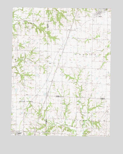
Winston, MO USGS Topographic Map
Click on map above to begin viewing in our Map Viewer.

This topographic map contains these locations and features:
Feature Name Type Latitude Longitude GNIS ID View Map
A-26 LakeReservoirN39.8100°W94.2202°760870View Map
Christian Chapel CemeteryCemeteryN39.8556°W94.2297°742057View Map
Crossroads Correctional CenterBuildingN39.7655°W94.2239°2735651View Map
DeKalb A-33 LakeReservoirN39.8399°W94.2343°760868View Map
Delano CemeteryCemeteryN39.7897°W94.2291°742055View Map
Eureka School (historical)SchoolN39.8308°W94.1866°717658View Map
Finkle Lake DamDamN39.8433°W94.2202°762618View Map
Four County PlazaLocaleN39.7556°W94.2361°736096View Map
Grindstone-Lost-Muddy Creek Watershed Dam A-26DamN39.8100°W94.2202°760869View Map
Grindstone-Lost-Muddy Creek Watershed Dam A-33DamN39.8400°W94.2369°760867View Map
Harris SchoolSchoolN39.7797°W94.2488°729509View Map
Island Number 10 School (historical)SchoolN39.8111°W94.1491°720181View Map
Jones CemeteryCemeteryN39.7531°W94.2144°742052View Map
Jordan BranchStreamN39.7647°W94.1574°720429View Map
Karr Lake DamDamN39.8550°W94.2452°762619View Map
Kenney CemeteryCemeteryN39.7650°W94.1305°742053View Map
Kidder - Altamont - Winston Fire Protection District WinstonBuildingN39.8699°W94.1418°2621246View Map
Kidder CemeteryCemeteryN39.7725°W94.1285°742054View Map
Kinney School (historical)SchoolN39.7733°W94.1477°730128View Map
Lone Cottage School (historical)SchoolN39.8039°W94.1858°721441View Map
MabelPopulated PlaceN39.8217°W94.1999°721705View Map
Mount Pleasant SchoolSchoolN39.8031°W94.2208°729568View Map
Prairie Gem School (historical)SchoolN39.7742°W94.1855°724848View Map
Ray SchoolSchoolN39.8458°W94.1491°725130View Map
Rice CreekStreamN39.8667°W94.2452°729625View Map
Rogers School (historical)SchoolN39.7600°W94.2338°747041View Map
Severling Lake DamDamN39.7733°W94.2352°761884View Map
Taylor Mills School (historical)SchoolN39.8575°W94.2286°729668View Map
Township of ColfaxCivilN39.8308°W94.1493°766577View Map
Village of WinstonCivilN39.8699°W94.1416°2399723View Map
Wamsley CemeteryCemeteryN39.8233°W94.2444°742056View Map
Wamsley Church (historical)ChurchN39.8217°W94.2444°729683View Map
Wamsley School (historical)SchoolN39.8331°W94.2344°729685View Map
Western Missouri Correctional CenterBuildingN39.7641°W94.2294°2735663View Map
WinstonPopulated PlaceN39.8700°W94.1399°730251View Map
Winston CemeteryCemeteryN39.8733°W94.1311°2681509View Map
Winston Elementary SchoolSchoolN39.8714°W94.1437°2545141View Map
Winston High SchoolSchoolN39.8712°W94.1440°2545163View Map
Winston Post OfficePost OfficeN39.8705°W94.1415°2782619View Map
Wood School (historical)SchoolN39.8611°W94.1813°729088View Map

Note: Coordinates in the location and feature list above are referenced to NAD83 datum.


Copyright (C) 2008-2024 Ryan Niemi / Sunset Dynamics ... All Rights Reserved