TopoQuest Logo
Do you find TopoQuest useful?
Help keep TopoQuest running and adding new maps/features by donating!
Bitcoin:  19c7KJd3qBynnjoSw5npx9KScwjBe4ifkT
Litecoin:  LXs6TkuXGGXo1vDsWCkWVdjQX94eUKd6ui
Home View Maps Find Maps Find Places Resources & Links


Fort Duchesne, Utah Topographic Map

USGS Map Title: Fort Duchesne, UT
USGS Map MRC: 40109C7
DRG (GeoTIFF) Download: o40109c7.tif


Neighboring USGS Topographic Map Quads:


  Whiterocks, UT  
40109D8
 

  Lapoint, UT  
40109D7
 

  Vernal NW, UT  
40109D6
 

  Roosevelt, UT  
40109C8
 

  Fort Duchesne, UT  
40109C7
 

  Vernal SW, UT  
40109C6
 

  Windy Ridge, UT  
40109B8
 

  Randlett, UT  
40109B7
 

  Pelican Lake, UT  
40109B6


Map MRC Location:

N41°
W110°
N41°
W109°
H8 H7 H6 H5 H4 H3 H2 H1
G8 G7 G6 G5 G4 G3 G2 G1
F8 F7 F6 F5 F4 F3 F2 F1
E8 E7 E6 E5 E4 E3 E2 E1
D8 D7 D6 D5 D4 D3 D2 D1
C8 C7 C6 C5 C4 C3 C2 C1
B8 B7 B6 B5 B4 B3 B2 B1
A8 A7 A6 A5 A4 A3 A2 A1
N40°
W110°
N40°
W109°

Fort Duchesne, UT USGS 1:24K Topographic Map Preview:
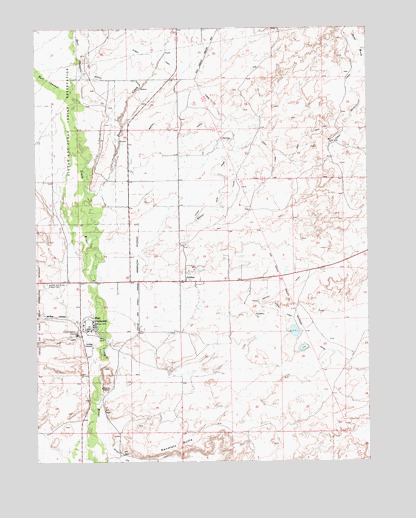
Fort Duchesne, UT USGS Topographic Map
Click on map above to begin viewing in our Map Viewer.

This topographic map contains these locations and features:
Feature Name Type Latitude Longitude GNIS ID View Map
Bottle HollowValleyN40.2886°W109.8588°1425892View Map
Bottle Hollow ReservoirReservoirN40.2833°W109.8640°1434789View Map
Bottle Hollow ReservoirReservoirN40.2900°W109.8690°1434791View Map
Bottle Hollow ResortLocaleN40.2908°W109.8621°1435182View Map
Bullock Draw DamDamN40.3550°W109.8174°1434805View Map
Bullock Draw ReservoirReservoirN40.3553°W109.8164°1434804View Map
Deep CreekStreamN40.3252°W109.8546°1440349View Map
East Channel Uinta RiverStreamN40.3569°W109.8613°1427675View Map
Fort DuchesnePopulated PlaceN40.2880°W109.8546°1428039View Map
Fort Duchesne CemeteryCemeteryN40.3335°W109.8167°1435546View Map
Fort Duchesne Police DepartmentBuildingN40.2867°W109.8605°2769018View Map
Fort Duchesne Post OfficePost OfficeN40.3024°W109.8631°2769095View Map
GusherPopulated PlaceN40.3019°W109.8185°1428449View Map
Gusher CemeteryCemeteryN40.2996°W109.8320°1435640View Map
Indian Agency HeadquartersLocaleN40.2869°W109.8596°1454446View Map
Moffat CanalCanalN40.3452°W109.8163°1430399View Map
North Bottle Hollow DamDamN40.2900°W109.8690°1434790View Map
Old Fort DuchesneLocaleN40.2563°W109.8532°1436065View Map
Ouray Park CanalCanalN40.2833°W109.7707°1431042View Map
Randlett ButteSummitN40.2544°W109.8210°1431566View Map
South Bottle Hollow DamDamN40.2833°W109.8640°1434788View Map
Thunderbird Acres Park CampgroundLocaleN40.3016°W109.8457°1436495View Map
Uintah and Ouray Indian CemeteryCemeteryN40.3013°W109.8712°1433775View Map
United States Bureau of Indian Affairs Uintah and Ouray Agency PoliceBuildingN40.2827°W109.8691°2730489View Map
Ute Tribe Ambulance ServiceBuildingN40.3024°W109.8609°2665425View Map
West Channel Uinta RiverStreamN40.3569°W109.8613°1434057View Map

Note: Coordinates in the location and feature list above are referenced to NAD83 datum.


Copyright (C) 2008-2025 Ryan Niemi / Sunset Dynamics ... All Rights Reserved