TopoQuest Logo
Do you find TopoQuest useful?
Help keep TopoQuest running and adding new maps/features by donating!
Bitcoin:  19c7KJd3qBynnjoSw5npx9KScwjBe4ifkT
Litecoin:  LXs6TkuXGGXo1vDsWCkWVdjQX94eUKd6ui
Home View Maps Find Maps Find Places Resources & Links


Fountain City, Indiana Topographic Map

USGS Map Title: Fountain City, IN
USGS Map MRC: 39084H8
DRG (GeoTIFF) Download: o39084h8.tif


Neighboring USGS Topographic Map Quads:


  Carlos, IN  
40085A1
 

  Lynn, IN  
40084A8
 

  Spartanburg, IN  
40084A7
 

  Greens Fork, IN  
39085H1
 

  Fountain City, IN  
39084H8
 

  Whitewater, IN  
39084H7
 

  Jacksonburg, IN  
39085G1
 

  Richmond, IN  
39084G8
 

  New Paris, OH  
39084G7


Map MRC Location:

N40°
W85°
N40°
W84°
H8 H7 H6 H5 H4 H3 H2 H1
G8 G7 G6 G5 G4 G3 G2 G1
F8 F7 F6 F5 F4 F3 F2 F1
E8 E7 E6 E5 E4 E3 E2 E1
D8 D7 D6 D5 D4 D3 D2 D1
C8 C7 C6 C5 C4 C3 C2 C1
B8 B7 B6 B5 B4 B3 B2 B1
A8 A7 A6 A5 A4 A3 A2 A1
N39°
W85°
N39°
W84°

Fountain City, IN USGS 1:24K Topographic Map Preview:
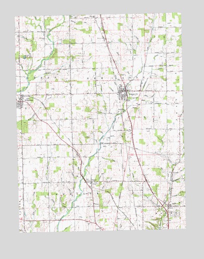
Fountain City, IN USGS Topographic Map
Click on map above to begin viewing in our Map Viewer.

This topographic map contains these locations and features:
Feature Name Type Latitude Longitude GNIS ID View Map
Berg BrookStreamN39.9256°W84.9380°430840View Map
Bridge BrookStreamN39.8887°W84.8902°431511View Map
Cain DitchCanalN39.8803°W84.9586°431943View Map
ChesterPopulated PlaceN39.8881°W84.8877°432449View Map
Chester CreekStreamN39.8928°W84.8886°432453View Map
Dover CemeteryCemeteryN39.9039°W84.9480°433659View Map
Dover RunStreamN39.9064°W84.9511°433660View Map
Fellow BrookStreamN39.9575°W84.9161°434438View Map
Fountain CityPopulated PlaceN39.9556°W84.9175°434712View Map
Fountain City - New Garden Township Fire DepartmentBuildingN39.9555°W84.9198°2626534View Map
Fountain City Police DepartmentBuildingN39.9557°W84.9198°2758090View Map
Fountain CreekStreamN39.9437°W84.9211°434713View Map
Fruit BranchStreamN39.9873°W84.9752°434881View Map
Garden RunStreamN39.9459°W84.9161°434947View Map
Grove CreekStreamN39.9500°W84.9105°435529View Map
High BrookStreamN39.9175°W84.9461°436138View Map
Hinshaw DitchCanalN39.9562°W84.9747°436240View Map
Hopewell ChurchChurchN39.9984°W84.9391°436459View Map
Hopewell RunStreamN39.9967°W84.9630°436468View Map
Independent Order of Odd Fellows CemeteryCemeteryN39.9650°W84.9211°436681View Map
Knoll RunStreamN39.9292°W84.9358°437407View Map
Knollenberg DitchCanalN39.9517°W84.9347°437408View Map
Land DrainStreamN39.9117°W84.8836°437598View Map
Levi Coffin HouseBuildingN39.9578°W84.9186°447662View Map
Line BrookStreamN39.9762°W84.9097°437957View Map
Long CreekStreamN39.8809°W84.9700°438258View Map
Morgan CreekStreamN39.9623°W84.9905°439430View Map
Nail CreekStreamN39.8925°W84.9586°439929View Map
New Garden ChurchChurchN39.9437°W84.9194°440048View Map
Odd RunStreamN39.9592°W84.9150°440510View Map
Old Center CemeteryCemeteryN39.9917°W84.9741°440549View Map
Old Concord CemeteryCemeteryN39.9867°W84.9772°440554View Map
Olive Hill Post Office (historical)Post OfficeN39.8759°W84.9952°453014View Map
Pole CreekStreamN39.9756°W84.9052°441399View Map
Quack CreekStreamN39.9292°W84.9358°441680View Map
Quill CreekStreamN39.9234°W84.9377°441699View Map
Reel RunStreamN39.9778°W84.9102°441864View Map
Silver BrookStreamN39.9812°W84.8889°443491View Map
Single CreekStreamN39.8862°W84.9636°443547View Map
Slow RunStreamN39.9612°W84.9139°443631View Map
Small RunStreamN39.9064°W84.8836°443644View Map
Spike BrookStreamN39.9045°W84.9536°443949View Map
Tie RunStreamN39.9064°W84.9511°444754View Map
Town CreekStreamN39.9659°W84.9908°444826View Map
Town of Fountain CityCivilN39.9547°W84.9191°2396944View Map
Township of New GardenCivilN39.9603°W84.9207°453664View Map
Township of WebsterCivilN39.8998°W84.9561°454045View Map
Tree BrookStreamN39.9014°W84.8852°444866View Map
Vernon BrookStreamN39.9175°W84.8755°445256View Map
WaynePopulated PlaceN39.8878°W84.9255°445578View Map
Web BranchStreamN39.8892°W84.9600°445606View Map
Web CreekStreamN39.9187°W84.9427°445607View Map
WebsterPopulated PlaceN39.9034°W84.9452°445619View Map
Webster CreekStreamN39.8962°W84.9533°445621View Map
Webster Volunteer Fire DepartmentBuildingN39.9025°W84.9458°2626281View Map
Well BrookStreamN39.9998°W84.9589°445659View Map
WHON-AM (Centerville)TowerN39.8925°W84.9358°448445View Map
William CreekStreamN39.9673°W84.9900°446051View Map
WilliamsburgPopulated PlaceN39.9509°W84.9964°449748View Map
Williamsburg Elementary SchoolSchoolN39.9525°W84.9958°447519View Map
Williamsburg Volunteer Fire DepartmentBuildingN39.9502°W84.9962°2625831View Map
Willow Grove CemeteryCemeteryN39.9512°W84.9141°446104View Map
Willow RunStreamN39.9531°W84.9072°446109View Map
Woods BranchStreamN39.9678°W84.8975°446305View Map
WQLK-FM (Richmond)TowerN39.8925°W84.9358°448977View Map
Young StadiumLocaleN39.9506°W84.9177°452419View Map
Youngs BrookStreamN39.9489°W84.9191°446415View Map

Note: Coordinates in the location and feature list above are referenced to NAD83 datum.


Copyright (C) 2008-2025 Ryan Niemi / Sunset Dynamics ... All Rights Reserved