TopoQuest Logo
Do you find TopoQuest useful?
Help keep TopoQuest running and adding new maps/features by donating!
Bitcoin:  19c7KJd3qBynnjoSw5npx9KScwjBe4ifkT
Litecoin:  LXs6TkuXGGXo1vDsWCkWVdjQX94eUKd6ui
Home View Maps Find Maps Find Places Resources & Links


Carlos, Indiana Topographic Map

USGS Map Title: Carlos, IN
USGS Map MRC: 40085A1
DRG (GeoTIFF) Download: o40085a1.tif


Neighboring USGS Topographic Map Quads:


  Farmland, IN  
40085B2
 

  Maxville, IN  
40085B1
 

  Winchester, IN  
40084B8
 

  Modoc, IN  
40085A2
 

  Carlos, IN  
40085A1
 

  Lynn, IN  
40084A8
 

  Hagerstown, IN  
39085H2
 

  Greens Fork, IN  
39085H1
 

  Fountain City, IN  
39084H8


Map MRC Location:

N41°
W86°
N41°
W85°
H8 H7 H6 H5 H4 H3 H2 H1
G8 G7 G6 G5 G4 G3 G2 G1
F8 F7 F6 F5 F4 F3 F2 F1
E8 E7 E6 E5 E4 E3 E2 E1
D8 D7 D6 D5 D4 D3 D2 D1
C8 C7 C6 C5 C4 C3 C2 C1
B8 B7 B6 B5 B4 B3 B2 B1
A8 A7 A6 A5 A4 A3 A2 A1
N40°
W86°
N40°
W85°

Carlos, IN USGS 1:24K Topographic Map Preview:
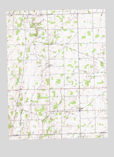
Carlos, IN USGS Topographic Map
Click on map above to begin viewing in our Map Viewer.

This topographic map contains these locations and features:
Feature Name Type Latitude Longitude GNIS ID View Map
Bedrock FarmsLocaleN40.0075°W85.0933°2710886View Map
Block RunStreamN40.0823°W85.0891°431194View Map
Buena VistaPopulated PlaceN40.1206°W85.0730°431765View Map
Buena Vista CemeteryCemeteryN40.1200°W85.0808°2014068View Map
Buena Vista ChurchChurchN40.1200°W85.0814°431766View Map
CarlosPopulated PlaceN40.0264°W85.0344°432134View Map
Carlos DrainStreamN40.0306°W85.0633°432135View Map
Cates FarmsLocaleN40.0494°W85.1072°2710883View Map
Country RunStreamN40.0523°W85.0539°433031View Map
Deck RunStreamN40.0367°W85.1033°433400View Map
Edwards DitchCanalN40.0673°W85.0397°434031View Map
Farquiner DitchCanalN40.1173°W85.0744°434410View Map
Gable RunStreamN40.0845°W85.0894°434911View Map
Groth FarmsLocaleN40.1169°W85.0306°2558106View Map
HuntsvillePopulated PlaceN40.0712°W85.0722°436639View Map
Huntsville CemeteryCemeteryN40.0699°W85.0754°2014069View Map
Huntsville DrainStreamN40.0700°W85.0880°436640View Map
Jordon CemeteryCemeteryN40.0041°W85.1209°437127View Map
Martindale ChurchChurchN40.0770°W85.0344°438680View Map
Maxwell Farms of IndianaLocaleN40.0725°W85.0900°2710888View Map
Mortar RunStreamN40.1075°W85.0872°439472View Map
Rail RunStreamN40.1248°W85.1016°441738View Map
Roots RunStreamN40.0953°W85.0905°442285View Map
Salem CemeteryCemeteryN40.0487°W85.1098°442886View Map
Township of UnionCivilN40.0595°W85.1214°453931View Map
Union ChurchChurchN40.0262°W85.0519°445108View Map
UnionportPopulated PlaceN40.1209°W85.0964°445137View Map
Villa RunStreamN40.0595°W85.0419°445293View Map

Note: Coordinates in the location and feature list above are referenced to NAD83 datum.


Copyright (C) 2008-2024 Ryan Niemi / Sunset Dynamics ... All Rights Reserved