TopoQuest Logo
Do you find TopoQuest useful?
Help keep TopoQuest running and adding new maps/features by donating!
Bitcoin:  19c7KJd3qBynnjoSw5npx9KScwjBe4ifkT
Litecoin:  LXs6TkuXGGXo1vDsWCkWVdjQX94eUKd6ui
Home View Maps Find Maps Find Places Resources & Links


Spartanburg, Indiana Topographic Map

USGS Map Title: Spartanburg, IN
USGS Map MRC: 40084A7
DRG (GeoTIFF) Download: o40084a7.tif


Neighboring USGS Topographic Map Quads:


  Winchester, IN  
40084B8
 

  Union City, IN  
40084B7
 

  Ansonia, OH  
40084B6
 

  Lynn, IN  
40084A8
 

  Spartanburg, IN  
40084A7
 

  Greenville West, OH  
40084A6
 

  Fountain City, IN  
39084H8
 

  Whitewater, IN  
39084H7
 

  New Madison, OH  
39084H6


Map MRC Location:

N41°
W85°
N41°
W84°
H8 H7 H6 H5 H4 H3 H2 H1
G8 G7 G6 G5 G4 G3 G2 G1
F8 F7 F6 F5 F4 F3 F2 F1
E8 E7 E6 E5 E4 E3 E2 E1
D8 D7 D6 D5 D4 D3 D2 D1
C8 C7 C6 C5 C4 C3 C2 C1
B8 B7 B6 B5 B4 B3 B2 B1
A8 A7 A6 A5 A4 A3 A2 A1
N40°
W85°
N40°
W84°

Spartanburg, IN USGS 1:24K Topographic Map Preview:
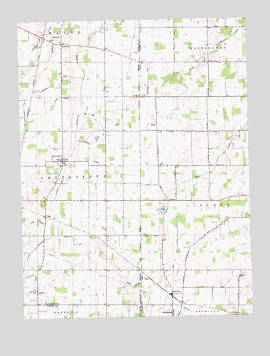
Spartanburg, IN USGS Topographic Map
Click on map above to begin viewing in our Map Viewer.

This topographic map contains these locations and features:
Feature Name Type Latitude Longitude GNIS ID View Map
A K FarmsLocaleN40.0900°W84.7989°2710762View Map
ArbaPopulated PlaceN40.0109°W84.8669°430231View Map
Armstrong Anderson DitchCanalN40.0859°W84.8714°430258View Map
Baker Angus FarmLocaleN40.0789°W84.7911°2710778View Map
BartoniaPopulated PlaceN40.1153°W84.8511°430552View Map
Bartonia CemeteryCemeteryN40.1170°W84.8577°430553View Map
Bartonia RunStreamN40.1189°W84.8555°430554View Map
Bass CemeteryCemeteryN40.0639°W84.7977°1037665View Map
Beech Grove CemeteryCemeteryN40.0159°W84.7572°1806152View Map
Beech Grove Church of the BrethrenChurchN40.0164°W84.7550°1060855View Map
Blair FarmsLocaleN40.0047°W84.7561°2710851View Map
Bowen DitchCanalN40.0342°W84.8472°431389View Map
Chapel CemeteryCemeteryN40.0324°W84.7986°1038989View Map
Clemens CemeteryCemeteryN40.0814°W84.7991°1039176View Map
CretePopulated PlaceN40.0434°W84.8616°433126View Map
Crete DrainStreamN40.0331°W84.8630°433127View Map
Dobson School (historical)SchoolN40.0198°W84.7972°1055507View Map
Elm Hill School (historical)SchoolN40.1073°W84.7900°1055508View Map
Elson DitchCanalN40.1103°W84.8133°434142View Map
Glen KarnPopulated PlaceN40.0098°W84.7919°1064727View Map
Glen Karn DitchCanalN40.0145°W84.8022°1040893View Map
Glenkarn Post Office (historical)Post OfficeN40.0098°W84.7916°1968031View Map
Green BranchStreamN40.0917°W84.8408°435386View Map
Greene FarmsLocaleN40.0542°W84.8050°2710766View Map
Harshman DitchCanalN40.0964°W84.8719°435818View Map
Hoosier HillSummitN40.0003°W84.8510°1851956View Map
Horn DitchCanalN40.0259°W84.7902°1041794View Map
Hutchison DitchCanalN40.1184°W84.8627°436662View Map
J K FarmLocaleN40.0942°W84.7958°2646642View Map
Karn BranchStreamN40.0164°W84.8094°437168View Map
LongPopulated PlaceN40.0781°W84.7980°1076290View Map
Long Post Office (historical)Post OfficeN40.0778°W84.7986°1968182View Map
Martin DairyLocaleN40.0131°W84.7736°2710854View Map
Morman DitchCanalN40.0522°W84.8556°2612577View Map
Northfork FarmsLocaleN40.1083°W84.7839°2710841View Map
Sauerkraut School (historical)SchoolN40.0187°W84.7563°1055543View Map
School Number 12 (historical)SchoolN40.0925°W84.7805°1055547View Map
School Number 7 (historical)SchoolN40.0403°W84.7516°1055545View Map
Slow RunStreamN40.0864°W84.8419°443632View Map
SpartanburgPopulated PlaceN40.0662°W84.8516°443920View Map
Spartanburg CreekStreamN40.0750°W84.8441°443921View Map
Special School Number 3 (historical)SchoolN40.0778°W84.7772°1055549View Map
TampicoPopulated PlaceN40.0487°W84.7930°1063050View Map
Tampico Post Office (historical)Post OfficeN40.0487°W84.7930°1968205View Map
Tampico School (historical)SchoolN40.0567°W84.7991°1055555View Map
Township of GreensforkCivilN40.0582°W84.8711°453354View Map
Township of LibertyCivilN40.0478°W84.7580°1086017View Map
Wildcat Woods EstatesPopulated PlaceN40.1192°W84.7583°2634658View Map

Note: Coordinates in the location and feature list above are referenced to NAD83 datum.


Copyright (C) 2008-2024 Ryan Niemi / Sunset Dynamics ... All Rights Reserved