TopoQuest Logo
Do you find TopoQuest useful?
Help keep TopoQuest running and adding new maps/features by donating!
Bitcoin:  19c7KJd3qBynnjoSw5npx9KScwjBe4ifkT
Litecoin:  LXs6TkuXGGXo1vDsWCkWVdjQX94eUKd6ui
Home View Maps Find Maps Find Places Resources & Links


Fountain Run, Kentucky Topographic Map

USGS Map Title: Fountain Run, KY
USGS Map MRC: 36085F8
DRG (GeoTIFF) Download: o36085f8.tif


Neighboring USGS Topographic Map Quads:


  Austin, KY  
36086G1
 

  Tracy, KY  
36085G8
 

  Freedom, KY  
36085G7
 

  Holland, KY  
36086F1
 

  Fountain Run, KY  
36085F8
 

  Gamaliel, KY  
36085F7
 

  Lafayette, TN  
36086E1
 

  Galen, TN  
36085E8
 

  Red Boiling Springs, TN  
36085E7


Map MRC Location:

N37°
W86°
N37°
W85°
H8 H7 H6 H5 H4 H3 H2 H1
G8 G7 G6 G5 G4 G3 G2 G1
F8 F7 F6 F5 F4 F3 F2 F1
E8 E7 E6 E5 E4 E3 E2 E1
D8 D7 D6 D5 D4 D3 D2 D1
C8 C7 C6 C5 C4 C3 C2 C1
B8 B7 B6 B5 B4 B3 B2 B1
A8 A7 A6 A5 A4 A3 A2 A1
N36°
W86°
N36°
W85°

Fountain Run, KY USGS 1:24K Topographic Map Preview:
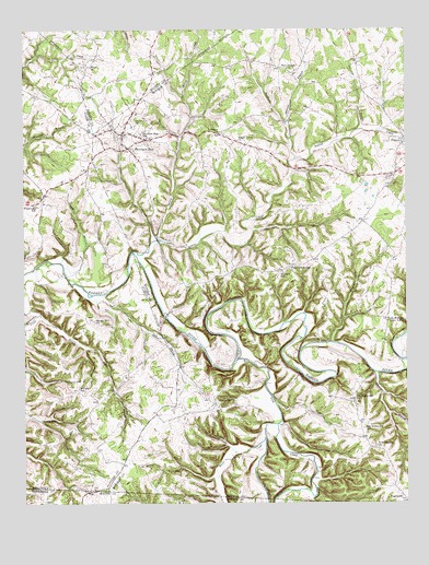
Fountain Run, KY USGS Topographic Map
Click on map above to begin viewing in our Map Viewer.

This topographic map contains these locations and features:
Feature Name Type Latitude Longitude GNIS ID View Map
AkersvillePopulated PlaceN36.6476°W85.9378°485807View Map
Bethel BranchStreamN36.7233°W85.8832°2784647View Map
BugtusslePopulated PlaceN36.6259°W85.8758°507615View Map
City of Fountain RunCivilN36.7238°W85.9562°2403654View Map
Coonfoot BranchStreamN36.6653°W85.9000°490047View Map
Coruth BranchStreamN36.6884°W85.9883°490130View Map
Flatwoods SchoolSchoolN36.7034°W85.9966°492230View Map
Fountain RunPopulated PlaceN36.7189°W85.9657°492374View Map
Fountain Run CemeteryCemeteryN36.7228°W85.9650°492375View Map
Fountain Run Mennonite ChurchChurchN36.7244°W85.9671°2647164View Map
Fountain Run SchoolSchoolN36.7176°W85.9605°492376View Map
Fountain Run Volunteer Fire DepartmentBuildingN36.7214°W85.9669°2636594View Map
Grooms BranchStreamN36.7156°W85.9114°493419View Map
Gwinn BranchStreamN36.6592°W85.8844°493510View Map
Howard SchoolSchoolN36.6839°W85.9155°494674View Map
Indian CreekStreamN36.6909°W85.9647°494926View Map
Jack Edward Cosby BottomFlatN36.6373°W85.9339°2742644View Map
Jakes BranchStreamN36.6939°W85.9586°495150View Map
John Wilson RunStreamN36.7424°W85.8795°2787996View Map
Lebanon ChurchChurchN36.7198°W85.9364°496132View Map
Long ForkStreamN36.6456°W85.9172°497108View Map
Long HollowValleyN36.6790°W85.9740°497116View Map
Maple Grove ChurchChurchN36.7176°W85.9305°497507View Map
Midway SchoolSchoolN36.6514°W85.9825°498173View Map
Millstone BranchStreamN36.6969°W85.9252°498385View Map
New Design ChurchChurchN36.7367°W85.9141°499311View Map
New Liberty ChurchChurchN36.6393°W85.8841°499365View Map
Old Rocky Hill ChurchChurchN36.6526°W85.8922°499875View Map
Old Rocky Hill School (historical)SchoolN36.6446°W85.8893°499876View Map
Old Walnut Grove School (historical)SchoolN36.6735°W85.8808°499897View Map
Pikeville BranchStreamN36.7234°W85.8892°500621View Map
Puncheon CreekStreamN36.6753°W85.9950°501447View Map
Rough Hill ChurchChurchN36.6726°W85.9772°502382View Map
Salt Lick CreekStreamN36.6631°W85.9311°1269923View Map
Slickrock BranchStreamN36.7134°W85.9116°503687View Map
Spring CreekStreamN36.6942°W85.9564°504130View Map
White CreekStreamN36.6417°W85.9211°506580View Map
White Oak CreekStreamN36.6426°W85.9214°1304528View Map
White Oak Ridge ChurchChurchN36.6871°W85.9131°506632View Map
Wood ChurchChurchN36.7367°W85.9780°507081View Map

Note: Coordinates in the location and feature list above are referenced to NAD83 datum.


Copyright (C) 2008-2024 Ryan Niemi / Sunset Dynamics ... All Rights Reserved