TopoQuest Logo
Do you find TopoQuest useful?
Help keep TopoQuest running and adding new maps/features by donating!
Bitcoin:  19c7KJd3qBynnjoSw5npx9KScwjBe4ifkT
Litecoin:  LXs6TkuXGGXo1vDsWCkWVdjQX94eUKd6ui
Home View Maps Find Maps Find Places Resources & Links


Four Oaks NE, North Carolina Topographic Map

USGS Map Title: Four Oaks NE, NC
USGS Map MRC: 35078D3
DRG (GeoTIFF) Download: o35078d3.tif


Neighboring USGS Topographic Map Quads:


  Powhatan, NC  
35078E4
 

  Selma, NC  
35078E3
 

  Kenly West, NC  
35078E2
 

  Four Oaks, NC  
35078D4
 

  Four Oaks NE, NC  
35078D3
 

  Princeton, NC  
35078D2
 

  Peacocks Crossroads, NC  
35078C4
 

  Newton Grove North, NC  
35078C3
 

  Grantham, NC  
35078C2


Map MRC Location:

N36°
W79°
N36°
W78°
H8 H7 H6 H5 H4 H3 H2 H1
G8 G7 G6 G5 G4 G3 G2 G1
F8 F7 F6 F5 F4 F3 F2 F1
E8 E7 E6 E5 E4 E3 E2 E1
D8 D7 D6 D5 D4 D3 D2 D1
C8 C7 C6 C5 C4 C3 C2 C1
B8 B7 B6 B5 B4 B3 B2 B1
A8 A7 A6 A5 A4 A3 A2 A1
N35°
W79°
N35°
W78°

Four Oaks NE, NC USGS 1:24K Topographic Map Preview:
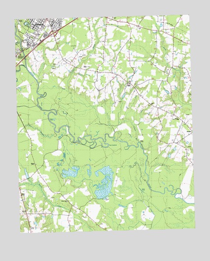
Four Oaks NE, NC USGS Topographic Map
Click on map above to begin viewing in our Map Viewer.

This topographic map contains these locations and features:
Feature Name Type Latitude Longitude GNIS ID View Map
Antioch ChurchChurchN35.3877°W78.3658°980227View Map
Arters BranchStreamN35.4863°W78.3694°980294View Map
Barefoot BridgeBridgeN35.4041°W78.3731°980547View Map
Black CreekStreamN35.4715°W78.3653°1025160View Map
Creeches MillPopulated PlaceN35.4660°W78.2650°1019852View Map
Gar GutGutN35.4104°W78.2928°985551View Map
Green ChapelChurchN35.4713°W78.3239°1026165View Map
Hickory Grove ChurchChurchN35.3935°W78.3394°986704View Map
Hills of Neuse Memorial GardensCemeteryN35.4802°W78.3739°1026164View Map
Mill BranchStreamN35.4929°W78.3147°1025528View Map
Miry BranchStreamN35.4349°W78.3567°990075View Map
OliverPopulated PlaceN35.4935°W78.2592°1006319View Map
Pierce's FerryLocaleN35.3907°W78.2522°992174View Map
Polecat BranchStreamN35.4263°W78.2875°1025621View Map
Polecat LandingLocaleN35.4257°W78.2858°1022023View Map
Rhodes BridgeBridgeN35.4032°W78.3625°993263View Map
Sage PondLakeN35.4413°W78.3447°993853View Map
Sanders BridgeBridgeN35.3871°W78.3361°994239View Map
Sanders ChapelChurchN35.4607°W78.2939°1026320View Map
Sardis ChurchChurchN35.4482°W78.2794°1026319View Map
Stewart ChapelChurchN35.4154°W78.3633°1026168View Map
Swan PondLakeN35.3924°W78.2894°995754View Map
Tees ChapelChurchN35.4396°W78.2617°1026166View Map
The CowboneLakeN35.4241°W78.3111°1026167View Map
Township of SmithfieldCivilN35.4975°W78.3664°1026857View Map
Whitley PlacePopulated PlaceN35.4266°W78.2633°1023229View Map

Note: Coordinates in the location and feature list above are referenced to NAD83 datum.


Copyright (C) 2008-2025 Ryan Niemi / Sunset Dynamics ... All Rights Reserved