TopoQuest Logo
Do you find TopoQuest useful?
Help keep TopoQuest running and adding new maps/features by donating!
Bitcoin:  19c7KJd3qBynnjoSw5npx9KScwjBe4ifkT
Litecoin:  LXs6TkuXGGXo1vDsWCkWVdjQX94eUKd6ui
Home View Maps Find Maps Find Places Resources & Links


Foxpark, Wyoming Topographic Map

USGS Map Title: Foxpark, WY
USGS Map MRC: 41106A2
DRG (GeoTIFF) Download: o41106a2.tif


Neighboring USGS Topographic Map Quads:


  Keystone, WY  
41106B3
 

  Albany, WY  
41106B2
 

  Lake Owen, WY  
41106B1
 

  Horatio Rock, WY  
41106A3
 

  Foxpark, WY  
41106A2
 

  Woods Landing, WY  
41106A1
 

  Northgate, CO  
40106H3
 

  Kings Canyon, CO  
40106H2
 

  Old Roach, CO  
40106H1


Map MRC Location:

N42°
W107°
N42°
W106°
H8 H7 H6 H5 H4 H3 H2 H1
G8 G7 G6 G5 G4 G3 G2 G1
F8 F7 F6 F5 F4 F3 F2 F1
E8 E7 E6 E5 E4 E3 E2 E1
D8 D7 D6 D5 D4 D3 D2 D1
C8 C7 C6 C5 C4 C3 C2 C1
B8 B7 B6 B5 B4 B3 B2 B1
A8 A7 A6 A5 A4 A3 A2 A1
N41°
W107°
N41°
W106°

Foxpark, WY USGS 1:24K Topographic Map Preview:
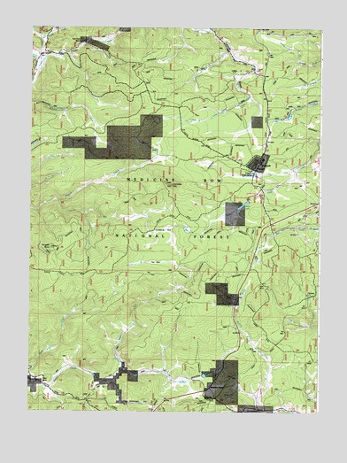
Foxpark, WY USGS Topographic Map
Click on map above to begin viewing in our Map Viewer.

This topographic map contains these locations and features:
Feature Name Type Latitude Longitude GNIS ID View Map
American MineMineN41.0055°W106.1628°1597738View Map
Badger CreekStreamN41.0139°W106.2497°1597867View Map
Big Laramie Valley Volunteer Fire Department Station 4BuildingN41.0131°W106.1685°2673677View Map
Collins (historical)Populated PlaceN41.1100°W106.1631°1598859View Map
Collins CreekStreamN41.1241°W106.1747°1598860View Map
Dell MineMineN41.1108°W106.2461°1703930View Map
Desert Rose MineMineN41.1116°W106.1597°1703931View Map
Douglas PointSummitN41.0530°W106.2414°1599309View Map
Evans CreekStreamN41.0789°W106.1367°1599642View Map
Evans Creek CampgroundLocaleN41.0705°W106.1503°1599643View Map
Fox ParkLocaleN41.0805°W106.1517°1704435View Map
Fox Park Census Designated PlaceCensusN41.0801°W106.1534°2629265View Map
FoxparkPopulated PlaceN41.0794°W106.1525°1599838View Map
Foxpark Work CenterLocaleN41.0778°W106.1539°1605019View Map
GrammLocaleN41.0383°W106.1292°1763994View Map
GrammPopulated PlaceN41.0383°W106.1292°1600012View Map
Gramm Post Office (historical)Post OfficeN41.0383°W106.1292°1763993View Map
Grindstone ParkFlatN41.0591°W106.1922°1600100View Map
Hay ParkFlatN41.0486°W106.1956°1600250View Map
Ione ProspectMineN41.0533°W106.1781°1726175View Map
Kansas Group - Keystone Holmes Area MineMineN41.1111°W106.2172°1703932View Map
Keystone MineMineN41.1211°W106.2286°1703934View Map
Lake CreekStreamN41.1141°W106.2453°1600783View Map
Lake Creek MinesMineN41.1111°W106.2309°1703933View Map
Lake Creek ResortLocaleN41.1203°W106.2286°1600795View Map
Lincoln GulchValleyN41.1241°W106.1745°1600924View Map
Maudem Group MineMineN41.1219°W106.2220°1703935View Map
Miller LakeLakeN41.0674°W106.1582°1601471View Map
Miller Lake CampgroundLocaleN41.0694°W106.1558°1605020View Map
Mountain HomePopulated PlaceN41.0080°W106.1725°1601587View Map
Muddy CreekStreamN41.1208°W106.2459°1601616View Map
Muscovite Claim MineMineN41.0491°W106.1736°1703936View Map
North ForkStreamN41.0139°W106.2092°1601741View Map
North Fork Pelton CreekStreamN41.0139°W106.2092°1601803View Map
Ox Yoke RanchLocaleN41.0005°W106.1503°1601978View Map
Park RunStreamN41.0686°W106.2381°1602030View Map
Porter RanchLocaleN41.0100°W106.2445°1602278View Map
Roosevelt CampLocaleN41.0111°W106.1811°1602626View Map
Smith North CreekStreamN41.1147°W106.2464°1603000View Map
Somber HillSummitN41.0739°W106.1900°1603080View Map
Webbers Sawmill (historical)LocaleN41.0966°W106.1992°1764002View Map
WyocoloPopulated PlaceN41.0044°W106.1725°1596647View Map

Note: Coordinates in the location and feature list above are referenced to NAD83 datum.


Copyright (C) 2008-2025 Ryan Niemi / Sunset Dynamics ... All Rights Reserved