TopoQuest Logo
Do you find TopoQuest useful?
Help keep TopoQuest running and adding new maps/features by donating!
Bitcoin:  19c7KJd3qBynnjoSw5npx9KScwjBe4ifkT
Litecoin:  LXs6TkuXGGXo1vDsWCkWVdjQX94eUKd6ui
Home View Maps Find Maps Find Places Resources & Links


Lake Owen, Wyoming Topographic Map

USGS Map Title: Lake Owen, WY
USGS Map MRC: 41106B1
DRG (GeoTIFF) Download: o41106b1.tif


Neighboring USGS Topographic Map Quads:


  Centennial, WY  
41106C2
 

  Rex Lake, WY  
41106C1
 

  Millbrook, WY  
41105C8
 

  Albany, WY  
41106B2
 

  Lake Owen, WY  
41106B1
 

  Sodergreen Lake, WY  
41105B8
 

  Foxpark, WY  
41106A2
 

  Woods Landing, WY  
41106A1
 

  Jelm Mountain, WY  
41105A8


Map MRC Location:

N42°
W107°
N42°
W106°
H8 H7 H6 H5 H4 H3 H2 H1
G8 G7 G6 G5 G4 G3 G2 G1
F8 F7 F6 F5 F4 F3 F2 F1
E8 E7 E6 E5 E4 E3 E2 E1
D8 D7 D6 D5 D4 D3 D2 D1
C8 C7 C6 C5 C4 C3 C2 C1
B8 B7 B6 B5 B4 B3 B2 B1
A8 A7 A6 A5 A4 A3 A2 A1
N41°
W107°
N41°
W106°

Lake Owen, WY USGS 1:24K Topographic Map Preview:
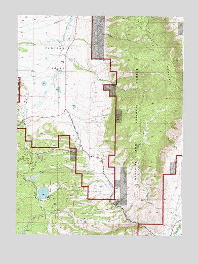
Lake Owen, WY USGS Topographic Map
Click on map above to begin viewing in our Map Viewer.

This topographic map contains these locations and features:
Feature Name Type Latitude Longitude GNIS ID View Map
Buckeye CreekStreamN41.2403°W106.0900°1598448View Map
Buckeye SchoolSchoolN41.2233°W106.0908°1598450View Map
Dale CreekStreamN41.1416°W106.0500°1599107View Map
Fence CreekStreamN41.1305°W106.0320°1599687View Map
Fox Creek DitchCanalN41.1355°W106.0045°1599834View Map
Hecht CreekStreamN41.2283°W106.0936°1600278View Map
Iron MountainSummitN41.1419°W106.0945°1600532View Map
LakeLocaleN41.1466°W106.1092°1600774View Map
Lake OwenLakeN41.1489°W106.1045°1601967View Map
Lake OwenReservoirN41.1450°W106.1006°1605734View Map
Lake Owen CampgroundLocaleN41.1455°W106.1011°1605037View Map
Lake Owen CreekStreamN41.1322°W106.0328°1600810View Map
Lake Owen DamDamN41.1450°W106.1006°1605733View Map
Lake Owen Mafic Complex MineMineN41.1458°W106.0964°1726161View Map
Middle Fork Little Laramie RiverStreamN41.2355°W106.0911°1601402View Map
Mountain Meadow RanchLocaleN41.1308°W106.0003°1601588View Map
South Fork Little Laramie RiverStreamN41.2355°W106.0911°1603152View Map
Squaw CreekStreamN41.1264°W106.0653°1603300View Map
Strain CreekStreamN41.1553°W106.0558°1603402View Map
Sunby ReservoirReservoirN41.2000°W106.0889°1605714View Map
Sundby DamDamN41.2000°W106.0889°1605713View Map
Sundby Reservoir Number 2ReservoirN41.2165°W106.0666°1609050View Map
Sundby Reservoir Number 2 DamDamN41.2166°W106.0672°1609049View Map

Note: Coordinates in the location and feature list above are referenced to NAD83 datum.


Copyright (C) 2008-2025 Ryan Niemi / Sunset Dynamics ... All Rights Reserved