TopoQuest Logo
Do you find TopoQuest useful?
Help keep TopoQuest running and adding new maps/features by donating!
Bitcoin:  19c7KJd3qBynnjoSw5npx9KScwjBe4ifkT
Litecoin:  LXs6TkuXGGXo1vDsWCkWVdjQX94eUKd6ui
Home View Maps Find Maps Find Places Resources & Links


Franksville, Wisconsin Topographic Map

USGS Map Title: Franksville, WI
USGS Map MRC: 42087G8
DRG (GeoTIFF) Download: o42087g8.tif


Neighboring USGS Topographic Map Quads:


  Hales Corners, WI  
42088H1
 

  Greendale, WI  
42087H8
 

  South Milwaukee, WI  
42087H7
 

  North Cape, WI  
42088G1
 

  Franksville, WI  
42087G8
 

  Racine North, WI  
42087G7
 

  Union Grove, WI  
42088F1
 

  Sturtevant, WI  
42087F8
 

  Racine South, WI  
42087F7


Map MRC Location:

N43°
W88°
N43°
W87°
H8 H7 H6 H5 H4 H3 H2 H1
G8 G7 G6 G5 G4 G3 G2 G1
F8 F7 F6 F5 F4 F3 F2 F1
E8 E7 E6 E5 E4 E3 E2 E1
D8 D7 D6 D5 D4 D3 D2 D1
C8 C7 C6 C5 C4 C3 C2 C1
B8 B7 B6 B5 B4 B3 B2 B1
A8 A7 A6 A5 A4 A3 A2 A1
N42°
W88°
N42°
W87°

Franksville, WI USGS 1:24K Topographic Map Preview:
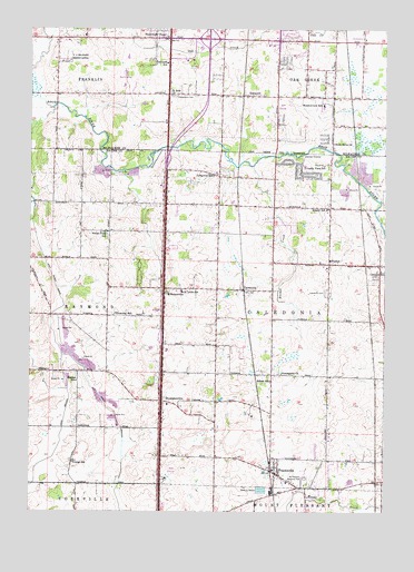
Franksville, WI USGS Topographic Map
Click on map above to begin viewing in our Map Viewer.

This topographic map contains these locations and features:
Feature Name Type Latitude Longitude GNIS ID View Map
Caddy Vista Elementary SchoolSchoolN42.8395°W87.9031°1562500View Map
CaledoniaPopulated PlaceN42.8078°W87.9242°1562510View Map
Caledonia Fire Department Station 1BuildingN42.8126°W87.8955°2697898View Map
Caledonia Memorial ParkCemeteryN42.8069°W87.8959°1562511View Map
Caledonia Mt Pleasant Fire Station 10BuildingN42.7556°W87.9007°2698072View Map
Caledonia Police DepartmentBuildingN42.8127°W87.8954°2759601View Map
Caledonia Town HallBuildingN42.8134°W87.8954°1850927View Map
Caledonia Wildlife AreaParkN42.7911°W87.9029°1850928View Map
Caledonia-Mount Pleasant ParkParkN42.7578°W87.9031°1569842View Map
Community ChurchChurchN42.7859°W87.9112°1563296View Map
Country View Christian AcademySchoolN42.8213°W87.9172°2716151View Map
Discovery Stage Preschool and Child CareSchoolN42.8074°W87.9469°1573218View Map
Edison SchoolSchoolN42.7842°W87.9151°1564452View Map
Forest Field SchoolSchoolN42.8228°W87.9726°1565113View Map
Franklin Business ParkLocaleN42.8653°W87.9811°2118070View Map
Franklin Fire Department Station 2BuildingN42.8645°W87.9913°2698126View Map
Franklin Industrial ParkLocaleN42.8689°W87.9867°2118071View Map
FranksvillePopulated PlaceN42.7600°W87.9134°1565278View Map
Gifford Elementary SchoolSchoolN42.7579°W87.8865°1850941View Map
Green Ridge ParkParkN42.8322°W87.8929°1850946View Map
Hunter SchoolSchoolN42.7839°W87.9834°1566813View Map
HusherPopulated PlaceN42.8142°W87.8945°1566829View Map
Husher CreekStreamN42.8397°W87.9215°1577248View Map
Independent CemeteryCemeteryN42.8578°W87.9497°1566894View Map
Interchange 322CrossingN42.8722°W87.9373°1964401View Map
Interchange 325CrossingN42.8411°W87.9520°1964402View Map
Interchange 327CrossingN42.8078°W87.9533°2351448View Map
Interchange 329CrossingN42.7786°W87.9539°2351449View Map
KilbournvillePopulated PlaceN42.8078°W87.9523°1567472View Map
Lafayette SchoolSchoolN42.8372°W87.9348°1567718View Map
Linwood SchoolSchoolN42.8128°W87.8762°1568156View Map
Meadowview Elementary SchoolSchoolN42.8551°W87.8970°1569298View Map
Oak Creek Police DepartmentBuildingN42.8713°W87.9182°2759569View Map
Oak Hills Golf CourseLocaleN42.8550°W87.9114°2118413View Map
Oakbrook Shopping CenterLocaleN42.8714°W87.9140°1876435View Map
OakwoodPopulated PlaceN42.8581°W87.9245°1570715View Map
Oakwood Golf CourseLocaleN42.8622°W87.9668°1876436View Map
Oakwood SchoolSchoolN42.8664°W87.9512°1570727View Map
Out On A Limb AcresLocaleN42.8325°W87.9772°2516925View Map
Parkway Christian AcademySchoolN42.8460°W87.8924°2716347View Map
Paynesville ChapelChurchN42.8731°W87.9512°1571104View Map
Root River CanalCanalN42.8203°W87.9976°1572590View Map
Root River ChurchChurchN42.8456°W87.8929°1572591View Map
Ryan CreekStreamN42.8614°W87.9984°1572765View Map
Saint John ChurchChurchN42.8581°W87.9501°1573008View Map
Shepard Hills Elementary SchoolSchoolN42.8684°W87.9075°1877035View Map
Shumway SchoolSchoolN42.8011°W87.9701°1574085View Map
South Hills Country ClubLocaleN42.7606°W87.9495°1851025View Map
Southbranch Industrial ParkLocaleN42.8672°W87.9453°2118419View Map
ThompsonvillePopulated PlaceN42.7786°W87.9529°1575395View Map
Trinity Lutheran SchoolSchoolN42.8276°W87.8952°1575642View Map
Trinity SchoolSchoolN42.7628°W87.9848°1575641View Map
WZXA-FM (Sturtevant)TowerN42.7692°W87.8920°1582633View Map

Note: Coordinates in the location and feature list above are referenced to NAD83 datum.


Copyright (C) 2008-2024 Ryan Niemi / Sunset Dynamics ... All Rights Reserved