TopoQuest Logo
Do you find TopoQuest useful?
Help keep TopoQuest running and adding new maps/features by donating!
Bitcoin:  19c7KJd3qBynnjoSw5npx9KScwjBe4ifkT
Litecoin:  LXs6TkuXGGXo1vDsWCkWVdjQX94eUKd6ui
Home View Maps Find Maps Find Places Resources & Links


Sturtevant, Wisconsin Topographic Map

USGS Map Title: Sturtevant, WI
USGS Map MRC: 42087F8
DRG (GeoTIFF) Download: o42087f8.tif


Neighboring USGS Topographic Map Quads:


  North Cape, WI  
42088G1
 

  Franksville, WI  
42087G8
 

  Racine North, WI  
42087G7
 

  Union Grove, WI  
42088F1
 

  Sturtevant, WI  
42087F8
 

  Racine South, WI  
42087F7
 

  Paddock Lake, WI  
42088E1
 

  Pleasant Prairie, WI  
42087E8
 

  Kenosha, WI  
42087E7


Map MRC Location:

N43°
W88°
N43°
W87°
H8 H7 H6 H5 H4 H3 H2 H1
G8 G7 G6 G5 G4 G3 G2 G1
F8 F7 F6 F5 F4 F3 F2 F1
E8 E7 E6 E5 E4 E3 E2 E1
D8 D7 D6 D5 D4 D3 D2 D1
C8 C7 C6 C5 C4 C3 C2 C1
B8 B7 B6 B5 B4 B3 B2 B1
A8 A7 A6 A5 A4 A3 A2 A1
N42°
W88°
N42°
W87°

Sturtevant, WI USGS 1:24K Topographic Map Preview:
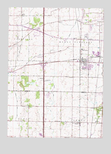
Sturtevant, WI USGS Topographic Map
Click on map above to begin viewing in our Map Viewer.

This topographic map contains these locations and features:
Feature Name Type Latitude Longitude GNIS ID View Map
Badger SchoolSchoolN42.6884°W87.9984°1561073View Map
Barlett SchoolSchoolN42.7372°W87.8787°1561174View Map
Burr Oak SchoolSchoolN42.6406°W87.9312°1562449View Map
Concordia Lutheran SchoolSchoolN42.6989°W87.8897°2716324View Map
Des Moines SchoolSchoolN42.6803°W87.9504°1563916View Map
East Branch Root River CanalCanalN42.7203°W87.9820°1564300View Map
Evans County ParkParkN42.7345°W87.9715°1564729View Map
Evans ParkParkN42.7311°W87.9662°1850939View Map
Fritchen SchoolSchoolN42.7428°W87.9826°1565341View Map
Harvest View EstatesPopulated PlaceN42.6869°W87.9944°2508608View Map
Herzog SchoolSchoolN42.6836°W87.9145°1566331View Map
Interchange 333CrossingN42.7258°W87.9539°2351450View Map
Interchange 335CrossingN42.6944°W87.9536°2351451View Map
Interchange 337CrossingN42.6694°W87.9528°2351452View Map
Interchange 339CrossingN42.6403°W87.9528°2351453View Map
Ives GrovePopulated PlaceN42.7292°W87.9662°1567050View Map
Ives Grove Golf LinksLocaleN42.7259°W87.9642°1850958View Map
Jensen's Mobile Home VillagePopulated PlaceN42.7186°W87.9250°2508616View Map
Kirchner Dairy FarmLocaleN42.6517°W87.9172°2712472View Map
Maplecrest Country ClubLocaleN42.6253°W87.9237°1850123View Map
Mount Pleasant Police DepartmentBuildingN42.7259°W87.8932°2759548View Map
Oakdale EstatesPopulated PlaceN42.6653°W87.9481°2508615View Map
Paris Lutheran CemeteryCemeteryN42.6550°W87.9806°1571035View Map
Pike River SchoolSchoolN42.6539°W87.8848°1571391View Map
Racine Correctional InstitutionBuildingN42.7103°W87.9035°2756160View Map
Racine Correctional Institution SchoolSchoolN42.7100°W87.9028°1572866View Map
Racine County Sheriff's Office Patrol StationBuildingN42.7283°W87.9597°2759799View Map
Saint Sebastian SchoolSchoolN42.6966°W87.9015°1851016View Map
Samuel Curtis Johnson Fire BrigadeBuildingN42.7122°W87.8869°2697537View Map
Schulte Elementary SchoolSchoolN42.6933°W87.8896°1851020View Map
Shoreland Lutheran High SchoolSchoolN42.6411°W87.9188°1850182View Map
Skewes ParkParkN42.7239°W87.9737°1851021View Map
SomersPopulated PlaceN42.6403°W87.9104°1574369View Map
Somers Elementary SchoolSchoolN42.6385°W87.8943°1850184View Map
Somers Fire and Rescue Department Station 1BuildingN42.6393°W87.9003°2697895View Map
Somers Post OfficePost OfficeN42.6397°W87.9012°2712485View Map
Somers Town HallBuildingN42.6395°W87.8942°1850185View Map
South Shore Fire Department Station 9BuildingN42.7010°W87.8934°2697501View Map
SturtevantPopulated PlaceN42.6981°W87.8945°1575001View Map
Sturtevant Police DepartmentBuildingN42.7008°W87.8933°2759463View Map
Sturtevant Post OfficePost OfficeN42.7001°W87.9046°2712563View Map
Sturtevant Transitional FacilityBuildingN42.7133°W87.8990°2756163View Map
SylvaniaPopulated PlaceN42.6986°W87.9584°1577847View Map
Sylvania AirportAirportN42.7031°W87.9563°1582228View Map
Sylvania CemeteryCemeteryN42.6820°W87.9540°1575206View Map
Town of Mount Pleasant (historical)CivilN42.7150°W87.8876°1583767View Map
Treadwell SchoolSchoolN42.7206°W87.9140°1575582View Map
Tucker SchoolSchoolN42.7367°W87.9334°1575703View Map
Village of Mount PleasantCivilN42.7116°W87.8836°2013469View Map
Village of SomersCivilN42.6412°W87.8919°2772244View Map
Village of SturtevantCivilN42.7005°W87.9015°1584241View Map
Washington SchoolSchoolN42.6403°W87.8851°1576257View Map
WaxdalePopulated PlaceN42.6981°W87.8779°1576343View Map
West Lawn Memorial CemeteryCemeteryN42.7225°W87.8972°1576528View Map

Note: Coordinates in the location and feature list above are referenced to NAD83 datum.


Copyright (C) 2008-2024 Ryan Niemi / Sunset Dynamics ... All Rights Reserved