TopoQuest Logo
Do you find TopoQuest useful?
Help keep TopoQuest running and adding new maps/features by donating!
Bitcoin:  19c7KJd3qBynnjoSw5npx9KScwjBe4ifkT
Litecoin:  LXs6TkuXGGXo1vDsWCkWVdjQX94eUKd6ui
Home View Maps Find Maps Find Places Resources & Links


Racine North, Wisconsin Topographic Map

USGS Map Title: Racine North, WI
USGS Map MRC: 42087G7
DRG (GeoTIFF) Download: o42087g7.tif


Neighboring USGS Topographic Map Quads:


  Greendale, WI  
42087H8
 

  South Milwaukee, WI  
42087H7


  Franksville, WI  
42087G8
 

  Racine North, WI  
42087G7


  Sturtevant, WI  
42087F8
 

  Racine South, WI  
42087F7


Map MRC Location:

N43°
W88°
N43°
W87°
H8 H7 H6 H5 H4 H3 H2 H1
G8 G7 G6 G5 G4 G3 G2 G1
F8 F7 F6 F5 F4 F3 F2 F1
E8 E7 E6 E5 E4 E3 E2 E1
D8 D7 D6 D5 D4 D3 D2 D1
C8 C7 C6 C5 C4 C3 C2 C1
B8 B7 B6 B5 B4 B3 B2 B1
A8 A7 A6 A5 A4 A3 A2 A1
N42°
W88°
N42°
W87°

Racine North, WI USGS 1:24K Topographic Map Preview:
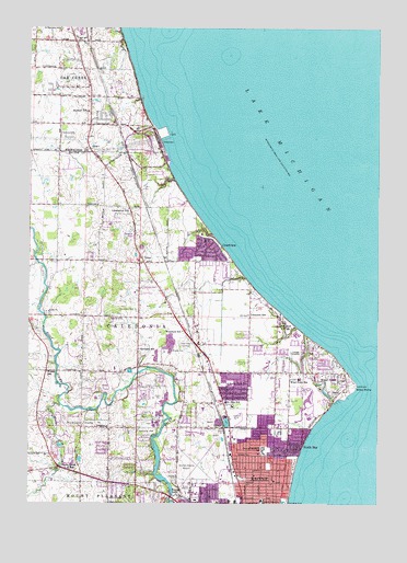
Racine North, WI USGS Topographic Map
Click on map above to begin viewing in our Map Viewer.

This topographic map contains these locations and features:
Feature Name Type Latitude Longitude GNIS ID View Map
Armstrong ParkParkN42.7692°W87.8323°1560948View Map
Bohemian National CemeteryCemeteryN42.7986°W87.8473°1570112View Map
Burbank SchoolSchoolN42.7906°W87.8354°1562413View Map
Caledonia Fire Department Station 12BuildingN42.8003°W87.8243°2697532View Map
CrestviewPopulated PlaceN42.8170°W87.8101°1563530View Map
Deerfield Elementary SchoolSchoolN42.8537°W87.8560°2716731View Map
Early Learning AcademySchoolN42.8538°W87.8563°2716598View Map
Four Mile Station Post OfficePost OfficeN42.7840°W87.8110°2768320View Map
Holy Cross CemeteryCemeteryN42.7914°W87.8187°1566587View Map
Holy Family CemeteryCemeteryN42.8009°W87.8368°1566598View Map
Hoods CreekStreamN42.7756°W87.8634°1566663View Map
Hoods Creek SchoolSchoolN42.7592°W87.8606°1566664View Map
Horlick MillLocaleN42.7531°W87.8242°1850954View Map
Horlicks 3WR1874 DamDamN42.7534°W87.8234°1792218View Map
Horlicks Pond 178ReservoirN42.7534°W87.8234°1792219View Map
IvesPopulated PlaceN42.7700°W87.8054°1577660View Map
Jerstad - Agerholm Elementary SchoolSchoolN42.7635°W87.7912°1567170View Map
Jerstad - Agerholm Middle SchoolSchoolN42.7647°W87.7916°2716241View Map
John H Batten AirportAirportN42.7596°W87.8192°1578026View Map
Johnson ParkParkN42.7725°W87.8548°1567243View Map
Lakeview SchoolSchoolN42.7997°W87.7959°1567802View Map
Lamberton SchoolSchoolN42.8278°W87.8395°1567816View Map
Melvin Avenue Residential Historic DistrictParkN42.7556°W87.7853°2709004View Map
North BayPopulated PlaceN42.7647°W87.7798°1570353View Map
North Park Elementary SchoolSchoolN42.7814°W87.8029°1570475View Map
Oak Creek Fire Department Station 2BuildingN42.8574°W87.8550°2697610View Map
Oak Creek HarborLocaleN42.8461°W87.8267°1578027View Map
Oak Creek Power PlantBuildingN42.8447°W87.8276°1578025View Map
Olympia Brown Elementary SchoolSchoolN42.7977°W87.7843°1564046View Map
Racine Fire Department Station 3BuildingN42.7574°W87.7941°2697535View Map
Racine Police Department Community Oriented Policing House - Jacato DriveBuildingN42.7512°W87.8115°2759881View Map
Racine QuarryMineN42.7725°W87.8000°2559670View Map
Rapids SchoolSchoolN42.7528°W87.8215°1572083View Map
REAL Charter SchoolSchoolN42.7978°W87.7841°2716762View Map
Renak-Polak Maple-Beech Woods State Natural AreaParkN42.8056°W87.8623°2059257View Map
Roosevelt Elementary SchoolSchoolN42.7510°W87.7914°1575344View Map
Saint Matthew Parish SchoolSchoolN42.8745°W87.8619°1876969View Map
Saint Rita SchoolSchoolN42.7769°W87.8045°1573554View Map
Scanlon SchoolSchoolN42.8534°W87.8540°1573772View Map
Shoop ParkParkN42.7792°W87.7634°1574069View Map
Shorecrest Shopping CenterLocaleN42.7689°W87.7884°1876830View Map
TaborPopulated PlaceN42.8156°W87.8351°1575214View Map
The Prairie SchoolSchoolN42.7724°W87.7741°1850981View Map
Town of Caledonia (historical)CivilN42.8014°W87.8709°1582904View Map
Village of CaledoniaCivilN42.7993°W87.8709°2397529View Map
Village of North BayCivilN42.7645°W87.7802°1583824View Map
Village of Wind PointCivilN42.7814°W87.7715°1584453View Map
WBZN-AM (Racine)TowerN42.7517°W87.8320°1582570View Map
Westfield SchoolSchoolN42.7953°W87.8195°1576579View Map
Wilson SchoolSchoolN42.7845°W87.8684°1576829View Map
Wind PointCapeN42.7809°W87.7576°1576847View Map
Wind PointPopulated PlaceN42.7845°W87.7662°1576848View Map
Wind Point Elementary SchoolSchoolN42.7828°W87.7781°1576849View Map
Wind Point Police DepartmentBuildingN42.7812°W87.7587°2759707View Map
Windpoint Light StationBuildingN42.7811°W87.7584°1851051View Map
WJJA-TV (Racine)TowerN42.8550°W87.8448°1582647View Map
WRKRTowerN42.7531°W87.8337°1578028View Map

Note: Coordinates in the location and feature list above are referenced to NAD83 datum.


Copyright (C) 2008-2025 Ryan Niemi / Sunset Dynamics ... All Rights Reserved