TopoQuest Logo
Do you find TopoQuest useful?
Help keep TopoQuest running and adding new maps/features by donating!
Bitcoin:  19c7KJd3qBynnjoSw5npx9KScwjBe4ifkT
Litecoin:  LXs6TkuXGGXo1vDsWCkWVdjQX94eUKd6ui
Home View Maps Find Maps Find Places Resources & Links


Free Union, Virginia Topographic Map

USGS Map Title: Free Union, VA
USGS Map MRC: 38078B5
DRG (GeoTIFF) Download: o38078b5.tif


Neighboring USGS Topographic Map Quads:


  McGaheysville, VA  
38078C6
 

  Swift Run Gap, VA  
38078C5
 

  Stanardsville, VA  
38078C4
 

  Browns Cove, VA  
38078B6
 

  Free Union, VA  
38078B5
 

  Earlysville, VA  
38078B4
 

  Crozet, VA  
38078A6
 

  Charlottesville West, VA  
38078A5
 

  Charlottesville East, VA  
38078A4


Map MRC Location:

N39°
W79°
N39°
W78°
H8 H7 H6 H5 H4 H3 H2 H1
G8 G7 G6 G5 G4 G3 G2 G1
F8 F7 F6 F5 F4 F3 F2 F1
E8 E7 E6 E5 E4 E3 E2 E1
D8 D7 D6 D5 D4 D3 D2 D1
C8 C7 C6 C5 C4 C3 C2 C1
B8 B7 B6 B5 B4 B3 B2 B1
A8 A7 A6 A5 A4 A3 A2 A1
N38°
W79°
N38°
W78°

Free Union, VA USGS 1:24K Topographic Map Preview:
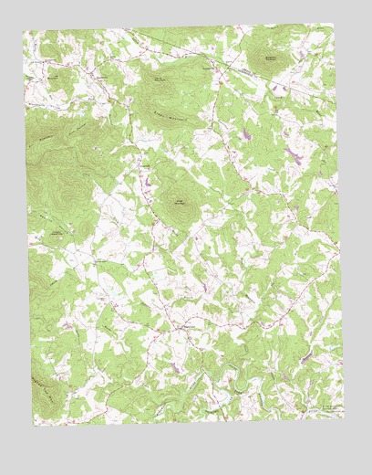
Free Union, VA USGS Topographic Map
Click on map above to begin viewing in our Map Viewer.

This topographic map contains these locations and features:
Feature Name Type Latitude Longitude GNIS ID View Map
Bingham ChurchChurchN38.2376°W78.5431°1463444View Map
Bingham MountainSummitN38.2379°W78.5270°1463445View Map
Blackwells HollowValleyN38.2276°W78.6058°1463541View Map
Blue Ridge ViewPopulated PlaceN38.1574°W78.5547°1675006View Map
Blueridge ForestPopulated PlaceN38.1437°W78.5067°1675007View Map
BoonesvillePopulated PlaceN38.2362°W78.5978°1477129View Map
BrinningtonPopulated PlaceN38.1349°W78.5589°1675011View Map
Buck MountainSummitN38.1935°W78.5636°1463990View Map
Buck Mountain CreekStreamN38.1376°W78.5381°1463993View Map
Burning Daylight FarmLocaleN38.1587°W78.5906°1675014View Map
Burruss BranchStreamN38.1640°W78.5578°1464145View Map
CedarmerePopulated PlaceN38.2493°W78.5831°1675019View Map
Cherry MountainSummitN38.1849°W78.6130°1464779View Map
Chisholm Dam Number OneDamN38.2085°W78.5164°1489069View Map
Chisholm Lake Number OneReservoirN38.2087°W78.5174°1489070View Map
Craig DamDamN38.1401°W78.5247°1489053View Map
Craig PondReservoirN38.1387°W78.5231°1489054View Map
CrossroadsPopulated PlaceN38.2065°W78.5800°1494895View Map
Crossroads Church (historical)ChurchN38.2037°W78.5795°1675030View Map
Davis ShopPopulated PlaceN38.2176°W78.5497°1675032View Map
Early Grove School (historical)SchoolN38.2410°W78.5100°1706348View Map
Elk RunStreamN38.1624°W78.5333°1466221View Map
Elliot Wood Church (historical)ChurchN38.2293°W78.5039°1690068View Map
FairgrovePopulated PlaceN38.1346°W78.5233°1675047View Map
Fishing CreekStreamN38.1285°W78.5139°1466612View Map
Flint Hill School (historical)SchoolN38.1371°W78.6036°1675048View Map
Free UnionPopulated PlaceN38.1549°W78.5645°1494948View Map
Free Union Baptist ChurchChurchN38.1540°W78.5689°1675050View Map
Free Union Census Designated PlaceCensusN38.1539°W78.5595°2629023View Map
Free Union Country SchoolSchoolN38.1532°W78.5629°1675051View Map
Free Union Post OfficePost OfficeN38.1543°W78.5633°1675052View Map
Free Union School (historical)SchoolN38.1746°W78.5778°1675053View Map
Fry Hill Church (historical)ChurchN38.2399°W78.6159°1675054View Map
Gentry CemeteryCemeteryN38.2398°W78.5892°1675057View Map
Gentry ChurchChurchN38.2401°W78.5895°1467033View Map
Gentry School (historical)SchoolN38.2401°W78.5897°1675058View Map
Good Shepherd ChurchChurchN38.2399°W78.6164°1493848View Map
Green MountainSummitN38.2210°W78.5678°1494968View Map
Harris MountainSummitN38.2337°W78.5728°1494985View Map
Hickory RidgePopulated PlaceN38.1649°W78.5233°1675062View Map
Kids Run Church (historical)ChurchN38.2418°W78.6203°1675071View Map
Laughlins DamDamN38.1335°W78.5697°1489012View Map
Laughlins LakeReservoirN38.1335°W78.5697°1489013View Map
Lick MountainSummitN38.2349°W78.6103°1469402View Map
LongwoodLocaleN38.1737°W78.5081°1675075View Map
Lost Valley Tree Farm and NurseryLocaleN38.1431°W78.6131°2677714View Map
Mallard LakePopulated PlaceN38.1451°W78.5014°1675076View Map
Mechums RiverStreamN38.1376°W78.5514°1485346View Map
Montvale School (historical)SchoolN38.2185°W78.5322°1690071View Map
Moormans RiverStreamN38.1376°W78.5514°1470724View Map
Morris DamDamN38.1468°W78.5047°1489047View Map
Morris PondReservoirN38.1477°W78.5032°1489048View Map
Muddy RunStreamN38.2271°W78.6070°1471238View Map
NortonsvillePopulated PlaceN38.2374°W78.5481°1495075View Map
Patterson StorePopulated PlaceN38.1896°W78.5720°1675112View Map
Peavine HollowValleyN38.1812°W78.6079°1472161View Map
Piney CreekStreamN38.1557°W78.5392°1472391View Map
Prize Hill CemeteryCemeteryN38.2393°W78.6142°1675115View Map
Prize Hill ChurchChurchN38.2396°W78.6147°1472800View Map
Rich HollowValleyN38.2274°W78.5976°1473180View Map
Rocky CreekStreamN38.1399°W78.5872°1473453View Map
Rockybar HollowValleyN38.2339°W78.6188°1473497View Map
Sinai CemeteryCemeteryN38.2057°W78.5050°1675138View Map
Sinai ChurchChurchN38.2060°W78.5047°1474622View Map
SpringwoodLocaleN38.1551°W78.5870°1675144View Map
The HomesteadLocaleN38.1574°W78.5775°1675149View Map
Thompson CemeteryCemeteryN38.1646°W78.5942°1475656View Map
Wards CreekStreamN38.1324°W78.5653°1476314View Map
Wesley CemeteryCemeteryN38.1765°W78.5989°1675163View Map
Wesley ChapelChurchN38.1765°W78.5978°1476458View Map
WilhaitPopulated PlaceN38.2224°W78.5247°1675164View Map
Wilhoit School (historical)SchoolN38.2396°W78.5111°1690076View Map
Wilsdorf DamDamN38.2135°W78.5397°1489016View Map
Wilsdorf PondReservoirN38.2135°W78.5397°1489017View Map
WindriftPopulated PlaceN38.1876°W78.5206°1675165View Map

Note: Coordinates in the location and feature list above are referenced to NAD83 datum.


Copyright (C) 2008-2024 Ryan Niemi / Sunset Dynamics ... All Rights Reserved