TopoQuest Logo
Do you find TopoQuest useful?
Help keep TopoQuest running and adding new maps/features by donating!
Bitcoin:  19c7KJd3qBynnjoSw5npx9KScwjBe4ifkT
Litecoin:  LXs6TkuXGGXo1vDsWCkWVdjQX94eUKd6ui
Home View Maps Find Maps Find Places Resources & Links


McGaheysville, Virginia Topographic Map

USGS Map Title: McGaheysville, VA
USGS Map MRC: 38078C6
DRG (GeoTIFF) Download: o38078c6.tif


Neighboring USGS Topographic Map Quads:


  Harrisonburg, VA  
38078D7
 

  Elkton West, VA  
38078D6
 

  Elkton East, VA  
38078D5
 

  Grottoes, VA  
38078C7
 

  McGaheysville, VA  
38078C6
 

  Swift Run Gap, VA  
38078C5
 

  Crimora, VA  
38078B7
 

  Browns Cove, VA  
38078B6
 

  Free Union, VA  
38078B5


Map MRC Location:

N39°
W79°
N39°
W78°
H8 H7 H6 H5 H4 H3 H2 H1
G8 G7 G6 G5 G4 G3 G2 G1
F8 F7 F6 F5 F4 F3 F2 F1
E8 E7 E6 E5 E4 E3 E2 E1
D8 D7 D6 D5 D4 D3 D2 D1
C8 C7 C6 C5 C4 C3 C2 C1
B8 B7 B6 B5 B4 B3 B2 B1
A8 A7 A6 A5 A4 A3 A2 A1
N38°
W79°
N38°
W78°

McGaheysville, VA USGS 1:24K Topographic Map Preview:
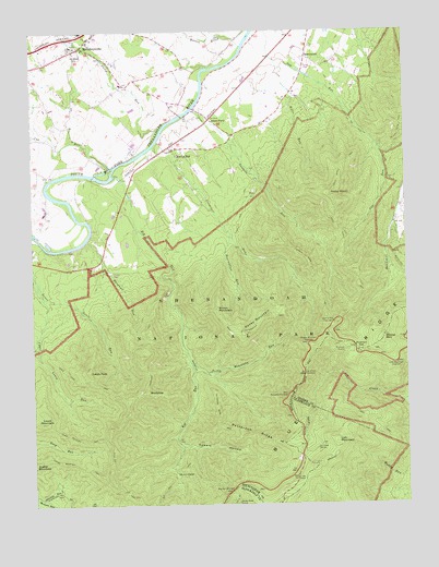
McGaheysville, VA USGS Topographic Map
Click on map above to begin viewing in our Map Viewer.

This topographic map contains these locations and features:
Feature Name Type Latitude Longitude GNIS ID View Map
Almond (historical)Populated PlaceN38.3376°W78.7159°1779310View Map
Austin Mountain TrailTrailN38.2604°W78.7350°1462628View Map
Bearwallow RunStreamN38.3218°W78.6831°1462913View Map
BerrytownPopulated PlaceN38.3685°W78.6570°1477112View Map
Big RunStreamN38.3373°W78.7214°1463399View Map
Big Run OverlookLocaleN38.2537°W78.6842°1463402View Map
Big Run ShelterLocaleN38.2587°W78.7022°1463403View Map
Big Run TrailTrailN38.2562°W78.7047°1463404View Map
Bonnie BrookStreamN38.3718°W78.6784°1481929View Map
Brown MountainSummitN38.3015°W78.6878°1495308View Map
Brown Mountain OverlookLocaleN38.2926°W78.6578°1463912View Map
Brown Rocky Mountain TrailTrailN38.2957°W78.6822°1463913View Map
Camp Shenandoah (historical)LocaleN38.3557°W78.7109°1779315View Map
Cub RunStreamN38.3393°W78.7234°1482870View Map
Doyles River CabinLocaleN38.2507°W78.6817°1465935View Map
Dundo HollowValleyN38.2515°W78.7479°1466046View Map
Eppert HollowValleyN38.2654°W78.7001°1466332View Map
Gap Run TrailTrailN38.3476°W78.6375°1466977View Map
Hangman RunStreamN38.3196°W78.7317°1467706View Map
Island FordPopulated PlaceN38.3518°W78.6886°1477439View Map
Ivy Creek OverlookLocaleN38.2843°W78.6592°1468556View Map
Ivy Creek ShelterLocaleN38.2649°W78.6553°1468557View Map
Lewis MountainSummitN38.2721°W78.7456°1469335View Map
Lewis Mountain TrailTrailN38.2668°W78.7339°1469338View Map
Lewis PeakSummitN38.2853°W78.7309°1469340View Map
Lewis Peak TrailTrailN38.2829°W78.7325°1469341View Map
Loft MountainSummitN38.2665°W78.6483°1495863View Map
Loft Mountain OverlookLocaleN38.2871°W78.6284°1469737View Map
McGaheysvillePopulated PlaceN38.3712°W78.7322°1485293View Map
McGaheysville Elementary SchoolSchoolN38.3712°W78.7357°1779331View Map
McGaheysville Post OfficePost OfficeN38.3709°W78.7325°2766245View Map
McGaheysville Station Elkton Volunteer Rescue Squad 35BuildingN38.3737°W78.7305°2085989View Map
Mount Olivet CemeteryCemeteryN38.3685°W78.7331°1470994View Map
Onemile RunStreamN38.3451°W78.7084°1471924View Map
Onemile Run TrailTrailN38.3249°W78.6789°1471925View Map
Patterson RidgeRidgeN38.2661°W78.6660°1472113View Map
Patterson Ridge TrailTrailN38.2757°W78.6884°1472114View Map
Pinefield GapGapN38.2912°W78.6403°1472376View Map
Pinefield ShelterLocaleN38.2907°W78.6459°1472377View Map
Rocky BarPopulated PlaceN38.3437°W78.7017°1473422View Map
Rocky Bar School (historical)SchoolN38.3435°W78.7031°1779340View Map
Rocky MountSummitN38.3317°W78.6497°1473466View Map
Rocky Mount TrailTrailN38.3396°W78.6450°1473472View Map
Rocky MountainSummitN38.2956°W78.6784°1473474View Map
Rocky Mountain RunStreamN38.2876°W78.6970°1473476View Map
RockytopSummitN38.2897°W78.7136°1473498View Map
Rockytop OverlookLocaleN38.2790°W78.6647°1473499View Map
Rockytop TrailTrailN38.2815°W78.7120°1473500View Map
Shenandoah WildernessReserveN38.2817°W78.6962°2035588View Map
Stonewall DistrictCivilN38.3603°W78.6824°1927525View Map
Stony RunStreamN38.3510°W78.7045°1487638View Map
Twomile Ridge TrailTrailN38.3093°W78.6536°1476006View Map
Twomile RunStreamN38.3543°W78.6950°1476007View Map
Twomile Run OverlookLocaleN38.2982°W78.6495°1476008View Map
Upper Lewis RunStreamN38.3051°W78.7459°1476116View Map
Walls RunStreamN38.3679°W78.6684°1476268View Map
Weaver MountainSummitN38.2946°W78.6325°1476418View Map
Whiteoak RunStreamN38.2524°W78.7495°1476617View Map

Note: Coordinates in the location and feature list above are referenced to NAD83 datum.


Copyright (C) 2008-2025 Ryan Niemi / Sunset Dynamics ... All Rights Reserved