TopoQuest Logo
Do you find TopoQuest useful?
Help keep TopoQuest running and adding new maps/features by donating!
Bitcoin:  19c7KJd3qBynnjoSw5npx9KScwjBe4ifkT
Litecoin:  LXs6TkuXGGXo1vDsWCkWVdjQX94eUKd6ui
Home View Maps Find Maps Find Places Resources & Links


Freedom, Indiana Topographic Map

USGS Map Title: Freedom, IN
USGS Map MRC: 39086B7
DRG (GeoTIFF) Download: o39086b7.tif


Neighboring USGS Topographic Map Quads:


  Patricksburg, IN  
39086C8
 

  Spencer, IN  
39086C7
 

  Gosport, IN  
39086C6
 

  Arney, IN  
39086B8
 

  Freedom, IN  
39086B7
 

  Whitehall, IN  
39086B6
 

  Bloomfield, IN  
39086A8
 

  Solsberry, IN  
39086A7
 

  Stanford, IN  
39086A6


Map MRC Location:

N40°
W87°
N40°
W86°
H8 H7 H6 H5 H4 H3 H2 H1
G8 G7 G6 G5 G4 G3 G2 G1
F8 F7 F6 F5 F4 F3 F2 F1
E8 E7 E6 E5 E4 E3 E2 E1
D8 D7 D6 D5 D4 D3 D2 D1
C8 C7 C6 C5 C4 C3 C2 C1
B8 B7 B6 B5 B4 B3 B2 B1
A8 A7 A6 A5 A4 A3 A2 A1
N39°
W87°
N39°
W86°

Freedom, IN USGS 1:24K Topographic Map Preview:
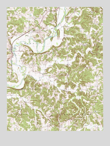
Freedom, IN USGS Topographic Map
Click on map above to begin viewing in our Map Viewer.

This topographic map contains these locations and features:
Feature Name Type Latitude Longitude GNIS ID View Map
AdelPopulated PlaceN39.1920°W86.7958°430020View Map
Adel CemeteryCemeteryN39.1899°W86.7965°430021View Map
Arthur CemeteryCemeteryN39.1364°W86.7946°430284View Map
BraysvillePopulated PlaceN39.2117°W86.7744°431458View Map
Burkett CemeteryCemeteryN39.2173°W86.8170°431834View Map
Burton CemeteryCemeteryN39.1923°W86.8383°431880View Map
Camden CemeteryCemeteryN39.1692°W86.8119°432003View Map
Defore CemeteryCemeteryN39.2181°W86.8744°433438View Map
Franklin CemeteryCemeteryN39.2186°W86.8006°434764View Map
Franklin Township Volunteer Fire Department Station 3BuildingN39.2067°W86.8712°2625843View Map
FreedomPopulated PlaceN39.2070°W86.8692°434803View Map
Goose CreekStreamN39.2173°W86.8464°435196View Map
Hedding ChurchChurchN39.2095°W86.7572°435971View Map
Hicks CemeteryCemeteryN39.2212°W86.8485°436117View Map
Kelley CemeteryCemeteryN39.1556°W86.8667°437216View Map
Kelley RidgeRidgeN39.1495°W86.8689°437219View Map
Leach CemeteryCemeteryN39.2055°W86.8430°437692View Map
Lick CreekStreamN39.1803°W86.8289°437859View Map
Light CemeteryCemeteryN39.2010°W86.8675°437881View Map
Livingston CemeteryCemeteryN39.1534°W86.8033°438187View Map
McIndoo CemeteryCemeteryN39.1767°W86.8744°438882View Map
McKee CemeteryCemeteryN39.2464°W86.8114°438890View Map
Mills CreekStreamN39.2264°W86.8103°439243View Map
Minks CemeteryCemeteryN39.1609°W86.7808°439270View Map
Neeley CemeteryCemeteryN39.1927°W86.8417°439977View Map
New HopePopulated PlaceN39.1831°W86.8278°440057View Map
NewarkPopulated PlaceN39.1289°W86.8072°440132View Map
Oliphant CemeteryCemeteryN39.2024°W86.8207°440631View Map
PottersvillePopulated PlaceN39.2073°W86.8142°441507View Map
Pryor CemeteryCemeteryN39.1772°W86.8105°441629View Map
Pryor CemeteryCemeteryN39.1309°W86.8181°441630View Map
Scott CemeteryCemeteryN39.2464°W86.8167°443138View Map
Snyder CemeteryCemeteryN39.1670°W86.8389°443745View Map
Stokey RidgeRidgeN39.1664°W86.8620°444190View Map
Township of FranklinCivilN39.2105°W86.8506°453310View Map
VilasPopulated PlaceN39.1700°W86.8400°445291View Map
Waker CemeteryCemeteryN39.1795°W86.8191°445362View Map
Watkins SpringSpringN39.1400°W86.8186°445550View Map
White CemeteryCemeteryN39.2364°W86.8139°445924View Map
White CemeteryCemeteryN39.2498°W86.8261°445925View Map

Note: Coordinates in the location and feature list above are referenced to NAD83 datum.


Copyright (C) 2008-2025 Ryan Niemi / Sunset Dynamics ... All Rights Reserved