TopoQuest Logo
Do you find TopoQuest useful?
Help keep TopoQuest running and adding new maps/features by donating!
Bitcoin:  19c7KJd3qBynnjoSw5npx9KScwjBe4ifkT
Litecoin:  LXs6TkuXGGXo1vDsWCkWVdjQX94eUKd6ui
Home View Maps Find Maps Find Places Resources & Links


Solsberry, Indiana Topographic Map

USGS Map Title: Solsberry, IN
USGS Map MRC: 39086A7
DRG (GeoTIFF) Download: o39086a7.tif


Neighboring USGS Topographic Map Quads:


  Arney, IN  
39086B8
 

  Freedom, IN  
39086B7
 

  Whitehall, IN  
39086B6
 

  Bloomfield, IN  
39086A8
 

  Solsberry, IN  
39086A7
 

  Stanford, IN  
39086A6
 

  Scotland, IN  
38086H8
 

  Koleen, IN  
38086H7
 

  Owensburg, IN  
38086H6


Map MRC Location:

N40°
W87°
N40°
W86°
H8 H7 H6 H5 H4 H3 H2 H1
G8 G7 G6 G5 G4 G3 G2 G1
F8 F7 F6 F5 F4 F3 F2 F1
E8 E7 E6 E5 E4 E3 E2 E1
D8 D7 D6 D5 D4 D3 D2 D1
C8 C7 C6 C5 C4 C3 C2 C1
B8 B7 B6 B5 B4 B3 B2 B1
A8 A7 A6 A5 A4 A3 A2 A1
N39°
W87°
N39°
W86°

Solsberry, IN USGS 1:24K Topographic Map Preview:
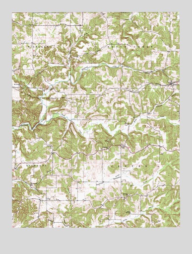
Solsberry, IN USGS Topographic Map
Click on map above to begin viewing in our Map Viewer.

This topographic map contains these locations and features:
Feature Name Type Latitude Longitude GNIS ID View Map
American BottomsBendN39.0273°W86.8031°430132View Map
Anderson BranchStreamN39.0642°W86.7722°430153View Map
Beech CemeteryCemeteryN39.0034°W86.7667°430712View Map
Beech CreekStreamN39.0606°W86.8550°430717View Map
Beechwood Lake DamDamN39.0945°W86.8339°448488View Map
Bingham CemeteryCemeteryN39.0664°W86.7742°431093View Map
Bridge CreekStreamN39.0228°W86.8075°431516View Map
Camp CreekStreamN39.0889°W86.8322°432021View Map
Combs SchoolSchoolN39.0475°W86.7922°432831View Map
Dry BranchStreamN39.0953°W86.7931°433709View Map
Eastern Volunteer Fire DepartmentBuildingN39.0820°W86.7549°2626231View Map
Goad SpringLakeN39.0074°W86.7874°435138View Map
Lawrence CemeteryCemeteryN39.0239°W86.7872°437667View Map
Mount Calvary ChurchChurchN39.0825°W86.8686°439531View Map
Newark CemeteryCemeteryN39.1248°W86.8086°440133View Map
Ore Branch ChurchChurchN39.0250°W86.8614°440691View Map
ParkPopulated PlaceN39.0162°W86.8494°440869View Map
Philpot CemeteryCemeteryN39.1064°W86.7944°441095View Map
RidgeportPopulated PlaceN39.0456°W86.8036°446730View Map
Ridgeport ChurchChurchN39.0456°W86.8033°441998View Map
Sharkey ChurchChurchN39.0470°W86.8453°443291View Map
SolsberryPopulated PlaceN39.0834°W86.7561°443761View Map
Stone CemeteryCemeteryN39.0425°W86.7642°444201View Map
Sylvania ChurchChurchN39.0189°W86.7892°444522View Map
TannerPopulated PlaceN39.0181°W86.7933°446731View Map
Township of Beech CreekCivilN39.1235°W86.7572°453104View Map
Township of CenterCivilN39.0369°W86.7566°453179View Map
Walnut ChurchChurchN39.0037°W86.8450°445405View Map

Note: Coordinates in the location and feature list above are referenced to NAD83 datum.


Copyright (C) 2008-2025 Ryan Niemi / Sunset Dynamics ... All Rights Reserved