TopoQuest Logo
Do you find TopoQuest useful?
Help keep TopoQuest running and adding new maps/features by donating!
Bitcoin:  19c7KJd3qBynnjoSw5npx9KScwjBe4ifkT
Litecoin:  LXs6TkuXGGXo1vDsWCkWVdjQX94eUKd6ui
Home View Maps Find Maps Find Places Resources & Links


Freeport, Michigan Topographic Map

USGS Map Title: Freeport, MI
USGS Map MRC: 42085G3
DRG (GeoTIFF) Download: o42085g3.tif


Neighboring USGS Topographic Map Quads:


  Cascade, MI  
42085H4
 

  Lowell, MI  
42085H3
 

  Saranac, MI  
42085H2
 

  Alto, MI  
42085G4
 

  Freeport, MI  
42085G3
 

  Lake Odessa, MI  
42085G2
 

  Middleville, MI  
42085F4
 

  Hastings, MI  
42085F3
 

  Woodland, MI  
42085F2


Map MRC Location:

N43°
W86°
N43°
W85°
H8 H7 H6 H5 H4 H3 H2 H1
G8 G7 G6 G5 G4 G3 G2 G1
F8 F7 F6 F5 F4 F3 F2 F1
E8 E7 E6 E5 E4 E3 E2 E1
D8 D7 D6 D5 D4 D3 D2 D1
C8 C7 C6 C5 C4 C3 C2 C1
B8 B7 B6 B5 B4 B3 B2 B1
A8 A7 A6 A5 A4 A3 A2 A1
N42°
W86°
N42°
W85°

Freeport, MI USGS 1:24K Topographic Map Preview:
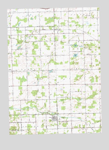
Freeport, MI USGS Topographic Map
Click on map above to begin viewing in our Map Viewer.

This topographic map contains these locations and features:
Feature Name Type Latitude Longitude GNIS ID View Map
Apostolic Christian ChurchChurchN42.8359°W85.3506°620165View Map
Bear CreekStreamN42.7770°W85.3447°620828View Map
Bear Swamp DrainCanalN42.8423°W85.3381°620879View Map
Bond DrainCanalN42.8011°W85.3058°621702View Map
Bowne CenterPopulated PlaceN42.8128°W85.3692°621810View Map
Bowne Center CemeteryCemeteryN42.8133°W85.3700°2567115View Map
Bowne Center United Methodist ChurchChurchN42.8128°W85.3692°2567057View Map
Bowne ChurchChurchN42.8278°W85.3186°621811View Map
Bowne Post Office (historical)Post OfficeN42.8128°W85.3692°2570758View Map
Calvary ChurchChurchN42.8128°W85.3283°622488View Map
Church LakeLakeN42.8375°W85.2833°623302View Map
Duck CreekStreamN42.7748°W85.3361°624916View Map
ElmdalePopulated PlaceN42.8536°W85.3111°625518View Map
Elmdale Church of the NazareneChurchN42.8542°W85.3067°2548819View Map
Elmdale Post Office (historical)Post OfficeN42.8536°W85.3111°2581748View Map
Elmdale StationLocaleN42.8539°W85.3106°2581797View Map
Fillmore Post Office (historical)Post OfficeN42.7550°W85.3583°2572382View Map
FreeportPopulated PlaceN42.7661°W85.3133°626464View Map
Freeport Area Volunteer Fire DepartmentBuildingN42.7657°W85.3167°2572789View Map
Freeport CemeteryCemeteryN42.7688°W85.3132°2572240View Map
Freeport District LibraryBuildingN42.7631°W85.3158°2572790View Map
Freeport Police DepartmentBuildingN42.7640°W85.3161°2572787View Map
Freeport Post OfficePost OfficeN42.7664°W85.3147°2572786View Map
Freeport United Brethren ChurchChurchN42.7653°W85.3139°2572785View Map
Freeport United Methodist ChurchChurchN42.7647°W85.3161°2572784View Map
Freeport Village HallBuildingN42.7658°W85.3153°2572788View Map
Geiger DrainCanalN42.7617°W85.3278°626707View Map
German CemeteryCemeteryN42.7618°W85.3430°626552View Map
Hess LakeLakeN42.8364°W85.2750°628160View Map
Hope ChurchChurchN42.7995°W85.3108°628562View Map
Johnson Airport (historical)AirportN42.8000°W85.3708°1623777View Map
Kilgus BranchStreamN42.8420°W85.3528°629660View Map
Lake Number TenLakeN42.8363°W85.3597°1614678View Map
Lake SchoolSchoolN42.8348°W85.2708°629995View Map
Logan LakeLakeN42.8123°W85.3174°630882View Map
Logan Post Office (historical)Post OfficeN42.8133°W85.3203°2570712View Map
Lowell Fire DepartmentBuildingN42.8467°W85.3417°2565311View Map
Mennonite CemeteryCemeteryN42.8275°W85.3178°2567114View Map
Messer BrookStreamN42.7578°W85.2653°632155View Map
Middleville State Game AreaParkN42.7534°W85.3650°619760View Map
Peddler LakeLakeN42.8275°W85.2837°634556View Map
Peddler Lake DrainCanalN42.8378°W85.2792°634557View Map
Pleasant Valley ChurchChurchN42.7984°W85.2708°635122View Map
Smelker DrainCanalN42.7664°W85.3470°638126View Map
Stecklee DrainCanalN42.7639°W85.3075°638771View Map
Township of BowneCivilN42.8130°W85.3694°1625964View Map
Township of CampbellCivilN42.8135°W85.2518°1626028View Map
Tyler Creek Golf ClubLocaleN42.8014°W85.3389°2567060View Map
Village of FreeportCivilN42.7642°W85.3158°2398927View Map
Walton DrainCanalN42.7873°W85.3211°1615747View Map
West Campbell Post Office (historical)Post OfficeN42.8278°W85.2717°2581724View Map

Note: Coordinates in the location and feature list above are referenced to NAD83 datum.


Copyright (C) 2008-2024 Ryan Niemi / Sunset Dynamics ... All Rights Reserved