TopoQuest Logo
Do you find TopoQuest useful?
Help keep TopoQuest running and adding new maps/features by donating!
Bitcoin:  19c7KJd3qBynnjoSw5npx9KScwjBe4ifkT
Litecoin:  LXs6TkuXGGXo1vDsWCkWVdjQX94eUKd6ui
Home View Maps Find Maps Find Places Resources & Links


Freezeout Lake, Montana Topographic Map

USGS Map Title: Freezeout Lake, MT
USGS Map MRC: 47112F1
DRG (GeoTIFF) Download: o47112f1.tif


Neighboring USGS Topographic Map Quads:


  Choteau, MT  
47112G2
 

  Choteau SE, MT  
47112G1
 

  T L Gap, MT  
47111G8
 

  Sevenmile Hill, MT  
47112F2
 

  Freezeout Lake, MT  
47112F1
 

  Cleiv, MT  
47111F8
 

  Golden Ridge, MT  
47112E2
 

  Lowry, MT  
47112E1
 

  Fairfield, MT  
47111E8


Map MRC Location:

N48°
W113°
N48°
W112°
H8 H7 H6 H5 H4 H3 H2 H1
G8 G7 G6 G5 G4 G3 G2 G1
F8 F7 F6 F5 F4 F3 F2 F1
E8 E7 E6 E5 E4 E3 E2 E1
D8 D7 D6 D5 D4 D3 D2 D1
C8 C7 C6 C5 C4 C3 C2 C1
B8 B7 B6 B5 B4 B3 B2 B1
A8 A7 A6 A5 A4 A3 A2 A1
N47°
W113°
N47°
W112°

Freezeout Lake, MT USGS 1:24K Topographic Map Preview:
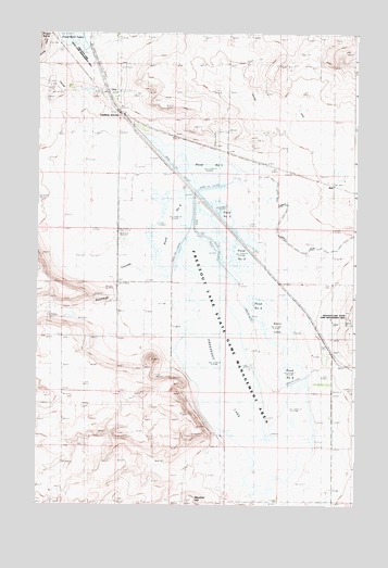
Freezeout Lake, MT USGS Topographic Map
Click on map above to begin viewing in our Map Viewer.

This topographic map contains these locations and features:
Feature Name Type Latitude Longitude GNIS ID View Map
22N03W08ABBA01 WellWellN47.6836°W112.0181°824515View Map
22N03W09CDCD01 WellWellN47.6700°W112.0019°824428View Map
22N03W29AABA01 WellWellN47.6405°W112.0133°824232View Map
22N03W29AABA02 WellWellN47.6405°W112.0133°824233View Map
22N03W29AABA03 WellWellN47.6405°W112.0133°824234View Map
22N03W29AABA04 WellWellN47.6405°W112.0133°824235View Map
22N03W29D___01 WellWellN47.6297°W112.0133°824149View Map
22N03W31BCCD01 WellWellN47.6394°W112.0064°824213View Map
22N04W13B___01 WellWellN47.6655°W112.0670°824394View Map
23N03W30ABDC01 WellWellN47.7236°W112.0364°824692View Map
23N04W24C___01 WellWellN47.7305°W112.0664°824713View Map
BolePopulated PlaceN47.7108°W112.0108°769087View Map
Bole (historical)LocaleN47.7108°W112.0108°1762133View Map
Bole Post Office (historical)Post OfficeN47.7108°W112.0108°1762145View Map
Bole School (historical)SchoolN47.7108°W112.0108°1761951View Map
Crossen CouleeValleyN47.7083°W112.1064°1762035View Map
Davis LakeLakeN47.6717°W112.0297°770476View Map
Dipping Tank CreekStreamN47.6444°W112.0517°1762030View Map
Eastham JunctionPopulated PlaceN47.7291°W112.0942°771124View Map
Floweree CouleeValleyN47.6397°W112.0536°1762029View Map
FlumeLocaleN47.7347°W112.0981°1762115View Map
Freezeout (historical)LocaleN47.6666°W112.0092°1762114View Map
Freezeout LakeLakeN47.6594°W112.0465°771624View Map
Green Post Office (historical)Post OfficeN47.6991°W112.0092°1762069View Map
Moehler HillSummitN47.6261°W112.0645°774314View Map
North Supply DitchCanalN47.6969°W112.0300°774860View Map
Pond Number FiveLakeN47.6774°W112.0385°807011View Map
Pond Number FourLakeN47.7000°W112.0711°807012View Map
Pond Number OneLakeN47.7150°W112.0621°775353View Map
Pond Number SixLakeN47.6600°W112.0250°807010View Map
Pond Number ThreeLakeN47.6886°W112.0511°775355View Map
Pond Number TwoLakeN47.7016°W112.0501°775354View Map
Road CouleeValleyN47.7444°W112.1064°1762037View Map
Roundup CouleeValleyN47.6805°W112.0931°778773View Map
Wolf CouleeValleyN47.7472°W112.1036°1762038View Map

Note: Coordinates in the location and feature list above are referenced to NAD83 datum.


Copyright (C) 2008-2025 Ryan Niemi / Sunset Dynamics ... All Rights Reserved