TopoQuest Logo
Do you find TopoQuest useful?
Help keep TopoQuest running and adding new maps/features by donating!
Bitcoin:  19c7KJd3qBynnjoSw5npx9KScwjBe4ifkT
Litecoin:  LXs6TkuXGGXo1vDsWCkWVdjQX94eUKd6ui
Home View Maps Find Maps Find Places Resources & Links


French Gulch, Oregon Topographic Map

USGS Map Title: French Gulch, OR
USGS Map MRC: 44117E6
DRG (GeoTIFF) Download: o44117e6.tif


Neighboring USGS Topographic Map Quads:


  Bowen Valley, OR  
44117F7
 

  Encina, OR  
44117F6
 

  Oxman, OR  
44117F5
 

  Dooley Mountain, OR  
44117E7
 

  French Gulch, OR  
44117E6
 

  Lost Basin, OR  
44117E5
 

  Wendt Butte, OR  
44117D7
 

  Bridgeport, OR  
44117D6
 

  Mormon Basin, OR  
44117D5


Map MRC Location:

N45°
W118°
N45°
W117°
H8 H7 H6 H5 H4 H3 H2 H1
G8 G7 G6 G5 G4 G3 G2 G1
F8 F7 F6 F5 F4 F3 F2 F1
E8 E7 E6 E5 E4 E3 E2 E1
D8 D7 D6 D5 D4 D3 D2 D1
C8 C7 C6 C5 C4 C3 C2 C1
B8 B7 B6 B5 B4 B3 B2 B1
A8 A7 A6 A5 A4 A3 A2 A1
N44°
W118°
N44°
W117°

French Gulch, OR USGS 1:24K Topographic Map Preview:
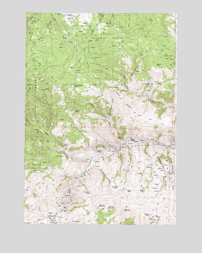
French Gulch, OR USGS Topographic Map
Click on map above to begin viewing in our Map Viewer.

This topographic map contains these locations and features:
Feature Name Type Latitude Longitude GNIS ID View Map
Bennett DamDamN44.6243°W117.7200°1133457View Map
Bennett ReservoirReservoirN44.6236°W117.7177°1117531View Map
Big Fir SpringSpringN44.5196°W117.6650°1117623View Map
Birch SpringSpringN44.5015°W117.7039°1117730View Map
Blue SpringSpringN44.6086°W117.6721°1117867View Map
Blue Spring GulchValleyN44.5827°W117.6660°1117870View Map
Bridgeport ValleyValleyN44.5035°W117.7305°1118076View Map
Burnt River SpringSpringN44.5187°W117.6955°1118361View Map
Campbell GulchValleyN44.5463°W117.6349°1118544View Map
Chicken PeakSummitN44.5668°W117.7113°1118887View Map
Clarks CreekStreamN44.5040°W117.7277°1118976View Map
Cottonwood SpringSpringN44.5223°W117.6723°1119352View Map
Dark CanyonValleyN44.5382°W117.6924°1119687View Map
Dead Horse CanyonValleyN44.5640°W117.6830°1119737View Map
Ebell Creek DivideRidgeN44.6104°W117.6994°1120370View Map
Fawn SpringSpringN44.6094°W117.6895°1120652View Map
French GulchValleyN44.5465°W117.6708°1120987View Map
French SpringSpringN44.5513°W117.6737°1120989View Map
Grouse GulchValleyN44.5796°W117.6652°1121464View Map
High Up SpringSpringN44.5060°W117.6468°1121816View Map
Mahogany SpringSpringN44.5954°W117.6420°1123691View Map
Marble CreekStreamN44.5035°W117.7319°1123751View Map
Miller GulchValleyN44.5302°W117.6260°1124202View Map
Mullen SpringSpringN44.5201°W117.6513°1124533View Map
Ridge Top Spring Number FourSpringN44.5111°W117.6834°1126001View Map
Ridge Top Spring Number ThreeSpringN44.5100°W117.6755°1126000View Map
Ridge Top Spring Number TwoSpringN44.5086°W117.6677°1125999View Map
Salt SpringSpringN44.5051°W117.6419°1126532View Map
Salt Spring Number OneSpringN44.5043°W117.6468°1126533View Map
Sheep FlatFlatN44.6179°W117.7019°1149336View Map
Snowshoe GulchValleyN44.5388°W117.6983°1127171View Map
Stump SpringSpringN44.5824°W117.6914°1127677View Map
Stump Spring ButteSummitN44.5824°W117.7105°1127678View Map
Tule SpringSpringN44.5064°W117.6956°1128286View Map
White Rock GulchValleyN44.5357°W117.6958°1128993View Map
Windy RidgeRidgeN44.5743°W117.6722°1129230View Map

Note: Coordinates in the location and feature list above are referenced to NAD83 datum.


Copyright (C) 2008-2024 Ryan Niemi / Sunset Dynamics ... All Rights Reserved