TopoQuest Logo
Do you find TopoQuest useful?
Help keep TopoQuest running and adding new maps/features by donating!
Bitcoin:  19c7KJd3qBynnjoSw5npx9KScwjBe4ifkT
Litecoin:  LXs6TkuXGGXo1vDsWCkWVdjQX94eUKd6ui
Home View Maps Find Maps Find Places Resources & Links


Lost Basin, Oregon Topographic Map

USGS Map Title: Lost Basin, OR
USGS Map MRC: 44117E5
DRG (GeoTIFF) Download: o44117e5.tif


Neighboring USGS Topographic Map Quads:


  Encina, OR  
44117F6
 

  Oxman, OR  
44117F5
 

  Lawrence Creek, OR  
44117F4
 

  French Gulch, OR  
44117E6
 

  Lost Basin, OR  
44117E5
 

  Durkee, OR  
44117E4
 

  Bridgeport, OR  
44117D6
 

  Mormon Basin, OR  
44117D5
 

  Rye Valley, OR  
44117D4


Map MRC Location:

N45°
W118°
N45°
W117°
H8 H7 H6 H5 H4 H3 H2 H1
G8 G7 G6 G5 G4 G3 G2 G1
F8 F7 F6 F5 F4 F3 F2 F1
E8 E7 E6 E5 E4 E3 E2 E1
D8 D7 D6 D5 D4 D3 D2 D1
C8 C7 C6 C5 C4 C3 C2 C1
B8 B7 B6 B5 B4 B3 B2 B1
A8 A7 A6 A5 A4 A3 A2 A1
N44°
W118°
N44°
W117°

Lost Basin, OR USGS 1:24K Topographic Map Preview:
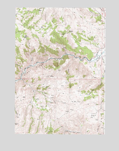
Lost Basin, OR USGS Topographic Map
Click on map above to begin viewing in our Map Viewer.

This topographic map contains these locations and features:
Feature Name Type Latitude Longitude GNIS ID View Map
Benchmark WaterholeLakeN44.6011°W117.5502°1117516View Map
Brattan SpringSpringN44.5740°W117.5179°1131462View Map
Burnt River CanyonValleyN44.5718°W117.5210°1118360View Map
Cave CreekStreamN44.5540°W117.6163°1118710View Map
Celia SpringSpringN44.6049°W117.5894°1118767View Map
Chambeam DitchCanalN44.5815°W117.5088°1116727View Map
Coyote WaterholeLakeN44.5991°W117.5561°1119484View Map
Cutting MineMineN44.5571°W117.5780°1638453View Map
Deer CreekStreamN44.5599°W117.6138°1119824View Map
Eddy SloughStreamN44.5027°W117.6052°1131900View Map
Fleming SpringSpringN44.6219°W117.5925°1120831View Map
Hooker GulchValleyN44.5671°W117.6019°1121969View Map
Kirby ReservoirReservoirN44.5956°W117.6113°1122779View Map
Lander (historical)LocaleN44.5613°W117.6141°1131460View Map
Lost BasinBasinN44.5199°W117.5158°1123482View Map
Powell CreekStreamN44.5702°W117.5010°1125635View Map
Powell SpringSpringN44.5364°W117.6140°1125639View Map
Reagan CreekStreamN44.5427°W117.5985°1125859View Map
Sheep MountainSummitN44.5577°W117.5769°1126827View Map
Sinker CreekStreamN44.5760°W117.5430°1127002View Map
Steep Slope SpringSpringN44.5098°W117.6248°1127574View Map
True Blue GulchValleyN44.5563°W117.5035°1128252View Map
True Blue ReservoirReservoirN44.5566°W117.5023°1131461View Map

Note: Coordinates in the location and feature list above are referenced to NAD83 datum.


Copyright (C) 2008-2025 Ryan Niemi / Sunset Dynamics ... All Rights Reserved