TopoQuest Logo
Do you find TopoQuest useful?
Help keep TopoQuest running and adding new maps/features by donating!
Bitcoin:  19c7KJd3qBynnjoSw5npx9KScwjBe4ifkT
Litecoin:  LXs6TkuXGGXo1vDsWCkWVdjQX94eUKd6ui
Home View Maps Find Maps Find Places Resources & Links


Friendship, Georgia Topographic Map

USGS Map Title: Friendship, GA
USGS Map MRC: 33083A1
DRG (GeoTIFF) Download: o33083a1.tif


Neighboring USGS Topographic Map Quads:


  Lake Sinclair East, GA  
33083B2
 

  Devereux, GA  
33083B1
 

  Warthen NW, GA  
33082B8
 

  Milledgeville, GA  
33083A2
 

  Friendship, GA  
33083A1
 

  Deepstep, GA  
33082A8
 

  Napier Pond, GA  
32083H2
 

  Gumm Pond, GA  
32083H1
 

  Tabernacle, GA  
32082H8


Map MRC Location:

N34°
W84°
N34°
W83°
H8 H7 H6 H5 H4 H3 H2 H1
G8 G7 G6 G5 G4 G3 G2 G1
F8 F7 F6 F5 F4 F3 F2 F1
E8 E7 E6 E5 E4 E3 E2 E1
D8 D7 D6 D5 D4 D3 D2 D1
C8 C7 C6 C5 C4 C3 C2 C1
B8 B7 B6 B5 B4 B3 B2 B1
A8 A7 A6 A5 A4 A3 A2 A1
N33°
W84°
N33°
W83°

Friendship, GA USGS 1:24K Topographic Map Preview:
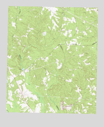
Friendship, GA USGS Topographic Map
Click on map above to begin viewing in our Map Viewer.

This topographic map contains these locations and features:
Feature Name Type Latitude Longitude GNIS ID View Map
Allen Mill (historical)Populated PlaceN33.0499°W83.1013°334766View Map
Body of Christ ChurchChurchN33.0965°W83.0954°348194View Map
County Line ChurchChurchN33.0579°W83.0890°355339View Map
FriendshipPopulated PlaceN33.0815°W83.0313°331773View Map
Friendship Baptist ChurchChurchN33.0807°W83.0307°348319View Map
Friendship ChurchChurchN33.0229°W83.1046°314417View Map
Garner Family CemeteryCemeteryN33.0946°W83.0571°1985804View Map
Gin BranchStreamN33.0113°W83.0293°348322View Map
Griffin Academy (historical)SchoolN33.0532°W83.0213°334920View Map
Harmony ChurchChurchN33.0521°W83.0707°315145View Map
Harmony ChurchyardCemeteryN33.0521°W83.0707°1986011View Map
John Thomas Family CemeteryCemeteryN33.0949°W83.0574°1985863View Map
Leverett-Sparks CemeteryCemeteryN33.0140°W83.0446°348347View Map
Long BranchStreamN33.0904°W83.0524°317311View Map
Minor School (historical)SchoolN33.0749°W83.0921°334848View Map
Mount Nebo Church CemeteryCemeteryN33.0821°W83.0301°1985837View Map
Nebo ChurchChurchN33.0815°W83.0301°319226View Map
O'Quinn PondReservoirN33.0512°W83.1023°341622View Map
O'Quinn Pond DamDamN33.0496°W83.1015°341621View Map
Peavy LakeReservoirN33.0351°W83.1232°340123View Map
Peavy Lake DamDamN33.0351°W83.1232°340122View Map
Pleasant Grove School (historical)SchoolN33.0368°W83.0349°334921View Map
Prosser Fields CemeteryCemeteryN33.0726°W83.0713°1985886View Map
Roberson Chapel ChurchChurchN33.1221°W83.0054°348251View Map
Rogers CemeteryCemeteryN33.0201°W83.0699°345312View Map
Second Darien Church CemeteryCemeteryN33.1207°W83.0015°1985793View Map
Simmons CemeteryCemeteryN33.1243°W83.0171°348259View Map
Spring CreekStreamN33.0640°W83.1060°323385View Map
Spring LakeStreamN33.0010°W83.1221°323443View Map
Trawick Family Cemetery Number 1CemeteryN33.0840°W83.0765°1985867View Map
Underwood - Harrison Family CemeteryCemeteryN33.1172°W83.0444°1985870View Map
White Oak CreekStreamN33.0782°W83.0854°325171View Map

Note: Coordinates in the location and feature list above are referenced to NAD83 datum.


Copyright (C) 2008-2024 Ryan Niemi / Sunset Dynamics ... All Rights Reserved