TopoQuest Logo
Do you find TopoQuest useful?
Help keep TopoQuest running and adding new maps/features by donating!
Bitcoin:  19c7KJd3qBynnjoSw5npx9KScwjBe4ifkT
Litecoin:  LXs6TkuXGGXo1vDsWCkWVdjQX94eUKd6ui
Home View Maps Find Maps Find Places Resources & Links


Warthen NW, Georgia Topographic Map

USGS Map Title: Warthen NW, GA
USGS Map MRC: 33082B8
DRG (GeoTIFF) Download: o33082b8.tif


Neighboring USGS Topographic Map Quads:


  Shoulderbone, GA  
33083C1
 

  Sparta, GA  
33082C8
 

  Jewell, GA  
33082C7
 

  Devereux, GA  
33083B1
 

  Warthen NW, GA  
33082B8
 

  Warthen NE, GA  
33082B7
 

  Friendship, GA  
33083A1
 

  Deepstep, GA  
33082A8
 

  Warthen, GA  
33082A7


Map MRC Location:

N34°
W83°
N34°
W82°
H8 H7 H6 H5 H4 H3 H2 H1
G8 G7 G6 G5 G4 G3 G2 G1
F8 F7 F6 F5 F4 F3 F2 F1
E8 E7 E6 E5 E4 E3 E2 E1
D8 D7 D6 D5 D4 D3 D2 D1
C8 C7 C6 C5 C4 C3 C2 C1
B8 B7 B6 B5 B4 B3 B2 B1
A8 A7 A6 A5 A4 A3 A2 A1
N33°
W83°
N33°
W82°

Warthen NW, GA USGS 1:24K Topographic Map Preview:
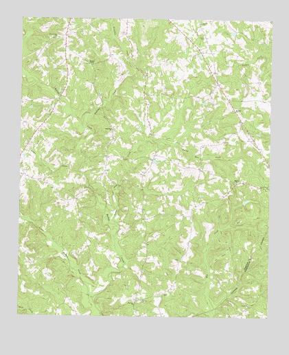
Warthen NW, GA USGS Topographic Map
Click on map above to begin viewing in our Map Viewer.

This topographic map contains these locations and features:
Feature Name Type Latitude Longitude GNIS ID View Map
Archer Grove ChurchChurchN33.1790°W82.8757°354386View Map
Archer Grove Church CemeteryCemeteryN33.1788°W82.8757°1985768View Map
Bailey Family CemeteryCemeteryN33.1646°W82.9110°1985769View Map
Balerma CemeteryCemeteryN33.1815°W82.8918°348189View Map
Balerma ChurchChurchN33.1818°W82.8915°354441View Map
Barnes Family CemeteryCemeteryN33.1924°W82.9271°1985770View Map
Browns Chapel African Methodist Episcopal CemeteryCemeteryN33.2035°W82.9532°1985781View Map
Carr Family CemeteryCemeteryN33.1438°W82.9107°1985785View Map
Dickson CemeteryCemeteryN33.2421°W82.9085°313472View Map
Dickson Cemetery Number 2CemeteryN33.2276°W82.9051°1985796View Map
Frasier CemeteryCemeteryN33.1488°W82.9193°314358View Map
Galillee SchoolSchoolN33.2485°W82.9101°314491View Map
Garland Family CemeteryCemeteryN33.1443°W82.9857°1985801View Map
Gilmore Family CemeteryCemeteryN33.1326°W82.9385°1985805View Map
Hancock State PrisonBuildingN33.2454°W82.9509°2735726View Map
Hopewell ChurchChurchN33.1301°W82.9415°315654View Map
Hopewell School (historical)SchoolN33.1299°W82.9418°348214View Map
Knowles ChapelChurchN33.2310°W82.9660°316505View Map
Knowles Chapel CemeteryCemeteryN33.2315°W82.9660°1985827View Map
Little Buffalo CreekStreamN33.1326°W82.9632°316975View Map
Lunsford-Wall-Sisson Family CemeteryCemeteryN33.2335°W82.9988°1985830View Map
Mount Hope ChurchChurchN33.2115°W82.8926°318669View Map
Mount Hope Church CemeteryCemeteryN33.2118°W82.8929°1985836View Map
N F Garland GravesiteCemeteryN33.1418°W82.9843°1985802View Map
Nazareth Church CemeteryCemeteryN33.2315°W82.9054°1985840View Map
Ozborn CemeteryCemeteryN33.1418°W82.9857°348240View Map
Pinkston CreekStreamN33.2043°W82.9682°320746View Map
Rocky CreekStreamN33.1849°W82.9679°321821View Map
Sandy Run ChurchChurchN33.2035°W82.9538°322498View Map
Sandy Run CreekStreamN33.1635°W82.9510°322501View Map
Shiver Grove ChurchChurchN33.2421°W82.9829°322918View Map
Shivers Mission CemeteryCemeteryN33.2421°W82.9832°1985851View Map
Smith CemeteryCemeteryN33.1343°W82.9268°323111View Map
Union CemeteryCemeteryN33.1299°W82.8851°348420View Map
Union ChurchChurchN33.1299°W82.8846°324528View Map
Zebulon Methodist ChurchChurchN33.1863°W82.9976°348280View Map
Zebulon Methodist Church CemeteryCemeteryN33.1860°W82.9976°1985874View Map

Note: Coordinates in the location and feature list above are referenced to NAD83 datum.


Copyright (C) 2008-2025 Ryan Niemi / Sunset Dynamics ... All Rights Reserved