TopoQuest Logo
Do you find TopoQuest useful?
Help keep TopoQuest running and adding new maps/features by donating!
Bitcoin:  19c7KJd3qBynnjoSw5npx9KScwjBe4ifkT
Litecoin:  LXs6TkuXGGXo1vDsWCkWVdjQX94eUKd6ui
Home View Maps Find Maps Find Places Resources & Links


Frog Lake, Wisconsin Topographic Map

USGS Map Title: Frog Lake, WI
USGS Map MRC: 46092A1
DRG (GeoTIFF) Download: o46092a1.tif


Neighboring USGS Topographic Map Quads:


  Dairyland, WI  
46092B2
 

  Scovils Lake, WI  
46092B1
 

  Minong Flowage, WI  
46091B8
 

  Webb Lake, WI  
46092A2
 

  Frog Lake, WI  
46092A1
 

  Horseshoe Lake, WI  
46091A8
 

  Birch Island Lake, WI  
45092H2
 

  McKenzie Lake, WI  
45092H1
 

  Dunn Lake, WI  
45091H8


Map MRC Location:

N47°
W93°
N47°
W92°
H8 H7 H6 H5 H4 H3 H2 H1
G8 G7 G6 G5 G4 G3 G2 G1
F8 F7 F6 F5 F4 F3 F2 F1
E8 E7 E6 E5 E4 E3 E2 E1
D8 D7 D6 D5 D4 D3 D2 D1
C8 C7 C6 C5 C4 C3 C2 C1
B8 B7 B6 B5 B4 B3 B2 B1
A8 A7 A6 A5 A4 A3 A2 A1
N46°
W93°
N46°
W92°

Frog Lake, WI USGS 1:24K Topographic Map Preview:
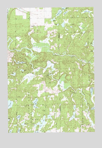
Frog Lake, WI USGS Topographic Map
Click on map above to begin viewing in our Map Viewer.

This topographic map contains these locations and features:
Feature Name Type Latitude Longitude GNIS ID View Map
Bass LakeLakeN46.0701°W92.1065°1561271View Map
Bradley LakeLakeN46.1076°W92.0518°1562132View Map
Casey CreekStreamN46.0066°W92.0027°1562768View Map
Fivemile CreekStreamN46.0772°W92.0391°1565045View Map
Fivemile Lookout TowerTowerN46.1072°W92.0282°1581215View Map
Forest Home CemeteryCemeteryN46.1063°W92.0905°1843115View Map
Frog LakeLakeN46.0260°W92.0861°1565349View Map
Lost LakeReservoirN46.0183°W92.0635°1568685View Map
Lower Lost Lake 2WP936 DamDamN46.0183°W92.0635°1792869View Map
Lucerne LakeLakeN46.0010°W92.1103°1568780View Map
McDowel BridgeBridgeN46.0580°W92.0655°1569210View Map
McKenzie CreekStreamN46.0083°W92.0041°1569241View Map
Meeker Run LakeLakeN46.0094°W92.1030°1569316View Map
Miniature LakeLakeN46.0155°W92.1100°1569556View Map
No Mans LakeLakeN46.1196°W92.0500°1570321View Map
Oak LakeLakeN46.0184°W92.0311°1570660View Map
Pear LakeLakeN46.0408°W92.0042°1571123View Map
Prinel LakeLakeN46.0311°W92.0853°1577254View Map
Richart LakeLakeN46.1128°W92.0588°1572284View Map
Saginaw LakeLakeN46.0625°W92.1035°1572807View Map
Spring LakeLakeN46.1202°W92.0092°2503015View Map
Stulen LakeLakeN46.0586°W92.1159°1574993View Map
Totagatic RiverStreamN46.0836°W92.0921°1580630View Map
Town of Webb LakeCivilN46.0273°W92.1126°1584390View Map
Warner LakeLakeN46.1196°W92.0402°1576217View Map
Webb CreekStreamN46.0622°W92.0863°1576366View Map
Webb Lake 18ReservoirN46.0499°W92.1185°1792742View Map
Webb Lake 2WP466 DamDamN46.0499°W92.1185°1792741View Map
Webb Lake CemeteryCemeteryN46.0219°W92.0713°1843201View Map
Webb Lake Police DepartmentBuildingN46.0360°W92.1121°2759906View Map
Webb Lake SchoolSchoolN46.0283°W92.1127°1576371View Map

Note: Coordinates in the location and feature list above are referenced to NAD83 datum.


Copyright (C) 2008-2025 Ryan Niemi / Sunset Dynamics ... All Rights Reserved