TopoQuest Logo
Do you find TopoQuest useful?
Help keep TopoQuest running and adding new maps/features by donating!
Bitcoin:  19c7KJd3qBynnjoSw5npx9KScwjBe4ifkT
Litecoin:  LXs6TkuXGGXo1vDsWCkWVdjQX94eUKd6ui
Home View Maps Find Maps Find Places Resources & Links


McKenzie Lake, Wisconsin Topographic Map

USGS Map Title: McKenzie Lake, WI
USGS Map MRC: 45092H1
DRG (GeoTIFF) Download: o45092h1.tif


Neighboring USGS Topographic Map Quads:


  Webb Lake, WI  
46092A2
 

  Frog Lake, WI  
46092A1
 

  Horseshoe Lake, WI  
46091A8
 

  Birch Island Lake, WI  
45092H2
 

  McKenzie Lake, WI  
45092H1
 

  Dunn Lake, WI  
45091H8
 

  Hertel, WI  
45092G2
 

  Poquettes Lake, WI  
45092G1
 

  Spooner, WI  
45091G8


Map MRC Location:

N46°
W93°
N46°
W92°
H8 H7 H6 H5 H4 H3 H2 H1
G8 G7 G6 G5 G4 G3 G2 G1
F8 F7 F6 F5 F4 F3 F2 F1
E8 E7 E6 E5 E4 E3 E2 E1
D8 D7 D6 D5 D4 D3 D2 D1
C8 C7 C6 C5 C4 C3 C2 C1
B8 B7 B6 B5 B4 B3 B2 B1
A8 A7 A6 A5 A4 A3 A2 A1
N45°
W93°
N45°
W92°

McKenzie Lake, WI USGS 1:24K Topographic Map Preview:
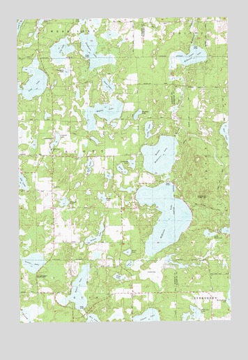
McKenzie Lake, WI USGS Topographic Map
Click on map above to begin viewing in our Map Viewer.

This topographic map contains these locations and features:
Feature Name Type Latitude Longitude GNIS ID View Map
Alpha Hotel AirportAirportN45.9458°W92.1088°2444106View Map
Behr LakeLakeN45.9390°W92.0832°1561509View Map
Benoit LakeLakeN45.8870°W92.0909°1561569View Map
Clubhouse LakeLakeN45.9400°W92.0575°1563211View Map
Cranberry LakeLakeN45.9781°W92.0960°1563489View Map
Crescent LakeLakeN45.9499°W92.1028°1563526View Map
Deep LakeLakeN45.9377°W92.0637°1563813View Map
Deer LakeLakeN45.9514°W92.0007°1563856View Map
Dubois LakeLakeN45.9095°W92.0806°1564139View Map
Durand LakeLakeN45.9245°W92.0984°1564196View Map
Eagle LakeLakeN45.9262°W92.0754°1564249View Map
Fish LakeLakeN45.9725°W92.1172°1565004View Map
Gaslyn Creek SchoolSchoolN45.8874°W92.1196°1565436View Map
Gaslyn LakeLakeN45.8999°W92.1167°1565437View Map
Goose LakeLakeN45.9725°W92.0714°1565659View Map
Lily LakeLakeN45.9871°W92.0990°1568051View Map
Lindy LakeLakeN45.9541°W92.0478°1568147View Map
Little Bass LakeLakeN45.9109°W92.0128°1568181View Map
Lost LakeLakeN45.8988°W92.0600°1568673View Map
Lower McKenzie LakeLakeN45.9841°W92.0214°1568741View Map
McKenzie LakeLakeN45.9183°W92.0385°1569243View Map
McKenzie Lake Lookout TowerTowerN45.9263°W92.0135°1581274View Map
Middle McKenzie LakeLakeN45.9432°W92.0410°1569428View Map
Mystery LakeLakeN45.9604°W92.0542°1570090View Map
Nicaboyne LakeLakeN45.9865°W92.0802°1570274View Map
North Midwest Cranberry Company WP99 DamDamN45.8999°W92.0385°1792783View Map
Perch LakeLakeN45.9037°W92.0608°1571213View Map
Rooney LakeLakeN45.9609°W92.0745°1572565View Map
Sacred Hearts CemeteryCemeteryN45.9506°W92.1040°1843171View Map
Sacred Hearts ChurchChurchN45.9461°W92.1057°1572791View Map
Scott SchoolSchoolN45.9427°W92.1055°1573847View Map
Scott TownhallBuildingN45.9427°W92.0919°1843178View Map
Scott Township Volunteer Fire DepartmentBuildingN45.9428°W92.1042°2696960View Map
Smith LakeLakeN45.8934°W92.0663°1574307View Map
South Midwest Cranberry Company WP99 DamDamN45.8983°W92.0385°1792785View Map
Town of ScottCivilN45.9422°W92.0945°1584114View Map
Wilkerson LakeLakeN45.8768°W92.0236°1576755View Map

Note: Coordinates in the location and feature list above are referenced to NAD83 datum.


Copyright (C) 2008-2024 Ryan Niemi / Sunset Dynamics ... All Rights Reserved