TopoQuest Logo
Do you find TopoQuest useful?
Help keep TopoQuest running and adding new maps/features by donating!
Bitcoin:  19c7KJd3qBynnjoSw5npx9KScwjBe4ifkT
Litecoin:  LXs6TkuXGGXo1vDsWCkWVdjQX94eUKd6ui
Home View Maps Find Maps Find Places Resources & Links


Dunn Lake, Wisconsin Topographic Map

USGS Map Title: Dunn Lake, WI
USGS Map MRC: 45091H8
DRG (GeoTIFF) Download: o45091h8.tif


Neighboring USGS Topographic Map Quads:


  Frog Lake, WI  
46092A1
 

  Horseshoe Lake, WI  
46091A8
 

  Minong, WI  
46091A7
 

  McKenzie Lake, WI  
45092H1
 

  Dunn Lake, WI  
45091H8
 

  Trego, WI  
45091H7
 

  Poquettes Lake, WI  
45092G1
 

  Spooner, WI  
45091G8
 

  Spooner Lake, WI  
45091G7


Map MRC Location:

N46°
W92°
N46°
W91°
H8 H7 H6 H5 H4 H3 H2 H1
G8 G7 G6 G5 G4 G3 G2 G1
F8 F7 F6 F5 F4 F3 F2 F1
E8 E7 E6 E5 E4 E3 E2 E1
D8 D7 D6 D5 D4 D3 D2 D1
C8 C7 C6 C5 C4 C3 C2 C1
B8 B7 B6 B5 B4 B3 B2 B1
A8 A7 A6 A5 A4 A3 A2 A1
N45°
W92°
N45°
W91°

Dunn Lake, WI USGS 1:24K Topographic Map Preview:
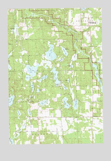
Dunn Lake, WI USGS Topographic Map
Click on map above to begin viewing in our Map Viewer.

This topographic map contains these locations and features:
Feature Name Type Latitude Longitude GNIS ID View Map
Bass LakeLakeN45.9153°W91.9977°1581544View Map
Boyle BrookStreamN45.9586°W91.9057°1562115View Map
Boyle Brook SpringSpringN45.9469°W91.9163°1833828View Map
Casey Creek FlowageReservoirN45.9872°W91.9907°1833832View Map
Casey LakeLakeN45.9435°W91.9679°1562771View Map
Conroy Ford 3WR374 DamDamN45.9866°W91.9902°1792623View Map
Dunn LakeLakeN45.9374°W91.9371°1564187View Map
Goose LakeLakeN45.9362°W91.9736°1565658View Map
Grass LakeLakeN45.9040°W91.9870°1565770View Map
Island LakeLakeN45.9582°W91.9430°1567016View Map
Jerry LakeLakeN45.9133°W91.9542°1567164View Map
Leisure LakeLakeN45.9597°W91.9246°1567958View Map
Lincoln LakeLakeN45.9112°W91.9113°1568081View Map
Little Casey LakeLakeN45.9268°W91.9252°1568220View Map
Loon LakeLakeN45.9282°W91.9686°1568625View Map
McKenzie CreekStreamN45.9763°W91.9057°1569239View Map
McKenzie Creek State Public Fishery AreaParkN45.9874°W91.8774°1833854View Map
McKinley LakeLakeN45.9121°W91.9240°1569246View Map
Mud LakeLakeN45.9520°W91.9300°1569975View Map
Rappy LakeLakeN45.9332°W91.9207°2771801View Map
Rigler LakeLakeN45.9183°W91.9718°1572311View Map
Rocky Ridge CreekStreamN45.8788°W91.9977°1833860View Map
Rocky Ridge LakeLakeN45.8790°W91.9979°1572505View Map
Rosewood CemeteryCemeteryN45.9715°W91.9738°1572597View Map
Schulze-Spooner Airport (historical)AirportN45.9016°W91.9007°1833868View Map
Spring LakeLakeN45.9038°W91.9722°1574678View Map
Sunfish LakeLakeN45.9356°W91.9537°1575076View Map
Tadpole CornersLocaleN45.8991°W91.8868°1575221View Map
Tomahawk LakeLakeN45.9242°W91.9610°1575497View Map
Tower LakeLakeN45.9149°W91.9721°1575524View Map
Town of CaseyCivilN45.9416°W91.9718°1582923View Map
Trego DamDamN45.9474°W91.8855°1575586View Map
Trego Hydro Generating StationLocaleN45.9478°W91.8883°2742372View Map
Trego LakeReservoirN45.9456°W91.8844°1575587View Map
Trego WP220 DamDamN45.9483°W91.8885°1793096View Map
Washburn County Youth CampLocaleN45.9624°W91.9238°1833891View Map

Note: Coordinates in the location and feature list above are referenced to NAD83 datum.


Copyright (C) 2008-2024 Ryan Niemi / Sunset Dynamics ... All Rights Reserved