TopoQuest Logo
Do you find TopoQuest useful?
Help keep TopoQuest running and adding new maps/features by donating!
Bitcoin:  19c7KJd3qBynnjoSw5npx9KScwjBe4ifkT
Litecoin:  LXs6TkuXGGXo1vDsWCkWVdjQX94eUKd6ui
Home View Maps Find Maps Find Places Resources & Links


Frost, Minnesota Topographic Map

USGS Map Title: Frost, MN
USGS Map MRC: 43093E8
DRG (GeoTIFF) Download: o43093e8.tif


Neighboring USGS Topographic Map Quads:


  Blue Earth, MN  
43094F1
 

  Oza Tanka Lakebed, MN  
43093F8
 

  Brush Creek, MN  
43093F7
 

  Elmore, MN  
43094E1
 

  Frost, MN  
43093E8
 

  Bricelyn, MN  
43093E7
 

  Lakota, IA  
43094D1
 

  Buffalo Center, IA  
43093D8
 

  Buffalo Center NE, IA  
43093D7


Map MRC Location:

N44°
W94°
N44°
W93°
H8 H7 H6 H5 H4 H3 H2 H1
G8 G7 G6 G5 G4 G3 G2 G1
F8 F7 F6 F5 F4 F3 F2 F1
E8 E7 E6 E5 E4 E3 E2 E1
D8 D7 D6 D5 D4 D3 D2 D1
C8 C7 C6 C5 C4 C3 C2 C1
B8 B7 B6 B5 B4 B3 B2 B1
A8 A7 A6 A5 A4 A3 A2 A1
N43°
W94°
N43°
W93°

Frost, MN USGS 1:24K Topographic Map Preview:
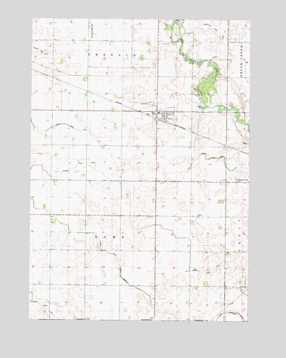
Frost, MN USGS Topographic Map
Click on map above to begin viewing in our Map Viewer.

This topographic map contains these locations and features:
Feature Name Type Latitude Longitude GNIS ID View Map
Bethany CemeteryCemeteryN43.5427°W93.9044°2049236View Map
Bethany ChurchChurchN43.5427°W93.9044°639999View Map
City of FrostCivilN43.5846°W93.9248°2394830View Map
County Ditch Number FiftyfiveCanalN43.6166°W93.8913°1817532View Map
County Ditch Number FortyfourCanalN43.5805°W93.8822°1817533View Map
County Ditch Number One Hundred TwoCanalN43.5036°W93.8827°1817531View Map
County Ditch Number ThirtyoneCanalN43.5105°W93.9986°641949View Map
DellPopulated PlaceN43.6241°W93.9150°654670View Map
Dell Lutheran ChurchChurchN43.6247°W93.9150°2049210View Map
Dell Post Office (historical)Post OfficeN43.6241°W93.9150°2049319View Map
Emerald CemeteryCemeteryN43.5894°W93.9311°643330View Map
FrostLocaleN43.5827°W93.9252°2049204View Map
FrostPopulated PlaceN43.5863°W93.9266°643976View Map
Frost Area AmbulanceBuildingN43.5840°W93.9243°2721256View Map
Frost City HallBuildingN43.5863°W93.9266°2049207View Map
Frost Police DepartmentBuildingN43.5863°W93.9266°2049208View Map
Frost Post OfficePost OfficeN43.5847°W93.9238°2049206View Map
Frost Public LibraryBuildingN43.5863°W93.9266°2049209View Map
Frost Volunteer Fire DepartmentBuildingN43.5840°W93.9243°2666266View Map
Judicial Ditch Number ThirteenCanalN43.5280°W93.9633°1817535View Map
Schaper Landing Strip (historical)AirportN43.6197°W93.9652°1817527View Map
South Blue Earth ChurchChurchN43.5583°W93.8813°1817534View Map
South Blue Earth Lutheran CemeteryCemeteryN43.5583°W93.8816°2049233View Map
Township of RomeCivilN43.5429°W93.9485°665451View Map
United Lutheran ChurchChurchN43.5861°W93.9225°2049205View Map

Note: Coordinates in the location and feature list above are referenced to NAD83 datum.


Copyright (C) 2008-2024 Ryan Niemi / Sunset Dynamics ... All Rights Reserved