TopoQuest Logo
Do you find TopoQuest useful?
Help keep TopoQuest running and adding new maps/features by donating!
Bitcoin:  19c7KJd3qBynnjoSw5npx9KScwjBe4ifkT
Litecoin:  LXs6TkuXGGXo1vDsWCkWVdjQX94eUKd6ui
Home View Maps Find Maps Find Places Resources & Links


Brush Creek, Minnesota Topographic Map

USGS Map Title: Brush Creek, MN
USGS Map MRC: 43093F7
DRG (GeoTIFF) Download: o43093f7.tif


Neighboring USGS Topographic Map Quads:


  Easton, MN  
43093G8
 

  Minnesota Lake, MN  
43093G7
 

  Matawan, MN  
43093G6
 

  Oza Tanka Lakebed, MN  
43093F8
 

  Brush Creek, MN  
43093F7
 

  Wells, MN  
43093F6
 

  Frost, MN  
43093E8
 

  Bricelyn, MN  
43093E7
 

  Kiester, MN  
43093E6


Map MRC Location:

N44°
W94°
N44°
W93°
H8 H7 H6 H5 H4 H3 H2 H1
G8 G7 G6 G5 G4 G3 G2 G1
F8 F7 F6 F5 F4 F3 F2 F1
E8 E7 E6 E5 E4 E3 E2 E1
D8 D7 D6 D5 D4 D3 D2 D1
C8 C7 C6 C5 C4 C3 C2 C1
B8 B7 B6 B5 B4 B3 B2 B1
A8 A7 A6 A5 A4 A3 A2 A1
N43°
W94°
N43°
W93°

Brush Creek, MN USGS 1:24K Topographic Map Preview:
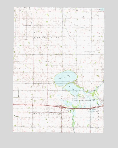
Brush Creek, MN USGS Topographic Map
Click on map above to begin viewing in our Map Viewer.

This topographic map contains these locations and features:
Feature Name Type Latitude Longitude GNIS ID View Map
Brush CreekPopulated PlaceN43.6447°W93.8483°640558View Map
Brush Creek CemeteryCemeteryN43.6452°W93.8274°1817509View Map
Brush Creek Post Office (historical)Post OfficeN43.6447°W93.8483°2049323View Map
County Ditch Number TwentyCanalN43.7491°W93.8594°641802View Map
County Ditch Number TwentyfiveCanalN43.6591°W93.8747°1817508View Map
Foster CreekStreamN43.6697°W93.7841°643836View Map
Interchange 134CrossingN43.6502°W93.8080°2049335View Map
North Blue Earth ChurchChurchN43.6300°W93.8488°648608View Map
North Blue Earth Lutheran CemeteryCemeteryN43.6302°W93.8491°2049242View Map
South Walnut LakeReservoirN43.6683°W93.7926°652355View Map
South Walnut Lake DamDamN43.6625°W93.7866°1776141View Map
Tabor ChurchChurchN43.6455°W93.8274°652978View Map
Township of Brush CreekCivilN43.6302°W93.8279°663692View Map
Township of Walnut LakeCivilN43.7173°W93.8277°665903View Map
Walnut LakeReservoirN43.6795°W93.8036°653745View Map
Walnut Lake CemeteryCemeteryN43.6958°W93.8291°1817510View Map
Walnut Lake Methodist CemeteryCemeteryN43.7236°W93.8269°2049241View Map
Walnut Lake State Wildlife Management AreaParkN43.6555°W93.7766°1817511View Map
Wells Municipal AirportAirportN43.7451°W93.7766°660466View Map

Note: Coordinates in the location and feature list above are referenced to NAD83 datum.


Copyright (C) 2008-2024 Ryan Niemi / Sunset Dynamics ... All Rights Reserved