TopoQuest Logo
Do you find TopoQuest useful?
Help keep TopoQuest running and adding new maps/features by donating!
Bitcoin:  19c7KJd3qBynnjoSw5npx9KScwjBe4ifkT
Litecoin:  LXs6TkuXGGXo1vDsWCkWVdjQX94eUKd6ui
Home View Maps Find Maps Find Places Resources & Links


Oza Tanka Lakebed, Minnesota Topographic Map

USGS Map Title: Oza Tanka Lakebed, MN
USGS Map MRC: 43093F8
DRG (GeoTIFF) Download: o43093f8.tif


Neighboring USGS Topographic Map Quads:


  Delavan, MN  
43094G1
 

  Easton, MN  
43093G8
 

  Minnesota Lake, MN  
43093G7
 

  Blue Earth, MN  
43094F1
 

  Oza Tanka Lakebed, MN  
43093F8
 

  Brush Creek, MN  
43093F7
 

  Elmore, MN  
43094E1
 

  Frost, MN  
43093E8
 

  Bricelyn, MN  
43093E7


Map MRC Location:

N44°
W94°
N44°
W93°
H8 H7 H6 H5 H4 H3 H2 H1
G8 G7 G6 G5 G4 G3 G2 G1
F8 F7 F6 F5 F4 F3 F2 F1
E8 E7 E6 E5 E4 E3 E2 E1
D8 D7 D6 D5 D4 D3 D2 D1
C8 C7 C6 C5 C4 C3 C2 C1
B8 B7 B6 B5 B4 B3 B2 B1
A8 A7 A6 A5 A4 A3 A2 A1
N43°
W94°
N43°
W93°

Oza Tanka Lakebed, MN USGS 1:24K Topographic Map Preview:
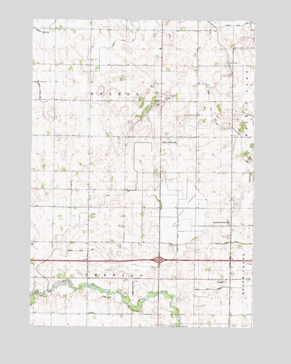
Oza Tanka Lakebed, MN USGS Topographic Map
Click on map above to begin viewing in our Map Viewer.

This topographic map contains these locations and features:
Feature Name Type Latitude Longitude GNIS ID View Map
Amundson Landing Strip (historical)AirportN43.6675°W93.8919°1817506View Map
County Ditch Number FiveCanalN43.6502°W93.9427°1817502View Map
County Ditch Number SeventyCanalN43.7244°W93.8952°1815543View Map
County Ditch Number ThirtysevenCanalN43.6416°W93.8913°1817507View Map
Dell CemeteryCemeteryN43.6252°W93.9150°1817504View Map
Ellingson Family CemeteryCemeteryN43.6513°W93.9683°2049237View Map
Erdahl Landing Strip (historical)AirportN43.6430°W93.9361°1817503View Map
Faribault CountyCivilN43.6739°W93.9480°659467View Map
Interchange 128CrossingN43.6525°W93.9275°2049336View Map
Judicial Ditch Number SixCanalN43.6786°W93.9544°1817501View Map
Martin Landing Strip (historical)AirportN43.7000°W93.9225°1817505View Map
Oza Tanka LakebedFlatN43.6736°W93.9155°649107View Map
Saint Marys CemeteryCemeteryN43.7188°W93.9241°650839View Map
Township of BarberCivilN43.7170°W93.9474°663504View Map
Township of EmeraldCivilN43.6303°W93.9479°664095View Map

Note: Coordinates in the location and feature list above are referenced to NAD83 datum.


Copyright (C) 2008-2024 Ryan Niemi / Sunset Dynamics ... All Rights Reserved