TopoQuest Logo
Do you find TopoQuest useful?
Help keep TopoQuest running and adding new maps/features by donating!
Bitcoin:  19c7KJd3qBynnjoSw5npx9KScwjBe4ifkT
Litecoin:  LXs6TkuXGGXo1vDsWCkWVdjQX94eUKd6ui
Home View Maps Find Maps Find Places Resources & Links


Garber, Iowa Topographic Map

USGS Map Title: Garber, IA
USGS Map MRC: 42091F3
DRG (GeoTIFF) Download: o42091f3.tif


Neighboring USGS Topographic Map Quads:


  Elkader, IA  
42091G4
 

  Littleport, IA  
42091G3
 

  Garnavillo, IA  
42091G2
 

  Edgewood, IA  
42091F4
 

  Garber, IA  
42091F3
 

  Colesburg, IA  
42091F2
 

  Thorpe, IA  
42091E4
 

  Greeley, IA  
42091E3
 

  Petersburg, IA  
42091E2


Map MRC Location:

N43°
W92°
N43°
W91°
H8 H7 H6 H5 H4 H3 H2 H1
G8 G7 G6 G5 G4 G3 G2 G1
F8 F7 F6 F5 F4 F3 F2 F1
E8 E7 E6 E5 E4 E3 E2 E1
D8 D7 D6 D5 D4 D3 D2 D1
C8 C7 C6 C5 C4 C3 C2 C1
B8 B7 B6 B5 B4 B3 B2 B1
A8 A7 A6 A5 A4 A3 A2 A1
N42°
W92°
N42°
W91°

Garber, IA USGS 1:24K Topographic Map Preview:
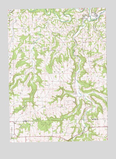
Garber, IA USGS Topographic Map
Click on map above to begin viewing in our Map Viewer.

This topographic map contains these locations and features:
Feature Name Type Latitude Longitude GNIS ID View Map
Asbury CemeteryCemeteryN42.7106°W91.3207°454250View Map
Bear CreekStreamN42.7386°W91.3079°454414View Map
Brownfield CreekStreamN42.6658°W91.2529°454866View Map
City of ElkportCivilN42.7416°W91.2749°2394659View Map
City of GarberCivilN42.7444°W91.2618°2394850View Map
Cow BranchStreamN42.6700°W91.2857°455682View Map
Ebenezer CemeteryCemeteryN42.6783°W91.3248°456217View Map
Elk CreekStreamN42.7380°W91.2693°456286View Map
Elk Creek CemeteryCemeteryN42.6707°W91.2904°456290View Map
ElkportPopulated PlaceN42.7397°W91.2779°456310View Map
Elkport (historical)LocaleN42.7397°W91.2779°1949187View Map
Elkport Post Office (historical)Post OfficeN42.7397°W91.2779°1949188View Map
GarberPopulated PlaceN42.7419°W91.2621°456820View Map
Garber (historical)LocaleN42.7419°W91.2621°1949181View Map
Garber BridgeBridgeN42.7397°W91.2615°1948988View Map
Garber Bridge AccessLocaleN42.7397°W91.2615°1948987View Map
Garber Fire DepartmentBuildingN42.7440°W91.2669°1949186View Map
Garber Post OfficePost OfficeN42.7419°W91.2621°1949182View Map
Hamlett CemeteryCemeteryN42.6579°W91.3100°457220View Map
Immanuel Hope Lutheran ChurchChurchN42.7397°W91.2779°1949189View Map
Immanuel Lutheran CemeteryCemeteryN42.7433°W91.2734°1949284View Map
Jehovahs Witnesses Kingdom HallChurchN42.7419°W91.2621°1949185View Map
Mount Harmony CemeteryCemeteryN42.7180°W91.2802°459294View Map
Musfeldt CemeteryCemeteryN42.7402°W91.3341°459417View Map
Pine CreekStreamN42.6683°W91.2799°460162View Map
Rabbit CreekStreamN42.6953°W91.3437°460490View Map
Sacred Heart CemeteryCemeteryN42.7425°W91.3749°460884View Map
Saint Johns Congregational ChurchChurchN42.7419°W91.2621°1949184View Map
Saint Michaels Catholic ChurchChurchN42.7419°W91.2621°1949183View Map
Saint Michaels CemeteryCemeteryN42.7430°W91.2731°461230View Map
Steeles BranchStreamN42.6692°W91.2840°461980View Map
Township of ElkCivilN42.6887°W91.3099°467776View Map
Twin Bridges ParkParkN42.6319°W91.2807°1999995View Map
Volga RiverStreamN42.7480°W91.2707°462590View Map
Wagner CemeteryCemeteryN42.7083°W91.3585°1949294View Map
Wayman CreekStreamN42.7405°W91.2596°462761View Map
Wolf CemeteryCemeteryN42.7417°W91.3585°1949283View Map
Wolf CreekStreamN42.7261°W91.2896°463155View Map
WoodPopulated PlaceN42.6575°W91.3326°463176View Map
Wood Post Office (historical)Post OfficeN42.6575°W91.3326°1949011View Map
Zion CemeteryCemeteryN42.6382°W91.2501°463259View Map

Note: Coordinates in the location and feature list above are referenced to NAD83 datum.


Copyright (C) 2008-2025 Ryan Niemi / Sunset Dynamics ... All Rights Reserved