TopoQuest Logo
Do you find TopoQuest useful?
Help keep TopoQuest running and adding new maps/features by donating!
Bitcoin:  19c7KJd3qBynnjoSw5npx9KScwjBe4ifkT
Litecoin:  LXs6TkuXGGXo1vDsWCkWVdjQX94eUKd6ui
Home View Maps Find Maps Find Places Resources & Links


Edgewood, Iowa Topographic Map

USGS Map Title: Edgewood, IA
USGS Map MRC: 42091F4
DRG (GeoTIFF) Download: o42091f4.tif


Neighboring USGS Topographic Map Quads:


  Volga, IA  
42091G5
 

  Elkader, IA  
42091G4
 

  Littleport, IA  
42091G3
 

  Strawberry Point, IA  
42091F5
 

  Edgewood, IA  
42091F4
 

  Garber, IA  
42091F3
 

  Dundee, IA  
42091E5
 

  Thorpe, IA  
42091E4
 

  Greeley, IA  
42091E3


Map MRC Location:

N43°
W92°
N43°
W91°
H8 H7 H6 H5 H4 H3 H2 H1
G8 G7 G6 G5 G4 G3 G2 G1
F8 F7 F6 F5 F4 F3 F2 F1
E8 E7 E6 E5 E4 E3 E2 E1
D8 D7 D6 D5 D4 D3 D2 D1
C8 C7 C6 C5 C4 C3 C2 C1
B8 B7 B6 B5 B4 B3 B2 B1
A8 A7 A6 A5 A4 A3 A2 A1
N42°
W92°
N42°
W91°

Edgewood, IA USGS 1:24K Topographic Map Preview:
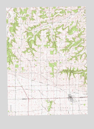
Edgewood, IA USGS Topographic Map
Click on map above to begin viewing in our Map Viewer.

This topographic map contains these locations and features:
Feature Name Type Latitude Longitude GNIS ID View Map
Alderson HollowValleyN42.7459°W91.4946°454121View Map
Bixby State ParkParkN42.6753°W91.3996°454649View Map
City of EdgewoodCivilN42.6442°W91.4017°2394620View Map
EdgewoodPopulated PlaceN42.6444°W91.4013°456235View Map
Edgewood - Colesburg Junior / Senior High SchoolSchoolN42.6448°W91.4052°1949232View Map
Edgewood (historical)LocaleN42.6467°W91.4015°1949231View Map
Edgewood Ambulance ServiceBuildingN42.6447°W91.4018°2599969View Map
Edgewood Bible ChurchChurchN42.6436°W91.4015°2000018View Map
Edgewood CemeteryCemeteryN42.6367°W91.3874°456236View Map
Edgewood Chiropractic and Sports Medicine CenterHospitalN42.6450°W91.4015°1949226View Map
Edgewood City HallBuildingN42.6447°W91.4024°1949225View Map
Edgewood ClinicHospitalN42.6458°W91.4015°1949227View Map
Edgewood Convalescent HomeHospitalN42.6403°W91.4029°2000017View Map
Edgewood Fire DepartmentBuildingN42.6450°W91.4004°2577234View Map
Edgewood LibraryBuildingN42.6447°W91.4024°1949224View Map
Edgewood Post OfficePost OfficeN42.6439°W91.3996°1949223View Map
Green Hill CemeteryCemeteryN42.6739°W91.4209°457101View Map
Honey Creek Post Office (historical)Post OfficeN42.6958°W91.4168°1949034View Map
Kleinlein CreekStreamN42.7453°W91.4988°458122View Map
Lloyd Kelchen Grain ElevatorLocaleN42.6417°W91.3890°2000019View Map
Lodomillo Post Office (historical)Post OfficeN42.6555°W91.4140°1949032View Map
Mossy Glen HollowValleyN42.7288°W91.4290°459257View Map
Mossy Glen State PreserveParkN42.7069°W91.4265°1948992View Map
Noble CemeteryCemeteryN42.6736°W91.4474°459532View Map
Saint Mark's Catholic ChurchChurchN42.6430°W91.3993°2000016View Map
Saint Marks CemeteryCemeteryN42.6375°W91.3888°2000009View Map
Stone's PlantationLocaleN42.7389°W91.4974°1948993View Map
Sylvan Post Office (historical)Post OfficeN42.6805°W91.4918°1949016View Map
Township of LodomilloCivilN42.6879°W91.4283°468294View Map
Trinity United Methodist ChurchChurchN42.6444°W91.4015°1949229View Map
Union CemeteryCemeteryN42.7389°W91.3782°462434View Map
United Methodist ChurchChurchN42.6455°W91.4026°1949228View Map
Woods Edge Golf CourseLocaleN42.6394°W91.4061°1949230View Map
YorkPopulated PlaceN42.6344°W91.4432°464158View Map
York Post Office (historical)Post OfficeN42.6344°W91.4432°1999892View Map

Note: Coordinates in the location and feature list above are referenced to NAD83 datum.


Copyright (C) 2008-2024 Ryan Niemi / Sunset Dynamics ... All Rights Reserved