TopoQuest Logo
Do you find TopoQuest useful?
Help keep TopoQuest running and adding new maps/features by donating!
Bitcoin:  19c7KJd3qBynnjoSw5npx9KScwjBe4ifkT
Litecoin:  LXs6TkuXGGXo1vDsWCkWVdjQX94eUKd6ui
Home View Maps Find Maps Find Places Resources & Links


Ashnola Pass, Washington Topographic Map

USGS Map Title: Ashnola Pass, WA
USGS Map MRC: 48120H3
DRG (GeoTIFF) Download: o48120h3.tif


Neighboring USGS Topographic Map Quads:


  Ashnola Mountain, WA  
48120H4
 

  Ashnola Pass, WA  
48120H3
 

  Remmel Mountain, WA  
48120H2
 

  Lost Peak, WA  
48120G4
 

  Billy Goat Mountain, WA  
48120G3
 

  Mount Barney, WA  
48120G2


Map MRC Location:

N49°
W121°
N49°
W120°
H8 H7 H6 H5 H4 H3 H2 H1
G8 G7 G6 G5 G4 G3 G2 G1
F8 F7 F6 F5 F4 F3 F2 F1
E8 E7 E6 E5 E4 E3 E2 E1
D8 D7 D6 D5 D4 D3 D2 D1
C8 C7 C6 C5 C4 C3 C2 C1
B8 B7 B6 B5 B4 B3 B2 B1
A8 A7 A6 A5 A4 A3 A2 A1
N48°
W121°
N48°
W120°

Ashnola Pass, WA USGS 1:24K Topographic Map Preview:
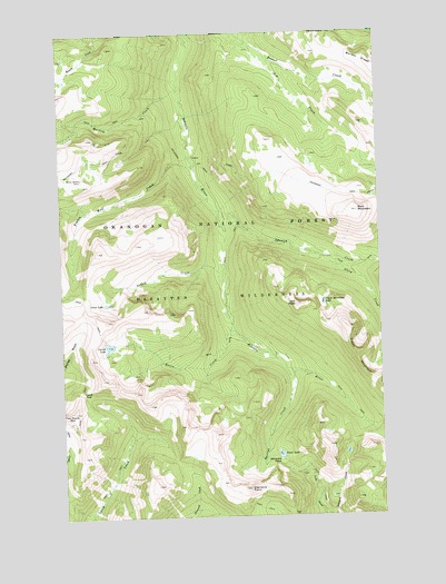
Ashnola Pass, WA USGS Topographic Map
Click on map above to begin viewing in our Map Viewer.

This topographic map contains these locations and features:
Feature Name Type Latitude Longitude GNIS ID View Map
Ashnola PassGapN48.8890°W120.2912°1515972View Map
Baker Brown CabinLocaleN48.9624°W120.3676°1516046View Map
Bald MountainSummitN48.9535°W120.2595°1516087View Map
Beaver CreekStreamN48.9976°W120.3026°1516320View Map
Bob CreekStreamN48.9976°W120.3023°1516736View Map
Corral LakeLakeN48.9193°W120.3578°1518126View Map
Crow LakeLakeN48.9300°W120.3588°1518354View Map
Diamond PointCapeN48.8818°W120.3037°1518760View Map
Fawn LakeLakeN48.8908°W120.2915°1519483View Map
Freds MountainSummitN48.9168°W120.2604°1519777View Map
Freds Mountain LakeLakeN48.9301°W120.2736°1519778View Map
Gabril CreekStreamN48.9388°W120.3120°1519863View Map
Glory CreekStreamN48.9421°W120.2734°1520008View Map
Larch PassGapN48.9071°W120.3682°1521908View Map
Martina CreekStreamN48.9857°W120.3290°1522775View Map
Raven CreekStreamN48.9243°W120.3093°1524905View Map
Spanish CreekStreamN48.9524°W120.3140°1526331View Map
Spotted CreekStreamN48.9104°W120.2859°1526390View Map
Timber Wolf CreekStreamN48.9654°W120.3237°1527234View Map
Van PeakSummitN48.9296°W120.2840°1527674View Map

Note: Coordinates in the location and feature list above are referenced to NAD83 datum.


Copyright (C) 2008-2025 Ryan Niemi / Sunset Dynamics ... All Rights Reserved