TopoQuest Logo
Do you find TopoQuest useful?
Help keep TopoQuest running and adding new maps/features by donating!
Bitcoin:  19c7KJd3qBynnjoSw5npx9KScwjBe4ifkT
Litecoin:  LXs6TkuXGGXo1vDsWCkWVdjQX94eUKd6ui
Home View Maps Find Maps Find Places Resources & Links


Lost Peak, Washington Topographic Map

USGS Map Title: Lost Peak, WA
USGS Map MRC: 48120G4
DRG (GeoTIFF) Download: o48120g4.tif


Neighboring USGS Topographic Map Quads:


  Tatoosh Buttes, WA  
48120H5
 

  Ashnola Mountain, WA  
48120H4
 

  Ashnola Pass, WA  
48120H3
 

  Mount Lago, WA  
48120G5
 

  Lost Peak, WA  
48120G4
 

  Billy Goat Mountain, WA  
48120G3
 

  Robinson Mountain, WA  
48120F5
 

  McLeod Mountain, WA  
48120F4
 

  Sweetgrass Butte, WA  
48120F3


Map MRC Location:

N49°
W121°
N49°
W120°
H8 H7 H6 H5 H4 H3 H2 H1
G8 G7 G6 G5 G4 G3 G2 G1
F8 F7 F6 F5 F4 F3 F2 F1
E8 E7 E6 E5 E4 E3 E2 E1
D8 D7 D6 D5 D4 D3 D2 D1
C8 C7 C6 C5 C4 C3 C2 C1
B8 B7 B6 B5 B4 B3 B2 B1
A8 A7 A6 A5 A4 A3 A2 A1
N48°
W121°
N48°
W120°

Lost Peak, WA USGS 1:24K Topographic Map Preview:
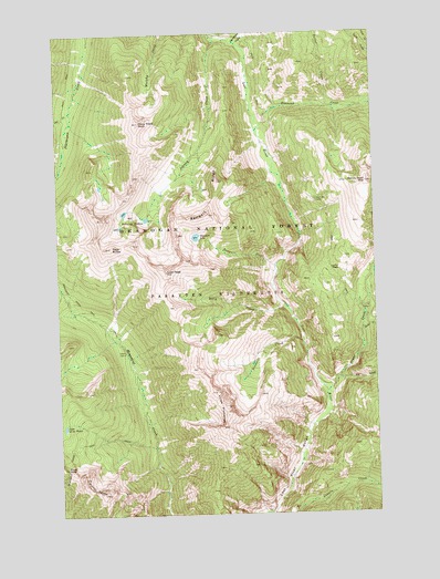
Lost Peak, WA USGS Topographic Map
Click on map above to begin viewing in our Map Viewer.

This topographic map contains these locations and features:
Feature Name Type Latitude Longitude GNIS ID View Map
Billy CreekStreamN48.8038°W120.4109°1516557View Map
Clints CabinLocaleN48.7924°W120.4740°1517865View Map
Deception CreekStreamN48.8724°W120.4284°1518558View Map
Diamond CreekStreamN48.8493°W120.4220°1518747View Map
Dollar CreekStreamN48.8560°W120.3937°1518842View Map
Dot CreekStreamN48.8551°W120.4954°1518883View Map
Drake CreekStreamN48.7815°W120.3957°1518915View Map
Hoot Owl CampLocaleN48.8313°W120.3987°1520904View Map
Jinks CreekStreamN48.7974°W120.3815°1521384View Map
Johnny CreekStreamN48.8740°W120.4365°1521409View Map
Johnny LakesLakeN48.8274°W120.4676°1521411View Map
Lake of the WoodsLakeN48.7727°W120.4995°1521857View Map
Lost PeakSummitN48.8126°W120.4576°1522504View Map
Lucky PassGapN48.8135°W120.3945°1522567View Map
Many Trails PeakSummitN48.8518°W120.4682°1522683View Map
Monument CreekStreamN48.7504°W120.4584°1523335View Map
Nanny Goat MountainSummitN48.8357°W120.3787°1523572View Map
Pasayten WildernessReserveN48.8743°W120.4887°1528732View Map
Pass ButteSummitN48.8193°W120.4795°1524230View Map
Pat CreekStreamN48.7851°W120.3909°1524243View Map
Pinnacle CreekStreamN48.7949°W120.4051°1524459View Map
Pistol PassGapN48.7615°W120.4990°1524486View Map
Pistol PeaksSummitN48.7574°W120.4876°1524487View Map
Rampart CreekStreamN48.8140°W120.4154°1524854View Map
Rampart LakeLakeN48.8220°W120.4464°1524855View Map
Rampart RidgeRidgeN48.8276°W120.3909°1524858View Map
Three PinnaclesPillarN48.7776°W120.4365°1527161View Map

Note: Coordinates in the location and feature list above are referenced to NAD83 datum.


Copyright (C) 2008-2025 Ryan Niemi / Sunset Dynamics ... All Rights Reserved