TopoQuest Logo
Do you find TopoQuest useful?
Help keep TopoQuest running and adding new maps/features by donating!
Bitcoin:  19c7KJd3qBynnjoSw5npx9KScwjBe4ifkT
Litecoin:  LXs6TkuXGGXo1vDsWCkWVdjQX94eUKd6ui
Home View Maps Find Maps Find Places Resources & Links


Mount Barney, Washington Topographic Map

USGS Map Title: Mount Barney, WA
USGS Map MRC: 48120G2
DRG (GeoTIFF) Download: o48120g2.tif


Neighboring USGS Topographic Map Quads:


  Ashnola Pass, WA  
48120H3
 

  Remmel Mountain, WA  
48120H2
 

  Bauerman Ridge, WA  
48120H1
 

  Billy Goat Mountain, WA  
48120G3
 

  Mount Barney, WA  
48120G2
 

  Coleman Peak, WA  
48120G1
 

  Sweetgrass Butte, WA  
48120F3
 

  Doe Mountain, WA  
48120F2
 

  Spur Peak, WA  
48120F1


Map MRC Location:

N49°
W121°
N49°
W120°
H8 H7 H6 H5 H4 H3 H2 H1
G8 G7 G6 G5 G4 G3 G2 G1
F8 F7 F6 F5 F4 F3 F2 F1
E8 E7 E6 E5 E4 E3 E2 E1
D8 D7 D6 D5 D4 D3 D2 D1
C8 C7 C6 C5 C4 C3 C2 C1
B8 B7 B6 B5 B4 B3 B2 B1
A8 A7 A6 A5 A4 A3 A2 A1
N48°
W121°
N48°
W120°

Mount Barney, WA USGS 1:24K Topographic Map Preview:
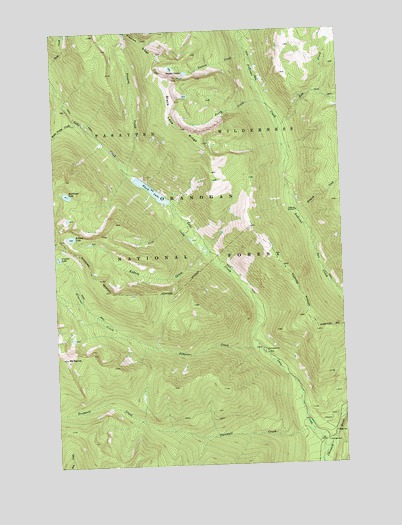
Mount Barney, WA USGS Topographic Map
Click on map above to begin viewing in our Map Viewer.

This topographic map contains these locations and features:
Feature Name Type Latitude Longitude GNIS ID View Map
Black LakeLakeN48.8290°W120.2081°1516607View Map
Black Lake RidgeRidgeN48.8468°W120.1943°1516612View Map
Blizzard CreekStreamN48.8224°W120.1454°1516654View Map
Cold CreekStreamN48.8110°W120.1837°1517922View Map
Crystal LakeLakeN48.8101°W120.2495°1518375View Map
Disaster CreekStreamN48.7829°W120.1623°1518795View Map
Dutton CreekStreamN48.8676°W120.1645°1519028View Map
Dutton LakesLakeN48.8640°W120.1948°1519029View Map
Farewell CreekStreamN48.7576°W120.1381°1519476View Map
Farewell Creek TrailheadLocaleN48.7604°W120.1445°1529714View Map
Halfmoon LakeLakeN48.8282°W120.2454°1520455View Map
Kidney CreekStreamN48.8113°W120.1831°1521653View Map
Kidney LakeLakeN48.8159°W120.2441°1521655View Map
Lake CreekStreamN48.7501°W120.1370°1521839View Map
Lake Creek TrailheadLocaleN48.7832°W120.1620°1529715View Map
Mount BarneySummitN48.7815°W120.2468°1516154View Map
Perry CreekStreamN48.8538°W120.1570°1524339View Map
Preston CreekStreamN48.8340°W120.2184°1524634View Map
Preston RidgeRidgeN48.8724°W120.2104°1524636View Map
Ram CreekStreamN48.8463°W120.1520°1524848View Map
Three Prong CreekStreamN48.8496°W120.2398°1527162View Map

Note: Coordinates in the location and feature list above are referenced to NAD83 datum.


Copyright (C) 2008-2025 Ryan Niemi / Sunset Dynamics ... All Rights Reserved